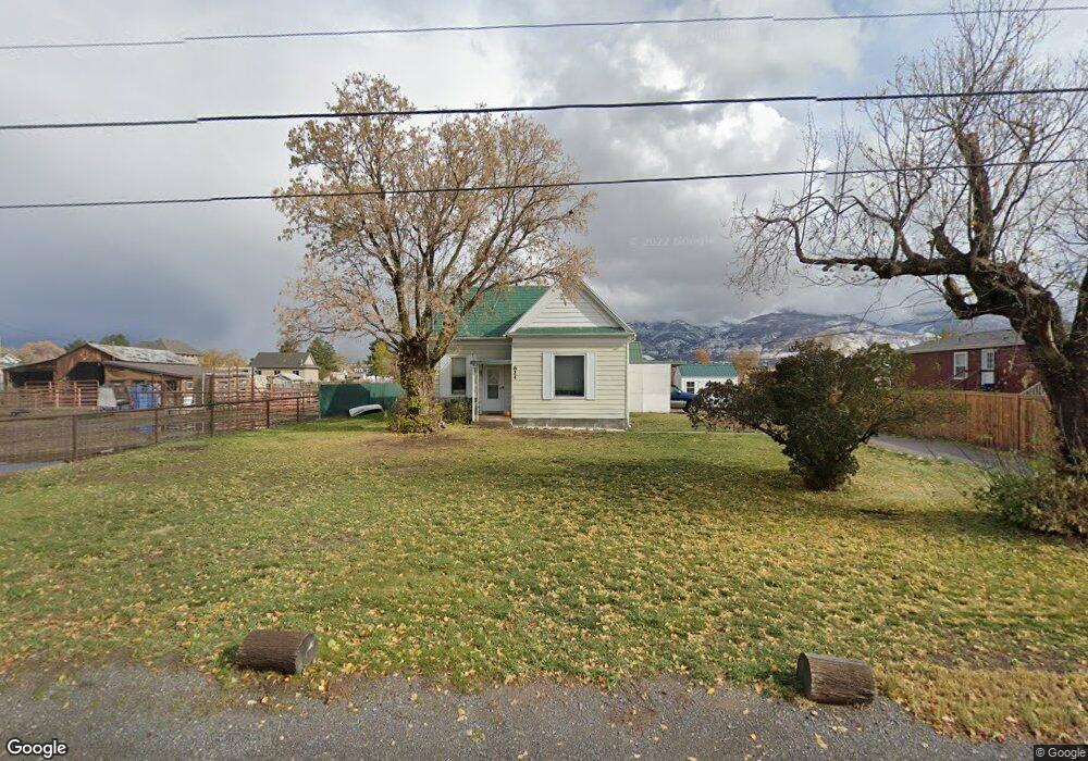
624 N Flint St Kaysville, UT 84037
Estimated Value: $409,000 - $740,000
3
Beds
1
Bath
1,671
Sq Ft
$315/Sq Ft
Est. Value
About This Home
This home is located at 624 N Flint St, Kaysville, UT 84037 and is currently estimated at $526,861, approximately $315 per square foot. 624 N Flint St is a home located in Davis County with nearby schools including Kay's Creek Elementary School, Shoreline Junior High School, and Davis High School.
Ownership History
Date
Name
Owned For
Owner Type
Purchase Details
Closed on
Mar 10, 2023
Sold by
Ford William K
Bought by
Ford William K and Ford Sarah
Current Estimated Value
Home Financials for this Owner
Home Financials are based on the most recent Mortgage that was taken out on this home.
Original Mortgage
$280,000
Outstanding Balance
$270,507
Interest Rate
6.09%
Mortgage Type
New Conventional
Estimated Equity
$256,354
Purchase Details
Closed on
Jul 28, 2021
Sold by
Ford William K
Bought by
Ford William K and Ford Sarah
Home Financials for this Owner
Home Financials are based on the most recent Mortgage that was taken out on this home.
Original Mortgage
$240,000
Interest Rate
2.93%
Mortgage Type
New Conventional
Purchase Details
Closed on
Jun 24, 2020
Sold by
Ford William K
Bought by
Ford William K and Ford Sarah
Home Financials for this Owner
Home Financials are based on the most recent Mortgage that was taken out on this home.
Original Mortgage
$189,600
Interest Rate
3.2%
Mortgage Type
New Conventional
Purchase Details
Closed on
Feb 18, 2015
Sold by
Walker Loretta N and Walker Leo F
Bought by
Ford William K
Home Financials for this Owner
Home Financials are based on the most recent Mortgage that was taken out on this home.
Original Mortgage
$5,000
Interest Rate
3.57%
Mortgage Type
Unknown
Purchase Details
Closed on
Nov 9, 2012
Sold by
Niebur Loretta L and Walker Loretta N
Bought by
Walker Loretta N and Walker Leo F
Home Financials for this Owner
Home Financials are based on the most recent Mortgage that was taken out on this home.
Original Mortgage
$102,000
Interest Rate
3.34%
Mortgage Type
New Conventional
Purchase Details
Closed on
Jul 16, 2001
Sold by
White Lois C and Kershaw Lavon
Bought by
Niebur Loretta L
Home Financials for this Owner
Home Financials are based on the most recent Mortgage that was taken out on this home.
Original Mortgage
$93,730
Interest Rate
7.37%
Create a Home Valuation Report for This Property
The Home Valuation Report is an in-depth analysis detailing your home's value as well as a comparison with similar homes in the area
Home Values in the Area
Average Home Value in this Area
Purchase History
| Date | Buyer | Sale Price | Title Company |
|---|---|---|---|
| Ford William K | -- | Inwest Title | |
| Ford William K | -- | -- | |
| Ford William K | -- | Inwest Title Servic | |
| Ford William K | -- | Inwest Title Servic | |
| Ford William K | -- | Premium Title & Escr | |
| Ford William K | -- | Us Title Company O | |
| Walker Loretta N | -- | Inwest Title Services Inc | |
| Niebur Loretta L | -- | Bonneville Title Company Inc |
Source: Public Records
Mortgage History
| Date | Status | Borrower | Loan Amount |
|---|---|---|---|
| Open | Ford William K | $280,000 | |
| Previous Owner | Ford William K | $240,000 | |
| Previous Owner | Ford William K | $189,600 | |
| Previous Owner | Ford William K | $5,000 | |
| Previous Owner | Ford William K | $154,400 | |
| Previous Owner | Walker Loretta N | $102,000 | |
| Previous Owner | Niebur Loretta L | $93,730 |
Source: Public Records
Tax History Compared to Growth
Tax History
| Year | Tax Paid | Tax Assessment Tax Assessment Total Assessment is a certain percentage of the fair market value that is determined by local assessors to be the total taxable value of land and additions on the property. | Land | Improvement |
|---|---|---|---|---|
| 2025 | $1,990 | $206,800 | $146,249 | $60,551 |
| 2024 | $1,914 | $201,850 | $125,304 | $76,546 |
| 2023 | $1,874 | $350,000 | $234,408 | $115,592 |
| 2022 | $1,906 | $199,650 | $128,741 | $70,909 |
| 2021 | $1,624 | $255,000 | $142,160 | $112,840 |
| 2020 | $1,458 | $223,000 | $119,636 | $103,364 |
| 2019 | $1,339 | $201,000 | $127,936 | $73,064 |
| 2018 | $1,216 | $182,000 | $104,938 | $77,062 |
| 2016 | $1,074 | $84,480 | $54,799 | $29,681 |
| 2015 | $1,012 | $75,625 | $54,799 | $20,826 |
| 2014 | $981 | $74,645 | $53,721 | $20,924 |
| 2013 | -- | $63,020 | $37,540 | $25,480 |
Source: Public Records
Map
Nearby Homes
- 1429 W Lincoln Way
- 256 Seemore Dr
- 268 E 900 S
- 282 E 925 S
- 129 N Mountain Vistas Rd
- 71 S Harvs Ln
- 473 E Alice Way
- 877 S Main St Unit B
- 493 E Alice Way
- 714 Rose Blossom Dr
- 917 S Main St Unit H
- 895 S Main St Unit E
- 774 W Farming Way
- 593 Kimball Dr
- 678 E Creekview Dr
- 1566 Pheasant Meadow Dr
- 48 S Flint St
- 680 N Main St Unit B19
- 267 S Melody St
- 51 N Hayfield Cir
- 600 N Flint St
- 627 N Flint St
- 16 Phillips St
- 10 Phillips St
- 657 N Flint St
- 593 N Flint St
- 20 Phillips St
- 671 N Flint St
- 90 Phillips St
- 577 N Flint St
- 64 Phillips St
- 683 N Flint St
- 30 Phillips St
- 12 Phillips St
- 1343 Flint Meadow Dr Unit 5
- 1343 Flint Meadow Dr Unit 6
- 1424 Flint Meadow Dr
- 953 Flint St
- 38 Phillips St
- 1407 Flint Meadow Dr