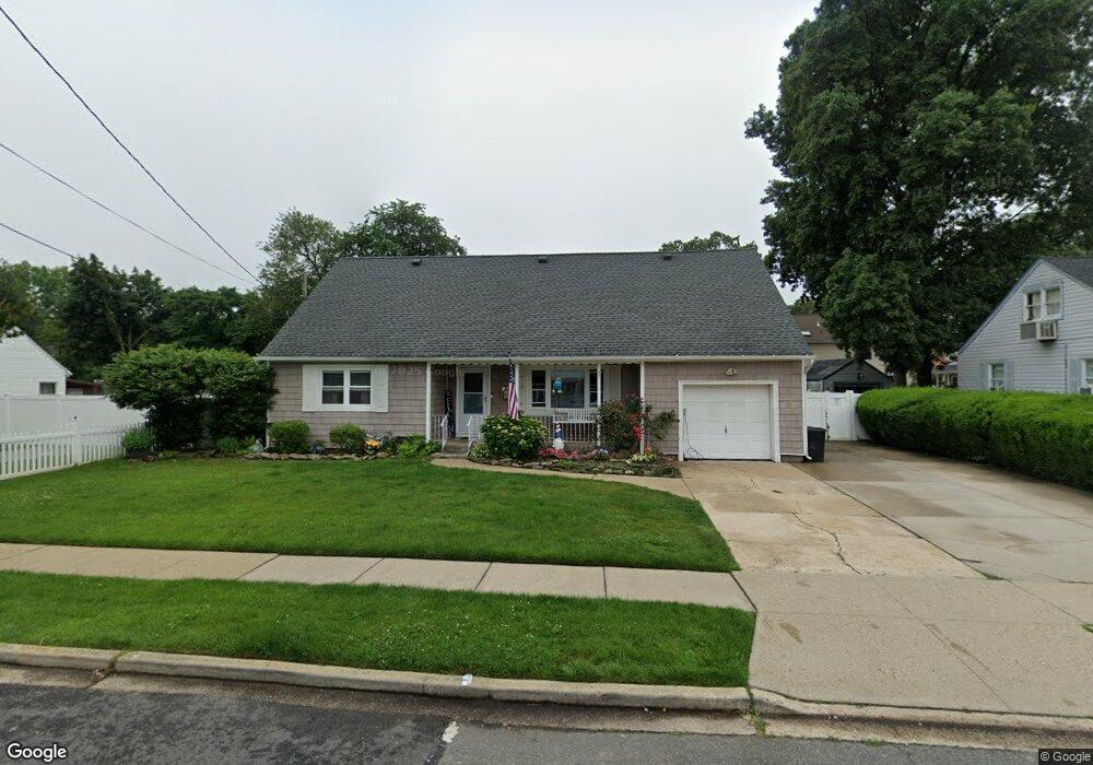
624 Robin Ct West Hempstead, NY 11552
Estimated Value: $722,000 - $770,237
4
Beds
2
Baths
1,836
Sq Ft
$406/Sq Ft
Est. Value
About This Home
This home is located at 624 Robin Ct, West Hempstead, NY 11552 and is currently estimated at $746,119, approximately $406 per square foot. 624 Robin Ct is a home located in Nassau County with nearby schools including Chestnut Street School, West Hempstead Secondary School, and Evergreen Charter School.
Ownership History
Date
Name
Owned For
Owner Type
Purchase Details
Closed on
Mar 17, 2021
Sold by
Mcgowan Annette and Martinez Migdalia
Bought by
Mcgowan Annette and Mcgowan Mark E
Current Estimated Value
Home Financials for this Owner
Home Financials are based on the most recent Mortgage that was taken out on this home.
Original Mortgage
$463,980
Outstanding Balance
$428,938
Interest Rate
5.27%
Mortgage Type
FHA
Estimated Equity
$317,181
Purchase Details
Closed on
Oct 30, 2014
Sold by
Last Jason F and Last Kelly
Bought by
Mcgowan Annette and Martinez Migdalia
Purchase Details
Closed on
Jun 20, 2001
Sold by
Bischoff Walter Lenard
Bought by
Last Jason F
Create a Home Valuation Report for This Property
The Home Valuation Report is an in-depth analysis detailing your home's value as well as a comparison with similar homes in the area
Home Values in the Area
Average Home Value in this Area
Purchase History
| Date | Buyer | Sale Price | Title Company |
|---|---|---|---|
| Mcgowan Annette | -- | Amrock Llc | |
| Mcgowan Annette | $370,000 | Sutton Land Title | |
| Last Jason F | $220,000 | Henoch Berkman |
Source: Public Records
Mortgage History
| Date | Status | Borrower | Loan Amount |
|---|---|---|---|
| Open | Mcgowan Annette | $463,980 |
Source: Public Records
Tax History Compared to Growth
Tax History
| Year | Tax Paid | Tax Assessment Tax Assessment Total Assessment is a certain percentage of the fair market value that is determined by local assessors to be the total taxable value of land and additions on the property. | Land | Improvement |
|---|---|---|---|---|
| 2025 | $10,802 | $437 | $234 | $203 |
| 2024 | $3,375 | $433 | $231 | $202 |
| 2023 | $10,105 | $475 | $256 | $219 |
| 2022 | $10,105 | $449 | $240 | $209 |
| 2021 | $13,606 | $457 | $244 | $213 |
| 2020 | $11,643 | $862 | $538 | $324 |
| 2019 | $13,212 | $862 | $538 | $324 |
| 2018 | $12,347 | $778 | $0 | $0 |
| 2017 | $6,397 | $778 | $538 | $240 |
| 2016 | $9,812 | $778 | $538 | $240 |
| 2015 | -- | $778 | $538 | $240 |
| 2014 | -- | $778 | $538 | $240 |
| 2013 | $3,265 | $778 | $538 | $240 |
Source: Public Records
Map
Nearby Homes
- 647 Jennings Ave
- 629 Park Ave
- 596 Lincoln Ave
- 815 Sunshine Ave
- 513 Washington Ave
- 55 Melvin Ave
- 841 Woodfield Rd
- 301 Coventry Rd N
- 312 Coventry Rd S
- 49 Carol St
- 321 Oakford St
- 757 Harrison St
- 5 Juliette Rd
- 450 Rhodes Ln
- 853 Arthur St
- 0 Rhodes Ln
- 899 Cleveland St
- 686 Tanwood Dr
- 467 Susan Ct
- 486 Champlain Ave