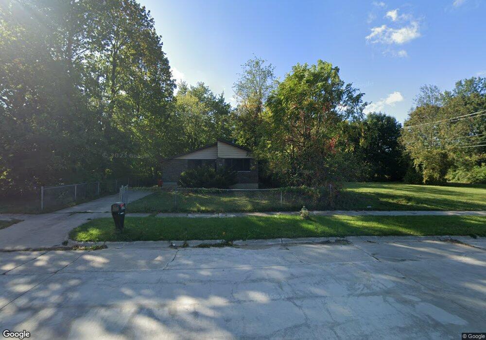
624 Waukonda Ave Benton Harbor, MI 49022
Estimated Value: $14,000 - $138,000
--
Bed
--
Bath
--
Sq Ft
5,053
Sq Ft Lot
About This Home
This home is located at 624 Waukonda Ave, Benton Harbor, MI 49022 and is currently estimated at $76,000. 624 Waukonda Ave is a home with nearby schools including Fair Plain Middle School, Benton Harbor High School, and Mildred C. Wells Preparatory Academy.
Ownership History
Date
Name
Owned For
Owner Type
Purchase Details
Closed on
Oct 13, 2017
Sold by
Witkowsk Berrin Conty Treasure Bret
Bought by
Muhammad Anton and Reyes Susan
Current Estimated Value
Purchase Details
Closed on
Nov 25, 2003
Sold by
Wolf William A
Bought by
Fizzell David L
Purchase Details
Closed on
Dec 7, 1999
Purchase Details
Closed on
Oct 27, 1999
Purchase Details
Closed on
May 7, 1998
Purchase Details
Closed on
Dec 18, 1996
Purchase Details
Closed on
Oct 18, 1996
Purchase Details
Closed on
Apr 18, 1994
Purchase Details
Closed on
Mar 29, 1990
Create a Home Valuation Report for This Property
The Home Valuation Report is an in-depth analysis detailing your home's value as well as a comparison with similar homes in the area
Home Values in the Area
Average Home Value in this Area
Purchase History
| Date | Buyer | Sale Price | Title Company |
|---|---|---|---|
| Muhammad Anton | -- | None Available | |
| Fizzell David L | $300 | -- | |
| -- | -- | -- | |
| -- | -- | -- | |
| -- | -- | -- | |
| -- | -- | -- | |
| -- | -- | -- | |
| -- | -- | -- | |
| -- | -- | -- |
Source: Public Records
Tax History Compared to Growth
Tax History
| Year | Tax Paid | Tax Assessment Tax Assessment Total Assessment is a certain percentage of the fair market value that is determined by local assessors to be the total taxable value of land and additions on the property. | Land | Improvement |
|---|---|---|---|---|
| 2025 | $28 | $2,700 | $0 | $0 |
| 2024 | $27 | $2,200 | $0 | $0 |
| 2023 | $21 | $500 | $0 | $0 |
| 2022 | $24 | $400 | $0 | $0 |
| 2021 | $38 | $600 | $600 | $0 |
| 2020 | $38 | $600 | $0 | $0 |
| 2019 | $38 | $600 | $0 | $0 |
| 2018 | $147 | $2,400 | $0 | $0 |
| 2017 | $50 | $800 | $0 | $0 |
| 2016 | $250 | $800 | $0 | $0 |
| 2015 | $50 | $800 | $0 | $0 |
| 2014 | $55 | $1,000 | $0 | $0 |
Source: Public Records
Map
Nearby Homes
- 470 N Mccord St
- 530 Rembert Ct
- 6525 Territorial Rd
- 696 Highland Ave
- 238 Pine St
- 137 Cornelia St
- 710 Buss Ave
- 1069 E Main St
- 992 Highland Ave
- 234 Walnut St
- 309 High St
- 255 High St
- 394 Linden St
- 1226 Chicago Ave
- 937 Hall St
- 391 Pipestone St
- 255 Collins Ave
- 419 Packard St
- 378 Pipestone St
- 293 Morning Walk Path
- 630 Waukonda Ave
- 614 Waukonda Ave
- 482 N Winans St
- 472 N Winans St
- 631 Waukonda Ave
- 468 N Winans St
- 611 Waukonda Ave
- 495 N Winans St
- 653 Waukonda Ave
- 653 Waukonda Ave
- 471 N Winans St
- 670 Waukonda Ave
- 615 Madison Ave
- 661 Waukonda Ave
- 537 Buena Vista Rd
- 491 N Stevens St
- 645 Madison Ave
- 545 Buena Vista Rd
- 536 N Winans St
- 546 Buena Vista Rd