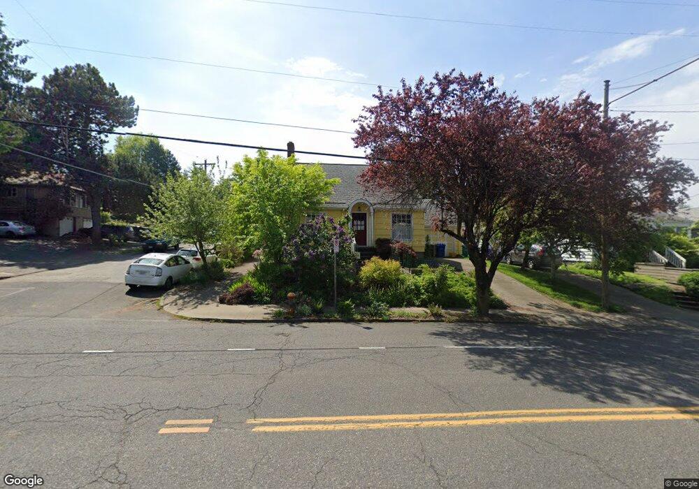
6240 E Burnside St Portland, OR 97215
Mount Tabor NeighborhoodEstimated Value: $545,000 - $581,000
3
Beds
1
Bath
2,180
Sq Ft
$256/Sq Ft
Est. Value
About This Home
This home is located at 6240 E Burnside St, Portland, OR 97215 and is currently estimated at $558,167, approximately $256 per square foot. 6240 E Burnside St is a home located in Multnomah County with nearby schools including Glencoe Elementary School, Mt Tabor Middle School, and Franklin High School.
Ownership History
Date
Name
Owned For
Owner Type
Purchase Details
Closed on
Dec 21, 2011
Sold by
Macdonald James B
Bought by
Ilem Leah
Current Estimated Value
Home Financials for this Owner
Home Financials are based on the most recent Mortgage that was taken out on this home.
Original Mortgage
$193,000
Outstanding Balance
$131,517
Interest Rate
3.93%
Mortgage Type
New Conventional
Estimated Equity
$426,650
Purchase Details
Closed on
Apr 21, 1998
Sold by
Freedman Samuel P and Freedman Karen
Bought by
Macdonald James B and Macdonald Sheila M
Home Financials for this Owner
Home Financials are based on the most recent Mortgage that was taken out on this home.
Original Mortgage
$115,995
Interest Rate
7.15%
Mortgage Type
FHA
Create a Home Valuation Report for This Property
The Home Valuation Report is an in-depth analysis detailing your home's value as well as a comparison with similar homes in the area
Home Values in the Area
Average Home Value in this Area
Purchase History
| Date | Buyer | Sale Price | Title Company |
|---|---|---|---|
| Ilem Leah | $204,000 | First American | |
| Macdonald James B | $117,500 | Pacific Nw Title |
Source: Public Records
Mortgage History
| Date | Status | Borrower | Loan Amount |
|---|---|---|---|
| Open | Ilem Leah | $193,000 | |
| Previous Owner | Macdonald James B | $115,995 |
Source: Public Records
Tax History Compared to Growth
Tax History
| Year | Tax Paid | Tax Assessment Tax Assessment Total Assessment is a certain percentage of the fair market value that is determined by local assessors to be the total taxable value of land and additions on the property. | Land | Improvement |
|---|---|---|---|---|
| 2024 | $5,359 | $200,280 | -- | -- |
| 2023 | $5,153 | $194,450 | $0 | $0 |
| 2022 | $5,041 | $188,790 | $0 | $0 |
| 2021 | $4,956 | $183,300 | $0 | $0 |
| 2020 | $4,547 | $177,970 | $0 | $0 |
| 2019 | $4,380 | $172,790 | $0 | $0 |
| 2018 | $4,251 | $167,760 | $0 | $0 |
| 2017 | $4,074 | $162,880 | $0 | $0 |
| 2016 | $3,729 | $158,140 | $0 | $0 |
| 2015 | $3,631 | $153,540 | $0 | $0 |
| 2014 | $3,576 | $149,070 | $0 | $0 |
Source: Public Records
Map
Nearby Homes
- 6134 E Burnside St
- 6055 E Burnside St
- 6541 E Burnside St
- 232 NE 61st Ave
- 304 NE 63rd Ave
- 6006 NE Davis St
- 223 SE 62nd Ave
- 235 NE 61st Ave Unit 36
- 6505 SE Thorburn St
- 280 NE 60th Ave Unit 22
- 6647 SE Thorburn St
- 5842 E Burnside St
- 350 NE 61st Ave
- 424 NE 61st Ave Unit 426
- 5536 NE Flanders St
- 5528 NE Flanders St
- 0 SE Ash Place Unit 10 24522620
- 7700 SE Stark St
- 5807 NE Everett St Unit 2
- 510 SE 62nd Ave
- 6230 E Burnside St
- 0 E Burnside St Unit 23620916
- 0 E Burnside St Unit 8015063
- 0 E Burnside St Unit 8065188
- 0 E Burnside St Unit 8058778
- 0 E Burnside St Unit 8105143
- 0 E Burnside St Unit 9002466
- 0 E Burnside St Unit 8055340
- 0 E Burnside St Unit 8072178
- 0 E Burnside St Unit 8109984
- 0 E Burnside St Unit 9073195
- 0 E Burnside St Unit 12616665
- 0 E Burnside St Unit 15540775
- 0 E Burnside St Unit 16604336
- 0 E Burnside St Unit 17158400
- 0 E Burnside St Unit 17500681
- -1 E Burnside St
- 0 E Burnside St Unit E4514
- 25 SE 63rd Ave Unit 29
- 29 SE 63rd Ave