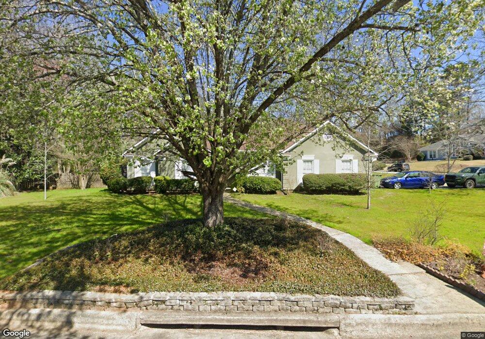
6240 Independence Dr Columbus, GA 31909
Midland NeighborhoodEstimated Value: $276,075 - $294,000
3
Beds
3
Baths
1,941
Sq Ft
$147/Sq Ft
Est. Value
About This Home
This home is located at 6240 Independence Dr, Columbus, GA 31909 and is currently estimated at $286,269, approximately $147 per square foot. 6240 Independence Dr is a home located in Muscogee County with nearby schools including Midland Academy, Midland Middle School, and Shaw High School.
Ownership History
Date
Name
Owned For
Owner Type
Purchase Details
Closed on
Jul 27, 2012
Sold by
Forsythe Bradley Wayne
Bought by
Lewis Mark B and Lewis Yeon C
Current Estimated Value
Purchase Details
Closed on
Apr 17, 2007
Sold by
Forsythe Bradley Wayne
Bought by
Doucette Forsythe Bradley Wayne and Doucette Forsythe Melissa
Home Financials for this Owner
Home Financials are based on the most recent Mortgage that was taken out on this home.
Original Mortgage
$156,800
Interest Rate
6.1%
Mortgage Type
Purchase Money Mortgage
Create a Home Valuation Report for This Property
The Home Valuation Report is an in-depth analysis detailing your home's value as well as a comparison with similar homes in the area
Home Values in the Area
Average Home Value in this Area
Purchase History
| Date | Buyer | Sale Price | Title Company |
|---|---|---|---|
| Lewis Mark B | $157,000 | -- | |
| Doucette Forsythe Bradley Wayne | -- | None Available |
Source: Public Records
Mortgage History
| Date | Status | Borrower | Loan Amount |
|---|---|---|---|
| Previous Owner | Doucette Forsythe Bradley Wayne | $156,800 |
Source: Public Records
Tax History Compared to Growth
Tax History
| Year | Tax Paid | Tax Assessment Tax Assessment Total Assessment is a certain percentage of the fair market value that is determined by local assessors to be the total taxable value of land and additions on the property. | Land | Improvement |
|---|---|---|---|---|
| 2025 | -- | $94,816 | $18,612 | $76,204 |
| 2024 | -- | $94,816 | $18,612 | $76,204 |
| 2023 | $2,520 | $94,816 | $18,612 | $76,204 |
| 2022 | $3,049 | $74,676 | $18,612 | $56,064 |
| 2021 | $2,918 | $71,476 | $18,612 | $52,864 |
| 2020 | $2,919 | $71,476 | $18,612 | $52,864 |
| 2019 | $2,928 | $71,476 | $18,612 | $52,864 |
| 2018 | $2,928 | $71,476 | $18,612 | $52,864 |
| 2017 | $2,938 | $71,476 | $18,612 | $52,864 |
| 2016 | $2,556 | $61,956 | $10,304 | $51,652 |
| 2015 | $1,024 | $61,956 | $10,304 | $51,652 |
| 2014 | $1,025 | $61,956 | $10,304 | $51,652 |
| 2013 | -- | $61,956 | $10,304 | $51,652 |
Source: Public Records
Map
Nearby Homes
- 6454 Patriot Dr
- 6222 Goodwin Dr
- 6251 Rockefeller Dr
- 7020 Stoneridge Cir
- 6036 Townes Way
- 6055 Townes Way
- 7101 Cross Tie Dr
- 6 Jamestown Ct
- 7076 Stoneybrook Dr
- 6528 Yellow Stone Ct
- 6333 Stony Creek Dr
- 6263 Potomac Cir
- 5378 Misty Ln
- 5422 Colony Dr
- 5966 Fornof Rd
- 6127 Stony Creek Dr
- 5324 Colony Dr
- 5408 Old Dominion Rd
- 7389 Sorrel Ct
- 8095 Santee Ct
- 6455 Independence Ct
- 6239 Independence Dr
- 6231 Independence Dr
- 6450 Independence Ct
- 6459 Independence Ct
- 6454 Independence Ct
- 6247 Independence Dr
- 6256 Independence Dr
- 6458 Independence Ct
- 6255 Independence Dr
- 6215 Independence Dr
- 6208 Independence Dr
- 6500 Steubenville Dr
- 6455 Patriot Dr
- 0 Independence Dr Unit 208520
- 0 Independence Dr
- 6200 Bayonne Dr
- 6459 Patriot Dr
- 6148 Bayonne Dr
- 6505 Steubenville Dr