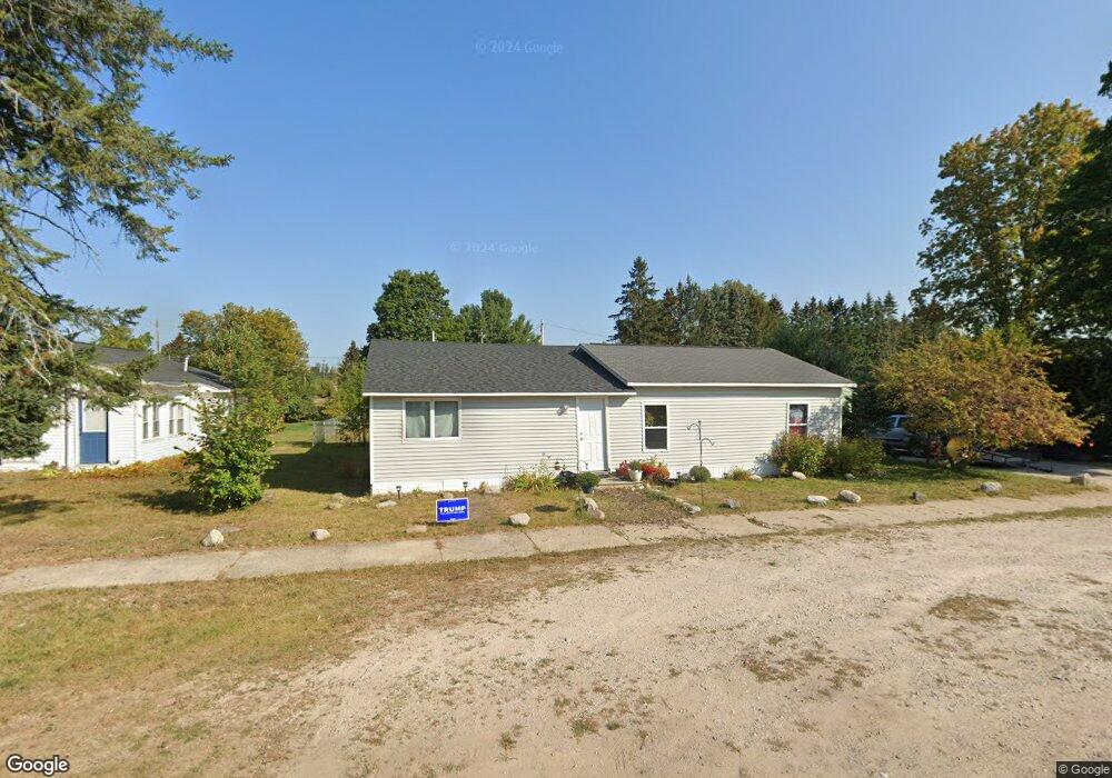
6241 W State St Pellston, MI 49769
Estimated Value: $179,852 - $211,000
3
Beds
1
Bath
--
Sq Ft
0.34
Acres
About This Home
This home is located at 6241 W State St, Pellston, MI 49769 and is currently estimated at $194,617. 6241 W State St is a home located in Emmet County with nearby schools including Pellston Elementary School and Pellston Middle/High School.
Ownership History
Date
Name
Owned For
Owner Type
Purchase Details
Closed on
Aug 8, 2008
Sold by
Blakemore Richard R and Blakemore Brandy
Bought by
Blakemore Brandy and Schlappi James
Current Estimated Value
Purchase Details
Closed on
Feb 21, 2007
Bought by
Blakemore Richard R and Blakemore Brandi
Purchase Details
Closed on
Jun 8, 2006
Bought by
Lasalle Bank Natl Assoc
Purchase Details
Closed on
Apr 8, 2004
Sold by
Brooks Helen R and Frechette Laurence
Bought by
Whennen Alice R and Whennen Michael
Purchase Details
Closed on
Nov 29, 2000
Sold by
Gee Loran and Burke Meredith
Bought by
Brooks Helen R and Brooks Frechette L
Purchase Details
Closed on
May 1, 1994
Bought by
Gee
Create a Home Valuation Report for This Property
The Home Valuation Report is an in-depth analysis detailing your home's value as well as a comparison with similar homes in the area
Home Values in the Area
Average Home Value in this Area
Purchase History
| Date | Buyer | Sale Price | Title Company |
|---|---|---|---|
| Blakemore Brandy | -- | -- | |
| Blakemore Richard R | $34,900 | -- | |
| Blakemore Richard R | $34,900 | E Title Agency Inc | |
| Lasalle Bank Natl Assoc | $80,800 | -- | |
| Whennen Alice R | $88,000 | -- | |
| Brooks Helen R | $70,000 | -- | |
| Gee | $29,500 | -- |
Source: Public Records
Tax History Compared to Growth
Tax History
| Year | Tax Paid | Tax Assessment Tax Assessment Total Assessment is a certain percentage of the fair market value that is determined by local assessors to be the total taxable value of land and additions on the property. | Land | Improvement |
|---|---|---|---|---|
| 2025 | $2,777 | $81,400 | $81,400 | $0 |
| 2024 | $2,777 | $76,000 | $76,000 | $0 |
| 2023 | $2,563 | $69,800 | $69,800 | $0 |
| 2022 | $2,563 | $63,900 | $63,900 | $0 |
| 2021 | $2,595 | $61,100 | $61,100 | $0 |
| 2020 | $2,590 | $58,600 | $58,600 | $0 |
| 2019 | -- | $53,700 | $53,700 | $0 |
| 2018 | -- | $53,700 | $53,700 | $0 |
| 2017 | -- | $53,400 | $53,400 | $0 |
| 2016 | -- | $50,300 | $50,300 | $0 |
| 2015 | -- | $49,600 | $0 | $0 |
| 2014 | -- | $44,400 | $0 | $0 |
Source: Public Records
Map
Nearby Homes
- 6457 State St
- 000 Vacant U S 31
- 6421 Airport Crossing Rd Unit 1
- 6672 Industrial Dr
- 0 Reed Rd Unit 474270
- TBD Teal Rd
- 9470 Silver Strand Rd
- 9670 Silver Strand Rd
- 4333 U S 31
- 9485 Ingleside Rd
- 3016 W Burt Lake Rd
- 10999 Koepke Rd
- 10222 W Munro Lake Dr
- 5100 N Bay Way
- 5383 N Conway Rd
- 1975 &1995 Club House Dr
- 1975 + 1995 Club House Dr
- 6430 Admirals Point Dr
- 6167 Lambert Dr
- 4310 E Burt Lake Rd
- 6233 W State St
- 6281 W State St
- 310 Tindle Rd
- 310 Tindle Rd
- 6282 Bogardus
- 6209 W State St
- 6301 W State St
- 6230 W State St
- 6286 Bogardus
- 6274 W State St
- 6305 W State St
- 6195 W State St
- 273 Milton Rd
- 6317 W State St
- 237 Milton Rd
- 6161 W State St
- 6227 Bogardus
- 6251 Bogardus
- 227 Milton Rd
- 6243 W Edgar St