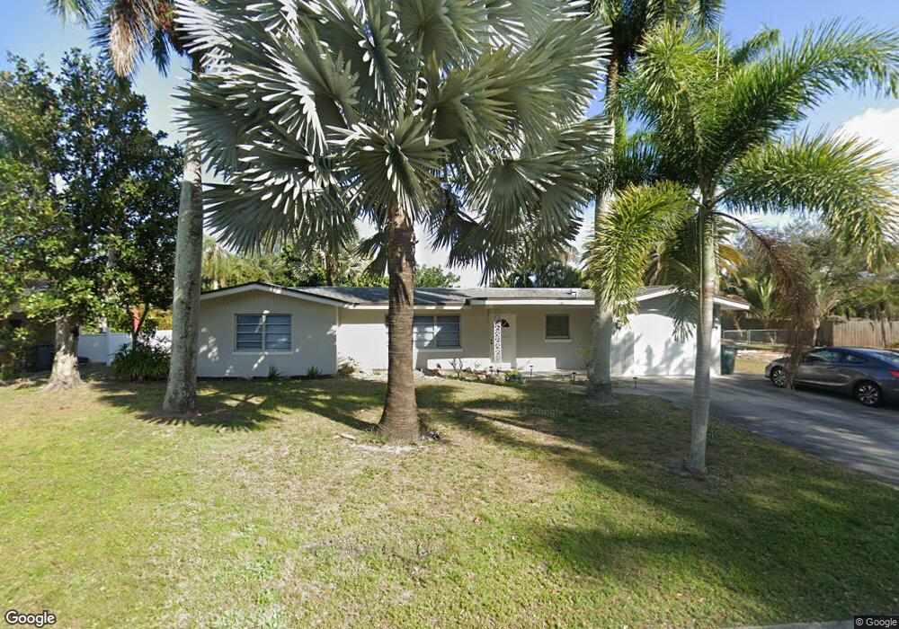
6243 Saint Andrews Cir N Fort Myers, FL 33919
Whiskey Creek NeighborhoodEstimated Value: $359,106 - $409,000
3
Beds
2
Baths
1,628
Sq Ft
$236/Sq Ft
Est. Value
About This Home
This home is located at 6243 Saint Andrews Cir N, Fort Myers, FL 33919 and is currently estimated at $383,777, approximately $235 per square foot. 6243 Saint Andrews Cir N is a home located in Lee County with nearby schools including Orangewood Elementary School, Allen Park Elementary School, and Edison Park Creative & Expressive Arts School.
Ownership History
Date
Name
Owned For
Owner Type
Purchase Details
Closed on
Sep 1, 2017
Sold by
Degroot Lauke
Bought by
Presto William
Current Estimated Value
Purchase Details
Closed on
Feb 11, 2014
Sold by
Degroot Barry
Bought by
Degroot Luke
Purchase Details
Closed on
Mar 17, 2005
Sold by
Degroot Luke and Degroot Phyllis
Bought by
Declar Degroot Phyllis Rollins and Phyllis Rollins Degroot Declaration Of T
Purchase Details
Closed on
Aug 4, 1997
Sold by
Degroot Kenneth J and Degroot Robyn R
Bought by
Degroot Luke and Degroot Phyllis
Create a Home Valuation Report for This Property
The Home Valuation Report is an in-depth analysis detailing your home's value as well as a comparison with similar homes in the area
Home Values in the Area
Average Home Value in this Area
Purchase History
| Date | Buyer | Sale Price | Title Company |
|---|---|---|---|
| Presto William | $120,000 | Security Title & Abstract Ll | |
| Degroot Luke | -- | Attorney | |
| Declar Degroot Phyllis Rollins | -- | -- | |
| Degroot Luke | $107,600 | -- |
Source: Public Records
Tax History Compared to Growth
Tax History
| Year | Tax Paid | Tax Assessment Tax Assessment Total Assessment is a certain percentage of the fair market value that is determined by local assessors to be the total taxable value of land and additions on the property. | Land | Improvement |
|---|---|---|---|---|
| 2025 | $4,274 | $165,086 | -- | -- |
| 2024 | $3,791 | $277,976 | -- | -- |
| 2023 | $3,791 | $252,705 | $0 | $0 |
| 2022 | $3,776 | $219,845 | $0 | $0 |
| 2021 | $3,194 | $222,718 | $56,668 | $166,050 |
| 2020 | $2,842 | $181,690 | $54,000 | $127,690 |
| 2019 | $2,826 | $179,259 | $54,000 | $125,259 |
| 2018 | $2,912 | $180,881 | $54,000 | $126,881 |
| 2017 | $3,018 | $192,113 | $37,500 | $154,613 |
| 2016 | $2,867 | $182,872 | $40,178 | $142,694 |
| 2015 | $2,543 | $147,001 | $37,053 | $109,948 |
| 2014 | -- | $124,995 | $23,853 | $101,142 |
| 2013 | -- | $109,702 | $17,766 | $91,936 |
Source: Public Records
Map
Nearby Homes
- 1420 Mandel Rd
- 5034 Westminster Dr
- 19 Winewood Ct
- 1358 Hopedale Dr
- 20 Catalpa Ct
- 1442 Byron Rd
- 8327 Riviera Ave
- 6011 Fountain Way
- 1427 Davis Dr
- 1221 La Faunce Way
- 1212 Twin Palm Dr
- 1457 Byron Rd
- 8451 Casa Del Rio Ln
- 6005 W Riverside Dr
- 5216 Cedarbend Dr Unit 3
- 1563 Covington Cir E
- 1515 Manchester Blvd
- 1250 Kasamada Dr
- 1348 Woodmere Ln
- 5224 Cedarbend Dr Unit 4
- 6241 Saint Andrews Cir N
- 6247 Saint Andrews Cir N
- 1440 Argyle Dr
- 1438 Argyle Dr
- 1442 Argyle Dr
- 6242 Saint Andrews Cir N
- 6239 Saint Andrews Cir N
- 6244 Saint Andrews Cir N
- 1436 Argyle Dr
- 6240 Saint Andrews Cir N
- 6246 Saint Andrews Cir N
- 6237 Saint Andrews Cir N
- 6238 Saint Andrews Cir N
- 1446 Argyle Dr
- 6361 Saint Andrews Cir S
- 1441 Argyle Dr
- 1506 Argyle Dr
- 6206 Saint Andrews Cir N
- 1443 Argyle Dr
- 6204 Saint Andrews Cir N