Estimated Value: $772,558 - $871,000
4
Beds
4
Baths
4,864
Sq Ft
$170/Sq Ft
Est. Value
About This Home
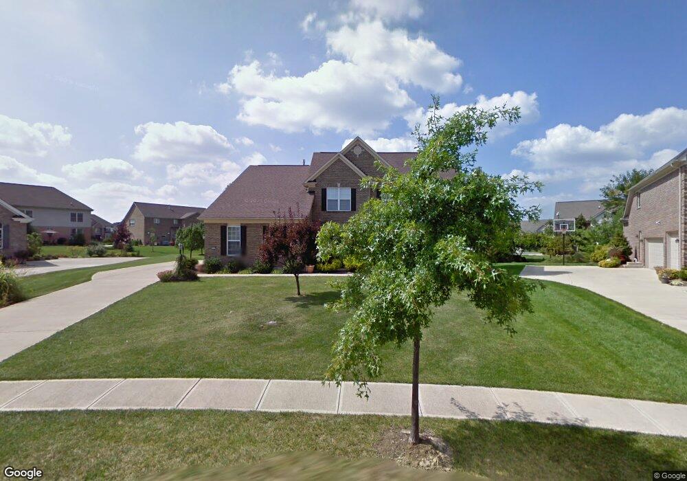
This home is located at 6247 Blackheath Cir, Mason, OH 45040 and is currently estimated at $826,140, approximately $169 per square foot. 6247 Blackheath Cir is a home located in Warren County with nearby schools including Mason Intermediate Elementary School, Mason Middle School, and William Mason High School.
Ownership History
Date
Name
Owned For
Owner Type
Purchase Details
Closed on
Feb 11, 2011
Sold by
Maine David L and Maine Stuart
Bought by
Lam Monica W and Mamak Marc A
Current Estimated Value
Home Financials for this Owner
Home Financials are based on the most recent Mortgage that was taken out on this home.
Original Mortgage
$314,000
Outstanding Balance
$215,982
Interest Rate
4.89%
Mortgage Type
New Conventional
Estimated Equity
$610,158
Purchase Details
Closed on
Jul 11, 2002
Sold by
Ray Murphy Homes
Bought by
Maine David L and Maine M Stuart
Home Financials for this Owner
Home Financials are based on the most recent Mortgage that was taken out on this home.
Original Mortgage
$250,000
Interest Rate
6.82%
Mortgage Type
New Conventional
Purchase Details
Closed on
Oct 11, 2001
Sold by
Mason Joint Venture
Bought by
Ray Murphy Homes Inc
Create a Home Valuation Report for This Property
The Home Valuation Report is an in-depth analysis detailing your home's value as well as a comparison with similar homes in the area
Home Values in the Area
Average Home Value in this Area
Purchase History
| Date | Buyer | Sale Price | Title Company |
|---|---|---|---|
| Lam Monica W | $392,500 | Chicago Title | |
| Maine David L | $371,415 | -- | |
| Ray Murphy Homes Inc | $233,700 | -- |
Source: Public Records
Mortgage History
| Date | Status | Borrower | Loan Amount |
|---|---|---|---|
| Open | Lam Monica W | $314,000 | |
| Closed | Maine David L | $250,000 |
Source: Public Records
Tax History Compared to Growth
Tax History
| Year | Tax Paid | Tax Assessment Tax Assessment Total Assessment is a certain percentage of the fair market value that is determined by local assessors to be the total taxable value of land and additions on the property. | Land | Improvement |
|---|---|---|---|---|
| 2024 | $8,463 | $208,530 | $30,190 | $178,340 |
| 2023 | $8,169 | $170,037 | $28,875 | $141,162 |
| 2022 | $8,063 | $170,037 | $28,875 | $141,162 |
| 2021 | $7,638 | $170,037 | $28,875 | $141,162 |
| 2020 | $8,099 | $154,578 | $26,250 | $128,328 |
| 2019 | $7,445 | $154,578 | $26,250 | $128,328 |
| 2018 | $7,470 | $154,578 | $26,250 | $128,328 |
| 2017 | $7,211 | $139,297 | $24,437 | $114,860 |
| 2016 | $7,428 | $139,297 | $24,437 | $114,860 |
| 2015 | $7,443 | $139,297 | $24,437 | $114,860 |
| 2014 | $7,460 | $130,180 | $22,840 | $107,350 |
| 2013 | $7,476 | $149,640 | $26,250 | $123,390 |
Source: Public Records
Map
Nearby Homes
- 4109 Old Manchester Ct
- 4154 Fieldsedge Dr
- 6550 Villagefield Dr
- 4087 Fieldsedge Dr Unit 285E
- 6545 Farmbrooke Ct
- 4762 Flagstone Dr
- 6551 Farmbrooke Ct
- 6674 Villager Place Unit 153D
- 3900 St Andrews Ct
- 6668 Pondfield Ln
- 6365 Fieldstone Dr
- 5799 Fairway Dr
- 6292 Greenwood Ct
- 6334 Greenwood Ct
- 6298 Greenwood Ct
- 6328 Greenwood Ct
- 6279 Greenwood Ct
- 6346 Coverage Ct
- 6350 Coverage Ct
- 6342 Coverage Ct
- 6237 Blackheath Cir
- 6257 Blackheath Cir
- 6234 Fairway Dr
- 6246 Fairway Dr
- 4186 Old Manchester Ct
- 6216 Fairway Dr
- 4176 Old Manchester Ct
- 6229 Blackheath Cir
- 6198 Fairway Dr
- 6264 Fairway Dr
- 4166 Old Manchester Ct
- 6178 Fairway Dr
- 6274 Blackheath Cir
- 4156 Old Manchester Ct
- 6355 Blackheath Cir
- 6272 Blackheath Cir
- 6241 Fairway Dr
- 6229 Fairway Dr
- 6160 Fairway Dr
- 4175 Old Manchester Ct