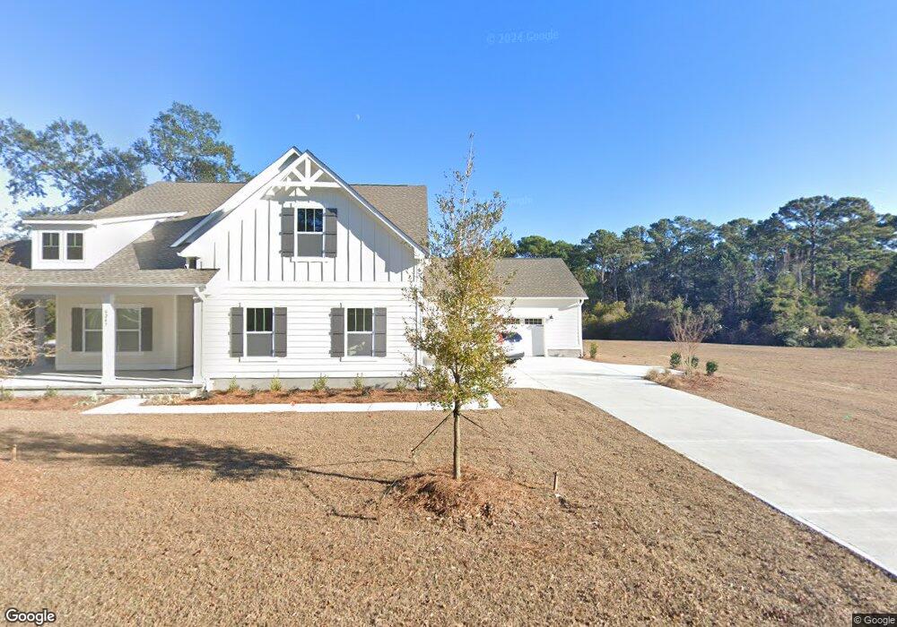
6247 Navigator Way Southport, NC 28461
Estimated Value: $817,000 - $931,000
4
Beds
4
Baths
2,398
Sq Ft
$361/Sq Ft
Est. Value
About This Home
This home is located at 6247 Navigator Way, Southport, NC 28461 and is currently estimated at $865,382, approximately $360 per square foot. 6247 Navigator Way is a home located in Brunswick County with nearby schools including Southport Elementary School, South Brunswick Middle School, and South Brunswick High School.
Ownership History
Date
Name
Owned For
Owner Type
Purchase Details
Closed on
Jun 22, 2022
Sold by
Bos and Christine
Bought by
Kluttz Keith E and Mumford Lisa C
Current Estimated Value
Purchase Details
Closed on
Feb 9, 2007
Sold by
Dinyovszky John S and Dinyovszky Mary V
Bought by
Bos Jon and Bos Christine
Purchase Details
Closed on
Apr 6, 2005
Sold by
Molloy Howard J and Molloy Bonnie F
Bought by
Dinyovszky John S and Dinyovszky Mary
Home Financials for this Owner
Home Financials are based on the most recent Mortgage that was taken out on this home.
Original Mortgage
$85,500
Interest Rate
5.5%
Mortgage Type
Future Advance Clause Open End Mortgage
Create a Home Valuation Report for This Property
The Home Valuation Report is an in-depth analysis detailing your home's value as well as a comparison with similar homes in the area
Home Values in the Area
Average Home Value in this Area
Purchase History
| Date | Buyer | Sale Price | Title Company |
|---|---|---|---|
| Kluttz Keith E | $154,000 | Clouser Zachary T | |
| Kluttz Keith E | $154,000 | Clouser Zachary T | |
| Bos Jon | $181,500 | Chicago Title Insurance Comp | |
| Dinyovszky John S | $95,000 | Chicago Title Insurance Comp |
Source: Public Records
Mortgage History
| Date | Status | Borrower | Loan Amount |
|---|---|---|---|
| Previous Owner | Dinyovszky John S | $85,500 |
Source: Public Records
Tax History Compared to Growth
Tax History
| Year | Tax Paid | Tax Assessment Tax Assessment Total Assessment is a certain percentage of the fair market value that is determined by local assessors to be the total taxable value of land and additions on the property. | Land | Improvement |
|---|---|---|---|---|
| 2025 | $4,991 | $663,430 | $153,000 | $510,430 |
| 2024 | $4,991 | $663,430 | $153,000 | $510,430 |
| 2023 | $803 | $153,000 | $153,000 | $0 |
| 2022 | $803 | $85,000 | $85,000 | $0 |
| 2021 | $711 | $85,000 | $85,000 | $0 |
| 2020 | $711 | $85,000 | $85,000 | $0 |
| 2019 | $711 | $85,000 | $85,000 | $0 |
| 2018 | $572 | $68,000 | $68,000 | $0 |
| 2017 | $571 | $68,000 | $68,000 | $0 |
| 2016 | $534 | $68,000 | $68,000 | $0 |
| 2015 | $534 | $68,000 | $68,000 | $0 |
| 2014 | $665 | $90,000 | $90,000 | $0 |
Source: Public Records
Map
Nearby Homes
- 1015 E Moore St
- 1012 E Moore St
- 1014 Softwind Way
- 1010 Softwind Way
- 1003 Softwind Way
- 5147 Fernwood Dr
- 282 Sand Dollar Ln
- 282 Sand Dollar Ln Unit 38
- 5138 Fernwood Dr
- 5122 Fernwood Dr
- 2035 Oakton Dr Unit 9
- 306 N Fodale Ave
- 2071 Rosin Dr Unit 19
- 131 Stuart Ave Unit 42
- The Thorpe Plan at Waters at Southport
- The Brandt Plan at Waters at Southport
- The Salters Plan at Waters at Southport
- 131 Stuart Ave
- The Summit Plan at Waters at Southport
- 712 Longleaf Dr
- 6222 Navigator Way
- Lot 20 Navigator Way
- 6 Navigator Way
- 6219 Navigator Way
- 0 Navigator Way
- 6245 Navigator Way
- 6221 Navigator Way
- 6223 Navigator Way
- 6220 Navigator Way
- 6218 Navigator Way
- 6225 Navigator Way
- 6224 Navigator Way
- 6217 Navigator Way
- 6217 Pebble Shore Ln
- 6227 Navigator Way
- 6219 Pebble Shore Ln
- 6211 Pebble Shore Ln
- 6215 Navigator Way
- 6229 Navigator Way
- 6221 Pebble Shore Ln