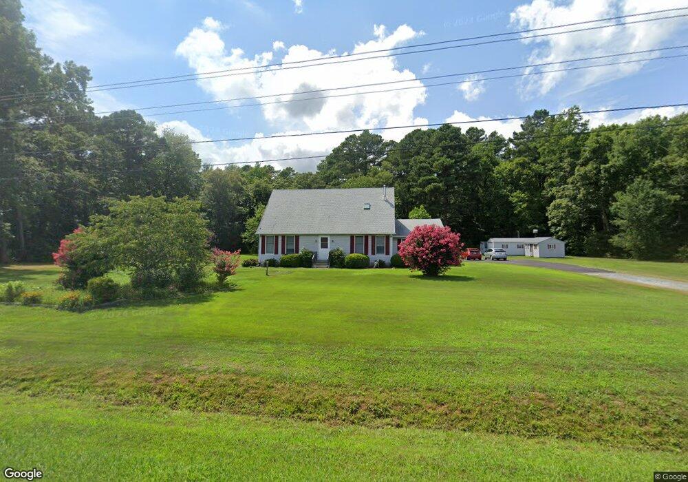
6248 Fire Tower Rd Salisbury, MD 21801
Estimated Value: $450,000 - $776,986
Studio
3
Baths
3,541
Sq Ft
$170/Sq Ft
Est. Value
About This Home
This home is located at 6248 Fire Tower Rd, Salisbury, MD 21801 and is currently estimated at $603,329, approximately $170 per square foot. 6248 Fire Tower Rd is a home located in Wicomico County with nearby schools including Westside Primary School, Westside Intermediate School, and Salisbury Middle School.
Ownership History
Date
Name
Owned For
Owner Type
Purchase Details
Closed on
Aug 20, 2012
Sold by
Fahey Richard Sean and Fahey Nicolle Marie
Bought by
Fahey Richard Sean
Current Estimated Value
Home Financials for this Owner
Home Financials are based on the most recent Mortgage that was taken out on this home.
Original Mortgage
$365,000
Outstanding Balance
$251,543
Interest Rate
3.56%
Mortgage Type
New Conventional
Estimated Equity
$351,786
Purchase Details
Closed on
Dec 18, 1986
Sold by
Toadvine William E and Toadvine Virginia H
Bought by
Miller Robert
Create a Home Valuation Report for This Property
The Home Valuation Report is an in-depth analysis detailing your home's value as well as a comparison with similar homes in the area
Home Values in the Area
Average Home Value in this Area
Purchase History
| Date | Buyer | Sale Price | Title Company |
|---|---|---|---|
| Fahey Richard Sean | -- | Maryland Title Center Llc | |
| Miller Robert | $23,900 | -- |
Source: Public Records
Mortgage History
| Date | Status | Borrower | Loan Amount |
|---|---|---|---|
| Open | Fahey Richard Sean | $365,000 |
Source: Public Records
Tax History
| Year | Tax Paid | Tax Assessment Tax Assessment Total Assessment is a certain percentage of the fair market value that is determined by local assessors to be the total taxable value of land and additions on the property. | Land | Improvement |
|---|---|---|---|---|
| 2025 | $4,296 | $470,133 | $0 | $0 |
| 2024 | $3,985 | $415,667 | $0 | $0 |
| 2023 | $3,571 | $361,200 | $43,400 | $317,800 |
| 2022 | $3,634 | $356,667 | $0 | $0 |
| 2021 | $3,585 | $352,133 | $0 | $0 |
| 2020 | $3,585 | $347,600 | $43,400 | $304,200 |
| 2019 | $3,484 | $332,933 | $0 | $0 |
| 2018 | $3,348 | $318,267 | $0 | $0 |
| 2017 | $3,193 | $303,600 | $0 | $0 |
| 2016 | -- | $303,600 | $0 | $0 |
| 2015 | $536 | $303,600 | $0 | $0 |
| 2014 | $536 | $304,500 | $0 | $0 |
Source: Public Records
Map
Nearby Homes
- 6148 Ayrshire Dr
- 5991 Hounds Bay Cir
- 26924 Black Horse Run
- 6229 Ayrshire Dr
- 26882 Pratt Rd
- 5823 Homestead St
- 5814 Homestead St
- 27018 Pratt Rd
- 6857 Fire Tower Rd
- 5850 Brook St
- 27120 Coach House Ln
- 26947 Pemberton Dr
- 5709 Royal Mile Blvd
- 5520 Cedarcrest Rd
- 26188 High Banks Dr
- 5686 N Nithsdale Dr Unit N
- 5482 Royal Mile Blvd
- 5474 Royal Mile Blvd
- 5461 Loch Ness Terrace
- 26929 S Tourmaline Dr
- 6244 Fire Tower Rd
- 6395 Fire Tower Rd
- 6395 Fire Tower Rd
- 6200 Fire Tower Rd
- 6298 Fire Tower Rd
- 6172 Fire Tower Rd
- 26460 Nanticoke Rd
- 26460 Nanticoke Rd
- 26504 Nanticoke Rd
- 26400 Nanticoke Rd
- 26400 Nanticoke Rd
- 26438 Nanticoke Rd
- 26598 Nanticoke Rd
- 26422 Nanticoke Rd
- 26535 Nanticoke Rd
- 26551 Nanticoke Rd
- 26608 Nanticoke Rd
- 26416 Nanticoke Rd
- 26563 Nanticoke Rd
- 26620 Nanticoke Rd
Your Personal Tour Guide
Ask me questions while you tour the home.