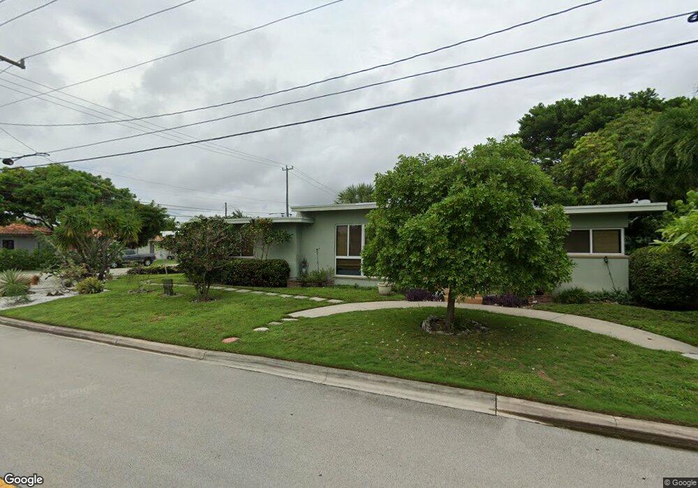
625 92nd St Surfside, FL 33154
Estimated Value: $1,305,897 - $1,550,000
2
Beds
2
Baths
1,337
Sq Ft
$1,077/Sq Ft
Est. Value
About This Home
This home is located at 625 92nd St, Surfside, FL 33154 and is currently estimated at $1,440,474, approximately $1,077 per square foot. 625 92nd St is a home located in Miami-Dade County with nearby schools including Ruth K. Broad Bay Harbor K-8 Center, Nautilus Middle School, and Miami Beach Senior High School.
Ownership History
Date
Name
Owned For
Owner Type
Purchase Details
Closed on
Jul 6, 2013
Sold by
Shamis Scott and Shamis Phyllis
Bought by
Shamis Scott and Shamis Phyllis
Current Estimated Value
Home Financials for this Owner
Home Financials are based on the most recent Mortgage that was taken out on this home.
Original Mortgage
$235,000
Outstanding Balance
$114,244
Interest Rate
3.91%
Mortgage Type
New Conventional
Estimated Equity
$1,326,230
Purchase Details
Closed on
Feb 12, 1997
Sold by
Joseph and Perillo Angela
Bought by
Shamis Scott and Winkler Phyllis
Home Financials for this Owner
Home Financials are based on the most recent Mortgage that was taken out on this home.
Original Mortgage
$125,400
Interest Rate
7.7%
Mortgage Type
New Conventional
Create a Home Valuation Report for This Property
The Home Valuation Report is an in-depth analysis detailing your home's value as well as a comparison with similar homes in the area
Home Values in the Area
Average Home Value in this Area
Purchase History
We collect this data history from publicly available records. To have your information removed, we recommend requesting removal directly through your county’s website.
| Date | Buyer | Sale Price | Title Company |
|---|---|---|---|
| Shamis Scott | -- | Attorney | |
| Shamis Scott | $132,000 | -- |
Source: Public Records
Mortgage History
We collect this data history from publicly available records. To have your information removed, we recommend requesting removal directly through your county’s website.
| Date | Status | Borrower | Loan Amount |
|---|---|---|---|
| Open | Shamis Scott | $235,000 | |
| Closed | Shamis Scott | $125,400 |
Source: Public Records
Tax History
| Year | Tax Paid | Tax Assessment Tax Assessment Total Assessment is a certain percentage of the fair market value that is determined by local assessors to be the total taxable value of land and additions on the property. | Land | Improvement |
|---|---|---|---|---|
| 2025 | $3,727 | $228,651 | -- | -- |
| 2024 | $3,642 | $222,207 | -- | -- |
| 2023 | $3,642 | $215,735 | $0 | $0 |
| 2022 | $3,534 | $209,452 | $0 | $0 |
| 2021 | $3,499 | $203,352 | $0 | $0 |
| 2020 | $3,477 | $200,545 | $0 | $0 |
| 2019 | $3,403 | $196,037 | $0 | $0 |
| 2018 | $3,271 | $192,382 | $0 | $0 |
| 2017 | $3,234 | $188,426 | $0 | $0 |
| 2016 | $3,245 | $184,551 | $0 | $0 |
| 2015 | $3,276 | $183,269 | $0 | $0 |
| 2014 | $3,307 | $181,815 | $0 | $0 |
Source: Public Records
Map
Nearby Homes
- 9264 Byron Ave
- 9280 Byron Ave
- 9208 Emerson Ave
- 9205 Byron Ave
- 9348 Byron Ave
- 9324 Abbott Ave
- 9124 Byron Ave
- 9148 Abbott Ave
- 919 92nd St
- 500 94th St
- 9308 Harding Ave
- 9116 Abbott Ave
- 9111 E Bay Harbor Dr Unit PHD
- 9201 E Bay Harbor Dr Unit 702
- 9201 E Bay Harbor Dr Unit 502
- 9201 E Bay Harbor Dr Unit 501
- 9201 E Bay Harbor Dr Unit 804
- 9201 E Bay Harbor Dr Unit 202
- 9201 E Bay Harbor Dr Unit 603
- 9201 E Bay Harbor Dr Unit 604
- 9241 Dickens Ave
- 9249 Dickens Ave
- 9233 Dickens Ave
- 9257 Dickens Ave
- 9225 Dickens Ave
- 9240 Carlyle Ave
- 9248 Carlyle Ave
- 9234 Carlyle Ave
- 9265 Dickens Ave
- 9224 Carlyle Ave
- 9217 Dickens Ave
- 9260 Carlyle Ave
- 9240 Dickens Ave
- 9232 Dickens Ave
- 9224 Dickens Ave
- 9256 Dickens Ave
- 9216 Carlyle Ave
- 9273 Dickens Ave
- 9209 Dickens Ave
- 9272 Carlyle Ave
Your Personal Tour Guide
Ask me questions while you tour the home.