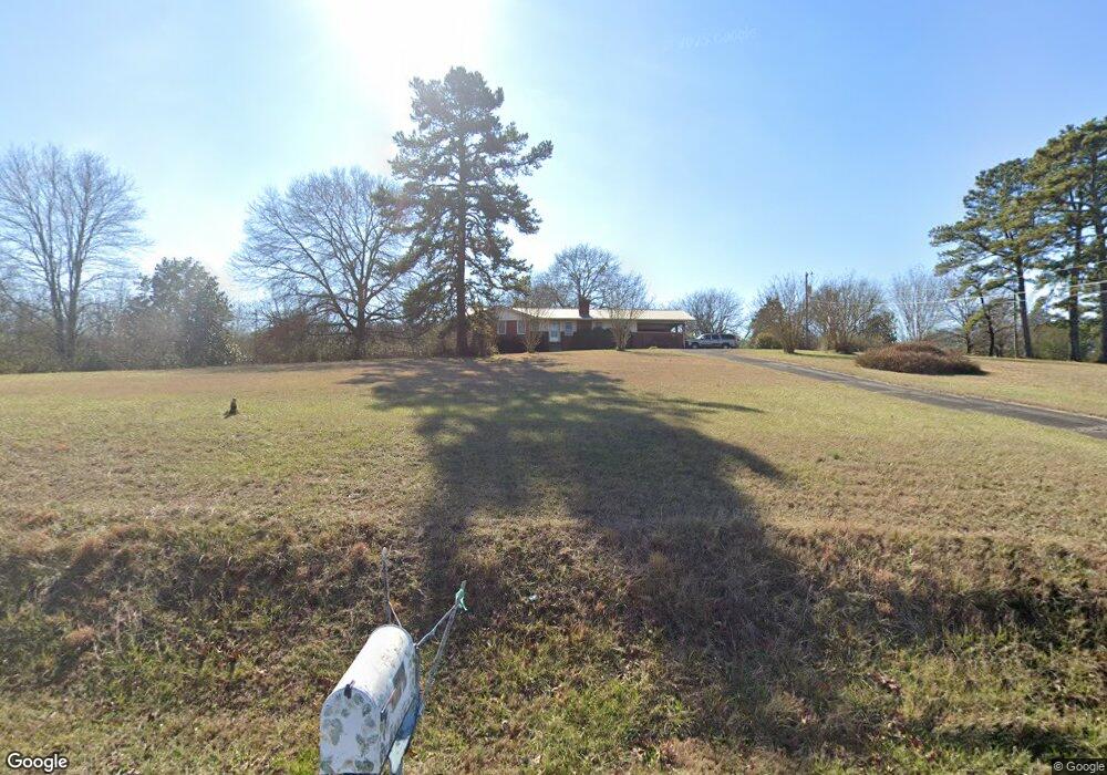
625 Bray Rd SW Calhoun, GA 30701
Estimated Value: $316,871 - $465,000
3
Beds
2
Baths
1,682
Sq Ft
$223/Sq Ft
Est. Value
About This Home
This home is located at 625 Bray Rd SW, Calhoun, GA 30701 and is currently estimated at $374,718, approximately $222 per square foot. 625 Bray Rd SW is a home located in Gordon County with nearby schools including Swain Elementary School, Ashworth Middle School, and Gordon Central High School.
Ownership History
Date
Name
Owned For
Owner Type
Purchase Details
Closed on
Apr 19, 2013
Sold by
King John Robert
Bought by
King Isaiah
Current Estimated Value
Purchase Details
Closed on
Dec 22, 2009
Sold by
King Charles Michael
Bought by
King John Robert
Purchase Details
Closed on
Mar 7, 2002
Sold by
King Margaret H
Bought by
Hollaran James Robert Estate
Purchase Details
Closed on
Apr 11, 2001
Sold by
Hollaran James Robert Estate
Bought by
King Margaret H As A Life Estate To John
Create a Home Valuation Report for This Property
The Home Valuation Report is an in-depth analysis detailing your home's value as well as a comparison with similar homes in the area
Home Values in the Area
Average Home Value in this Area
Purchase History
| Date | Buyer | Sale Price | Title Company |
|---|---|---|---|
| King Isaiah | -- | -- | |
| King John Robert | -- | -- | |
| Hollaran James Robert Estate | -- | -- | |
| King Margaret H As A Life Estate To John | -- | -- |
Source: Public Records
Tax History Compared to Growth
Tax History
| Year | Tax Paid | Tax Assessment Tax Assessment Total Assessment is a certain percentage of the fair market value that is determined by local assessors to be the total taxable value of land and additions on the property. | Land | Improvement |
|---|---|---|---|---|
| 2024 | $1,951 | $78,784 | $18,840 | $59,944 |
| 2023 | $1,854 | $74,984 | $18,840 | $56,144 |
| 2022 | $1,874 | $71,384 | $18,840 | $52,544 |
| 2021 | $1,677 | $61,864 | $18,840 | $43,024 |
| 2020 | $1,733 | $62,504 | $18,840 | $43,664 |
| 2019 | $1,743 | $62,504 | $18,840 | $43,664 |
| 2018 | $1,661 | $59,660 | $18,840 | $40,820 |
| 2017 | $1,702 | $57,420 | $18,840 | $38,580 |
| 2016 | $1,706 | $57,420 | $18,840 | $38,580 |
| 2015 | $1,685 | $56,220 | $18,840 | $37,380 |
| 2014 | $1,605 | $55,102 | $18,848 | $36,254 |
Source: Public Records
Map
Nearby Homes
- 110 Darby Rd SW
- 211 Darby Rd SW
- 261 Liberty Ln SW
- 0 Reeves Station Rd SW Unit 10548197
- 0 Reeves Station Rd SW Unit 7601645
- L2 Taylor Bridge Rd SW
- 1943 Rome Rd SW
- 0 Highway 53 Spur SW Unit 7529096
- 490 McDaniel Station Rd SW
- 506 McDaniel Station Rd SW
- 458 McDaniel Station Rd SW
- 474 McDaniel Station Rd SW
- 271 Old Belwood Rd SE
- 365 Riverboat Dr
- 238 Lighthouse Cove SW
- 301 Switch Rd SW
- 269 Riverboat Dr
- 19 Dublin Way NW
- Woodridge Plan at The Landing at Miller’s Ferry
- Kensington Plan at The Landing at Miller’s Ferry
- 597 Bray Rd SW
- 618 Bray Rd SW
- 577 Bray Rd SW
- 693 Bray Rd SW
- 703 Bray Rd SW
- 3399 S Calhoun Bypass
- 781 Bray Rd SW
- 774 Bray Rd SW
- 229 Countryside Dr SW
- 875 Bray Rd SW
- 327 Countryside Dr SW
- 283 Countryside Dr SW
- 869 Bray Rd SW
- 0 Countryside Dr SW Unit 8601344
- 326 Countryside Dr SW
- 298 Countryside Dr SW
- 00 Darby Rd SW
- 0 Darby Rd SW
- 0 Darby Rd SW Unit 7176524
- 0 Darby Rd SW Unit 7438149