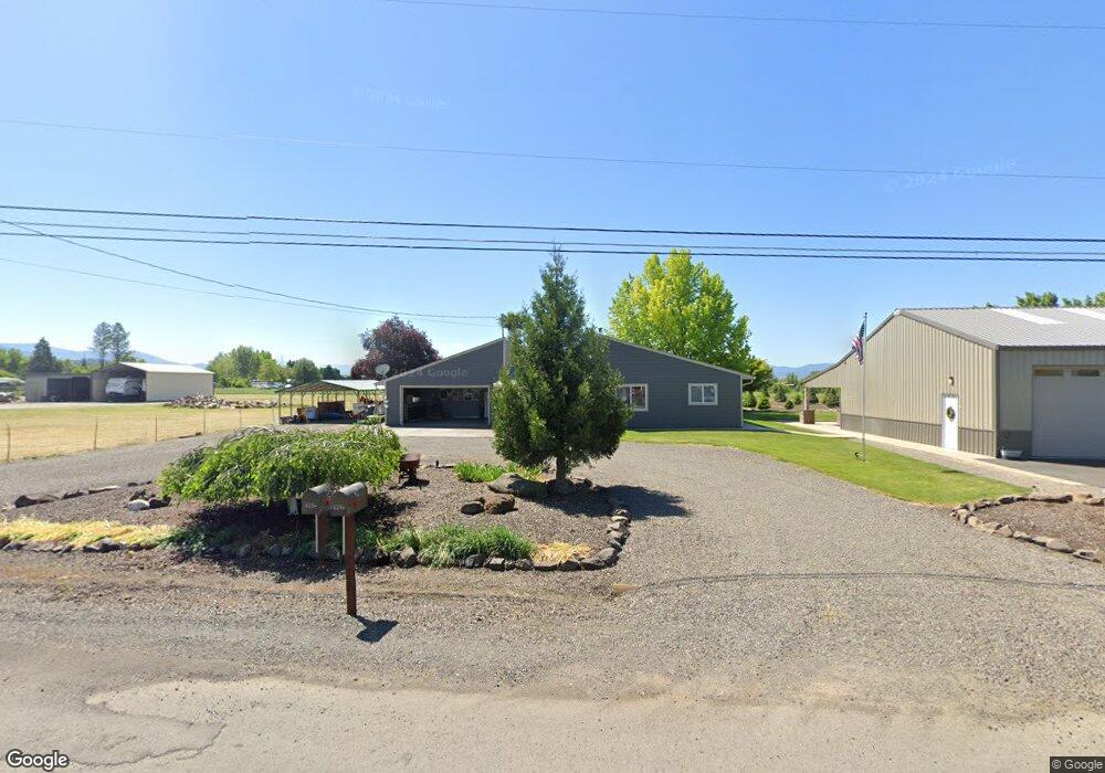
625 Judge Ln Central Point, OR 97502
Estimated Value: $453,195 - $544,000
3
Beds
2
Baths
1,608
Sq Ft
$315/Sq Ft
Est. Value
About This Home
This home is located at 625 Judge Ln, Central Point, OR 97502 and is currently estimated at $505,799, approximately $314 per square foot. 625 Judge Ln is a home located in Jackson County with nearby schools including Sams Valley Elementary School, Scenic Middle School, and Crater High School.
Ownership History
Date
Name
Owned For
Owner Type
Purchase Details
Closed on
Apr 4, 2016
Sold by
Duches Daniel R
Bought by
Jackson County
Current Estimated Value
Home Financials for this Owner
Home Financials are based on the most recent Mortgage that was taken out on this home.
Interest Rate
3.71%
Create a Home Valuation Report for This Property
The Home Valuation Report is an in-depth analysis detailing your home's value as well as a comparison with similar homes in the area
Home Values in the Area
Average Home Value in this Area
Purchase History
| Date | Buyer | Sale Price | Title Company |
|---|---|---|---|
| Jackson County | -- | -- |
Source: Public Records
Mortgage History
| Date | Status | Borrower | Loan Amount |
|---|---|---|---|
| Closed | Jackson County | -- |
Source: Public Records
Tax History Compared to Growth
Tax History
| Year | Tax Paid | Tax Assessment Tax Assessment Total Assessment is a certain percentage of the fair market value that is determined by local assessors to be the total taxable value of land and additions on the property. | Land | Improvement |
|---|---|---|---|---|
| 2025 | $3,097 | $252,106 | $67,306 | $184,800 |
| 2024 | $3,097 | $244,771 | $25,791 | $218,980 |
| 2023 | $2,994 | $237,647 | $25,027 | $212,620 |
| 2022 | $2,931 | $237,647 | $25,027 | $212,620 |
| 2021 | $2,624 | $212,573 | $24,303 | $188,270 |
| 2020 | $2,547 | $206,390 | $23,590 | $182,800 |
| 2019 | $2,488 | $194,557 | $22,227 | $172,330 |
| 2018 | $2,411 | $188,896 | $21,586 | $167,310 |
| 2017 | $2,354 | $188,896 | $21,586 | $167,310 |
| 2016 | $1,850 | $144,106 | $20,346 | $123,760 |
| 2015 | $1,764 | $144,106 | $20,346 | $123,760 |
| 2014 | $1,721 | $135,848 | $19,168 | $116,680 |
Source: Public Records
Map
Nearby Homes
- 5156 Peace Ln
- 1182 E Justice Rd
- 4824 Airway Dr Unit 371W06BB410
- 4676 Industry Dr
- 862 Enterprise Dr
- 4702 Industry Dr
- 1250 Vilas Rd
- 225 Wilson Rd
- 1141 Helicopter Way
- 1151 Helicopter Way
- 5011 Highway 62
- 2598 St James Way
- 2453 Crater Lake Hwy
- 2330 Savannah Dr
- 4595 Table Rock Rd
- 6348 Crater Lake Hwy
- 1729 E Gregory Rd
- 2248 Evan Way
- 4399 Table Rock Rd
- 2225 New Haven Dr
- 575 Judge Ln
- 675 Judge Ln
- 575 Judge St
- 5561 Peace Ln
- 525 Judge Ln
- 5633 Peace Ln
- 526 Judge Ln
- 2 Justice Rd
- 5560 Peace Ln
- 5508 Peace Ln
- 5421 Peace Ln
- 5468 Peace Ln
- 5610 Peace Ln
- 5468 Bierson Way Unit 101
- 5468 Bierson Way Unit 201
- 5468 Bierson Way
- 5468 Bierson Way
- 5411 Peace Ln
- 5448 Bierson Way
- 5448 Bierson Way