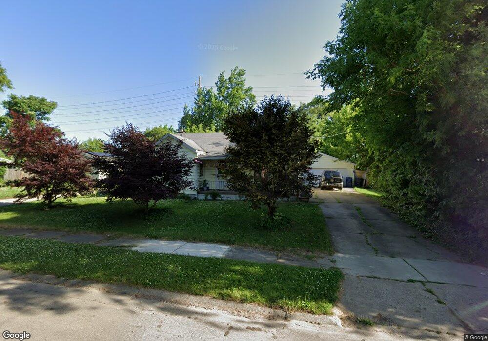
625 Macdonald Ave Flint, MI 48507
Circle Drive NeighborhoodEstimated Value: $78,000 - $101,000
2
Beds
1
Bath
951
Sq Ft
$92/Sq Ft
Est. Value
About This Home
This home is located at 625 Macdonald Ave, Flint, MI 48507 and is currently estimated at $87,945, approximately $92 per square foot. 625 Macdonald Ave is a home located in Genesee County with nearby schools including Freeman Elementary School, Flint Southwestern Classical Academy, and International Academy of Flint (K-12).
Ownership History
Date
Name
Owned For
Owner Type
Purchase Details
Closed on
Jun 29, 2012
Sold by
Kerr Jc
Bought by
Kerr Jc and Kerr John C
Current Estimated Value
Purchase Details
Closed on
Nov 9, 2007
Sold by
Morris Jack M and Morris Betty A
Bought by
Kerr J C
Purchase Details
Closed on
Mar 13, 2001
Sold by
Mazza Mazza M and Mazza James A
Bought by
James Anne
Create a Home Valuation Report for This Property
The Home Valuation Report is an in-depth analysis detailing your home's value as well as a comparison with similar homes in the area
Home Values in the Area
Average Home Value in this Area
Purchase History
| Date | Buyer | Sale Price | Title Company |
|---|---|---|---|
| Kerr Jc | -- | None Available | |
| Kerr J C | $45,000 | Lawyers Title | |
| James Anne | -- | -- |
Source: Public Records
Tax History Compared to Growth
Tax History
| Year | Tax Paid | Tax Assessment Tax Assessment Total Assessment is a certain percentage of the fair market value that is determined by local assessors to be the total taxable value of land and additions on the property. | Land | Improvement |
|---|---|---|---|---|
| 2025 | $1,329 | $43,300 | $0 | $0 |
| 2024 | $1,227 | $38,600 | $0 | $0 |
| 2023 | $1,196 | $35,700 | $0 | $0 |
| 2022 | $0 | $29,100 | $0 | $0 |
| 2021 | $1,214 | $25,100 | $0 | $0 |
| 2020 | $1,113 | $20,200 | $0 | $0 |
| 2019 | $1,085 | $15,800 | $0 | $0 |
| 2018 | $1,084 | $14,100 | $0 | $0 |
| 2017 | $1,055 | $0 | $0 | $0 |
| 2016 | $1,048 | $0 | $0 | $0 |
| 2015 | -- | $0 | $0 | $0 |
| 2014 | -- | $0 | $0 | $0 |
| 2012 | -- | $16,300 | $0 | $0 |
Source: Public Records
Map
Nearby Homes
- 810 Macdonald Ave
- 621 Burroughs Ave
- 4127 Custer Ave
- 4424 Cheyenne Ave
- 630 Buckingham Ave
- 4310 Cheyenne Ave
- 4205 Red Arrow Rd
- 454 E Atherton Rd
- 3343 Cheyenne Ave
- 326 Burroughs Ave
- 3614 Comanche Ave
- 3512 Barcey Ct
- 3505 Comanche Ave
- 4010 Milton Dr
- 2207 E Boatfield Ave
- 0000 E Bristol Rd
- 2130 E Whittemore Ave
- 3115 Circle Dr
- 2231 E Bergin Ave
- 2220 E Bergin Ave
- 4522 Ogema Ave Unit Bldg-Unit
- 4522 Ogema Ave
- 4518 Ogema Ave
- 617 Macdonald Ave
- 4510 Ogema Ave
- 626 McKeighan Ave
- 613 Macdonald Ave
- 630 McKeighan Ave
- 4602 Ogema Ave
- 626 Macdonald Ave
- 640 McKeighan Ave
- 622 Macdonald Ave
- 609 Macdonald Ave
- 618 Macdonald Ave
- 622 McKeighan Ave
- 614 Macdonald Ave
- 4608 Ogema Ave
- 605 Macdonald Ave
- 610 Macdonald Ave
- 618 McKeighan Ave