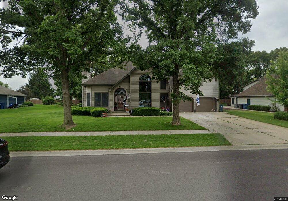
625 Michael Dr Morris, IL 60450
Estimated Value: $432,000 - $499,000
4
Beds
4
Baths
2,600
Sq Ft
$184/Sq Ft
Est. Value
About This Home
This home is located at 625 Michael Dr, Morris, IL 60450 and is currently estimated at $478,583, approximately $184 per square foot. 625 Michael Dr is a home located in Grundy County with nearby schools including Saratoga Elementary School, Morris Community High School, and Immaculate Conception School.
Create a Home Valuation Report for This Property
The Home Valuation Report is an in-depth analysis detailing your home's value as well as a comparison with similar homes in the area
Tax History
| Year | Tax Paid | Tax Assessment Tax Assessment Total Assessment is a certain percentage of the fair market value that is determined by local assessors to be the total taxable value of land and additions on the property. | Land | Improvement |
|---|---|---|---|---|
| 2024 | $10,507 | $144,786 | $22,225 | $122,561 |
| 2023 | $9,877 | $136,103 | $20,892 | $115,211 |
| 2022 | $8,493 | $128,025 | $19,652 | $108,373 |
| 2021 | $8,019 | $119,851 | $18,397 | $101,454 |
| 2020 | $7,673 | $113,067 | $17,356 | $95,711 |
| 2019 | $7,623 | $113,067 | $17,356 | $95,711 |
| 2018 | $5,932 | $85,149 | $17,405 | $67,744 |
| 2017 | $5,777 | $83,349 | $17,037 | $66,312 |
| 2016 | $5,581 | $80,772 | $20,337 | $60,435 |
| 2015 | $5,347 | $79,625 | $20,048 | $59,577 |
| 2014 | $5,172 | $75,661 | $19,050 | $56,611 |
| 2013 | $5,319 | $78,560 | $19,780 | $58,780 |
Source: Public Records
Map
Nearby Homes
- 523 Bedford Rd
- 00 U S 6
- 1810 Jana Ln
- 936 Thomas Dr
- 957 Thomas Dr
- 85 Carriage Dr
- 1301 Union St
- 1246 Wauponsee St
- Lot 1 W Commercial St
- Lot 3 Heron Lake Ct
- 1595 W Us Rte 6
- 1.88 Acres Rd
- 1112 & 1112 1/2 Butler St
- 1368 Heritage Dr
- 1220 Liberty St
- 109 Doe Cir
- 2380 Chestnut Ln
- 1466 Mollie Dr
- 1 By Railroad Track
- 0000 Lakewood Dr
Your Personal Tour Guide
Ask me questions while you tour the home.