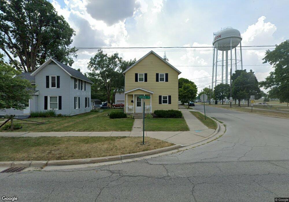
625 N Ottokee St Wauseon, OH 43567
Estimated Value: $120,718 - $134,000
4
Beds
1
Bath
1,320
Sq Ft
$97/Sq Ft
Est. Value
About This Home
This home is located at 625 N Ottokee St, Wauseon, OH 43567 and is currently estimated at $127,930, approximately $96 per square foot. 625 N Ottokee St is a home located in Fulton County with nearby schools including Wauseon Primary School, Wauseon Elementary School, and Wauseon Middle School.
Ownership History
Date
Name
Owned For
Owner Type
Purchase Details
Closed on
Nov 4, 2021
Sold by
Jump Deborah S and Elder D Cordes Trust
Bought by
Cordes Trust Rentals Llc
Current Estimated Value
Purchase Details
Closed on
Feb 4, 2020
Sold by
Cordes Eldor D Trustee
Bought by
Jump Deborah S Suc Trustee
Purchase Details
Closed on
Jan 1, 1990
Bought by
Cordes Eldor D
Create a Home Valuation Report for This Property
The Home Valuation Report is an in-depth analysis detailing your home's value as well as a comparison with similar homes in the area
Home Values in the Area
Average Home Value in this Area
Purchase History
| Date | Buyer | Sale Price | Title Company |
|---|---|---|---|
| Cordes Trust Rentals Llc | -- | None Available | |
| Jump Deborah S Suc Trustee | -- | -- | |
| Cordes Eldor D | -- | -- |
Source: Public Records
Tax History Compared to Growth
Tax History
| Year | Tax Paid | Tax Assessment Tax Assessment Total Assessment is a certain percentage of the fair market value that is determined by local assessors to be the total taxable value of land and additions on the property. | Land | Improvement |
|---|---|---|---|---|
| 2024 | $1,302 | $25,620 | $4,270 | $21,350 |
| 2023 | $1,302 | $25,620 | $4,270 | $21,350 |
| 2022 | $1,159 | $19,390 | $3,570 | $15,820 |
| 2021 | $1,244 | $19,390 | $3,570 | $15,820 |
| 2020 | $1,142 | $19,390 | $3,570 | $15,820 |
| 2019 | $1,113 | $18,620 | $3,570 | $15,050 |
| 2018 | $979 | $18,620 | $3,570 | $15,050 |
| 2017 | $967 | $18,620 | $3,570 | $15,050 |
| 2016 | $940 | $16,170 | $3,570 | $12,600 |
| 2015 | $880 | $16,170 | $3,570 | $12,600 |
| 2014 | $840 | $16,170 | $3,570 | $12,600 |
| 2013 | $1,030 | $18,380 | $3,220 | $15,160 |
Source: Public Records
Map
Nearby Homes
- 227 Wabash St
- 428 N Brunell St
- 351 E Walnut St
- 217 Marshall St
- 139 Marshall St
- 234 W Chestnut St
- 252 W Chestnut St
- 527 E Elm St
- 524 E Elm St
- 125 Cherry St
- 00 Glenwood
- 0 Glenwood Unit 6124946
- 420 Clover Ln
- 1270 S Park Ln
- 622 Vine St
- 303 Eastwood St
- 1285 N Shoop Ave
- 1338 N Park Ln
- 840 Pine St
- 660 Parkside Dr
- 621 N Ottokee St
- 615 N Ottokee St
- 215 Wabash St
- 225 Wabash St
- 610 N Ottokee St
- 612 N Ottokee St
- 607 N Ottokee St
- 614 N Ottokee St
- 604 N Ottokee St
- 229 Wabash St
- 234 Fountain Ave
- 231 Wabash St
- 620 Potter St
- 617 N Fulton St
- 0 Fountain St
- 607 N Fulton St
- 542 N Ottokee St
- 603 N Fulton St
- 612 Potter St
- 521 N Ottokee St