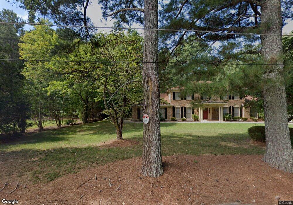
625 Redds Cir SW Lilburn, GA 30047
Estimated Value: $543,000 - $663,000
5
Beds
4
Baths
3,462
Sq Ft
$168/Sq Ft
Est. Value
About This Home
This home is located at 625 Redds Cir SW, Lilburn, GA 30047 and is currently estimated at $583,097, approximately $168 per square foot. 625 Redds Cir SW is a home located in Gwinnett County with nearby schools including Camp Creek Elementary School, Trickum Middle School, and Parkview High School.
Ownership History
Date
Name
Owned For
Owner Type
Purchase Details
Closed on
Nov 20, 2023
Sold by
Cox Marcella Cherry
Bought by
Cordova Jaime E
Current Estimated Value
Purchase Details
Closed on
Feb 25, 2021
Sold by
Cherry Sylvia R
Bought by
Cox Marcella C
Create a Home Valuation Report for This Property
The Home Valuation Report is an in-depth analysis detailing your home's value as well as a comparison with similar homes in the area
Home Values in the Area
Average Home Value in this Area
Purchase History
| Date | Buyer | Sale Price | Title Company |
|---|---|---|---|
| Cordova Jaime E | $500,000 | -- | |
| Cox Marcella C | -- | -- |
Source: Public Records
Tax History Compared to Growth
Tax History
| Year | Tax Paid | Tax Assessment Tax Assessment Total Assessment is a certain percentage of the fair market value that is determined by local assessors to be the total taxable value of land and additions on the property. | Land | Improvement |
|---|---|---|---|---|
| 2024 | $7,509 | $200,000 | $24,000 | $176,000 |
| 2023 | $7,509 | $221,080 | $24,000 | $197,080 |
| 2022 | $5,201 | $136,120 | $12,000 | $124,120 |
| 2021 | $1,242 | $136,120 | $12,000 | $124,120 |
| 2020 | $1,240 | $136,120 | $12,000 | $124,120 |
| 2019 | $1,151 | $124,360 | $14,000 | $110,360 |
| 2018 | $1,133 | $124,360 | $14,000 | $110,360 |
| 2016 | $1,170 | $105,560 | $14,000 | $91,560 |
| 2015 | $1,197 | $105,560 | $14,000 | $91,560 |
| 2014 | $1,207 | $87,280 | $14,000 | $73,280 |
Source: Public Records
Map
Nearby Homes
- 737 Lioness Ct
- 483 Rollingwood Dr
- 507 Castlearie Dr
- 507 Castleaire Dr Unit 1
- 5531 Four Winds Dr SW
- 5741 Wolf Laurel Ln SW
- 5607 Mountainbrooke Ct
- 851 Rockbridge Rd SW
- 717 Oxford Ct SW
- 358 W Wind Dr SW
- 771 Mountainbrooke Cir SW
- 5521 E Wind Dr SW
- 5632 Stillwater Ct
- 262 Harmony Grove Rd
- 5533 N Wind Dr SW
- 5781 Four Winds Dr SW Unit 1B
- 228 Amour Way SW
- 292 Old Rosser Rd
- 923 Tall Pine Ct SW
- 5820 Grove Place Crossing SW
- 5825 Grove Place Crossing SW Unit III
- 612 Redds Cir SW
- 603 Redds Cir SW
- 519 Grove Creek Ct SW
- 635 Redds Cir SW
- 529 Grove Creek Ct SW
- 5800 Grove Place Crossing SW
- 707 Lioness Ct
- 5815 Grove Place Crossing SW
- 539 Grove Creek Ct SW
- 0 Grove Creek Ct SW
- 5805 Grove Place Crossing SW Unit 3
- 618 Rollingwood Dr
- 608 Rollingwood Dr
- 549 Grove Creek Ct SW
- 628 Rollingwood Dr
- 598 Rollingwood Dr
- 524 Grove Creek Ct SW
- 504 Grove Creek Ct SW