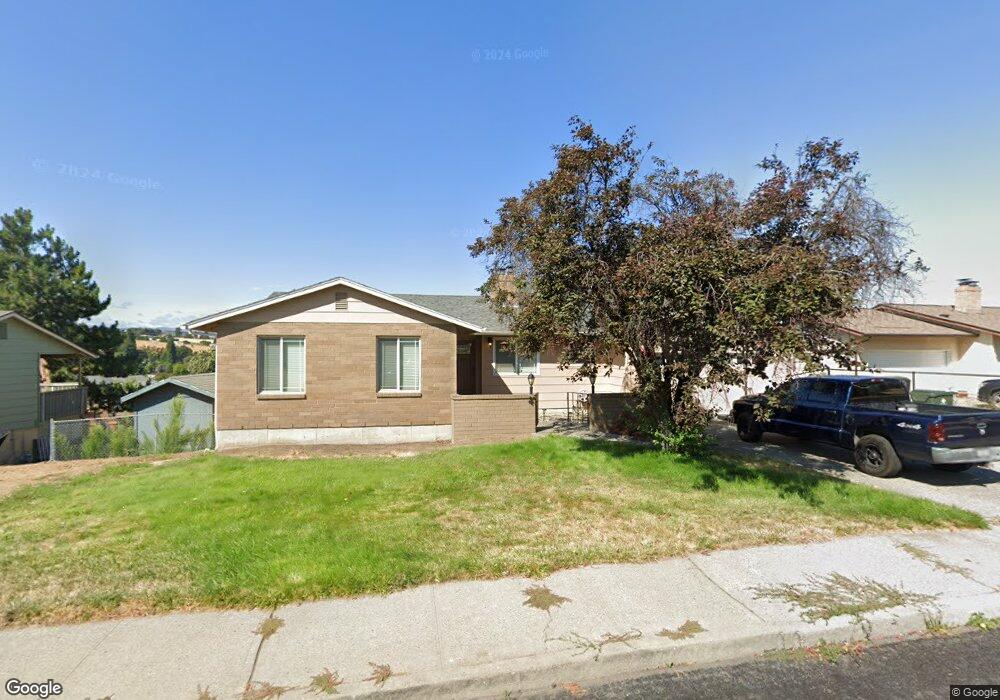
625 Summit Ridge Dr E the Dalles, OR 97058
Estimated Value: $478,875 - $572,000
4
Beds
3
Baths
2,568
Sq Ft
$205/Sq Ft
Est. Value
About This Home
This home is located at 625 Summit Ridge Dr E, the Dalles, OR 97058 and is currently estimated at $525,438, approximately $204 per square foot. 625 Summit Ridge Dr E is a home located in Wasco County with nearby schools including Dry Hollow Elementary School, The Dalles Middle School, and The Dalles High School.
Ownership History
Date
Name
Owned For
Owner Type
Purchase Details
Closed on
Dec 13, 2012
Sold by
Symons Phillip A and Symons Stefanie L
Bought by
Miller John D
Current Estimated Value
Home Financials for this Owner
Home Financials are based on the most recent Mortgage that was taken out on this home.
Original Mortgage
$241,722
Outstanding Balance
$157,515
Interest Rate
3.35%
Mortgage Type
VA
Estimated Equity
$367,923
Purchase Details
Closed on
Jan 25, 2012
Sold by
Federal Home Loan Mortgage Corporation
Bought by
Symons Philip A and Symons Stefanie L
Home Financials for this Owner
Home Financials are based on the most recent Mortgage that was taken out on this home.
Original Mortgage
$214,325
Interest Rate
3.88%
Mortgage Type
FHA
Purchase Details
Closed on
Sep 22, 2006
Sold by
Lingel Darrin R and Lingel Debbie G
Bought by
Potter Bryan O and Potter Veronica L
Home Financials for this Owner
Home Financials are based on the most recent Mortgage that was taken out on this home.
Original Mortgage
$264,000
Interest Rate
6.53%
Mortgage Type
New Conventional
Create a Home Valuation Report for This Property
The Home Valuation Report is an in-depth analysis detailing your home's value as well as a comparison with similar homes in the area
Purchase History
We collect this data history from publicly available records. To have your information removed, we recommend requesting removal directly through your county’s website.
| Date | Buyer | Sale Price | Title Company |
|---|---|---|---|
| Miller John D | $234,000 | None Available | |
| Symons Philip A | -- | None Available | |
| Potter Bryan O | $330,000 | -- |
Source: Public Records
Mortgage History
We collect this data history from publicly available records. To have your information removed, we recommend requesting removal directly through your county’s website.
| Date | Status | Borrower | Loan Amount |
|---|---|---|---|
| Open | Miller John D | $241,722 | |
| Previous Owner | Symons Philip A | $214,325 | |
| Previous Owner | Potter Bryan O | $264,000 |
Source: Public Records
Tax History
| Year | Tax Paid | Tax Assessment Tax Assessment Total Assessment is a certain percentage of the fair market value that is determined by local assessors to be the total taxable value of land and additions on the property. | Land | Improvement |
|---|---|---|---|---|
| 2025 | $5,045 | $280,823 | -- | -- |
| 2024 | $4,907 | $272,644 | -- | -- |
| 2023 | $4,764 | $264,703 | $0 | $0 |
| 2022 | $4,658 | $71,936 | $0 | $0 |
| 2021 | $4,516 | $69,841 | $0 | $0 |
| 2020 | $4,404 | $67,807 | $0 | $0 |
| 2019 | $4,651 | $65,832 | $0 | $0 |
| 2018 | $4,522 | $228,335 | $0 | $0 |
| 2017 | $4,379 | $221,684 | $0 | $0 |
| 2016 | $4,284 | $215,227 | $0 | $0 |
| 2015 | $4,206 | $208,958 | $0 | $0 |
| 2014 | $3,948 | $202,872 | $0 | $0 |
Source: Public Records
Map
Nearby Homes
- 397 Summit Ridge Dr E
- 3302 Old Dufur Rd
- 0 Fremont St
- 3113 Fremont St
- 3103 Fremont St
- 1700 Lone Pine Blvd
- 1300 Lone Pine Blvd
- 0 Lone Pine Ln
- 192 Honeysuckle Ln
- 1400 Lone Pine Blvd
- 1500 Lone Pine Blvd
- 170 Blue Heron Ct
- 260 Lone Pine Ln Unit 2
- 260 Lone Pine Ln Unit 8
- 162 Blue Heron Ct
- 157 Southshore Ave
- 3564 E 2nd St Unit 33
- 110 Southshore Ave
- 125 Southshore Ln
- 2606 E 10th St
- 619 Summit Ridge Dr E
- 635 Summit Ridge Dr E
- 680 Brentwood Dr E
- 611 Summit Ridge Dr E
- 674 Brentwood Dr E
- 630 Summit Ridge Dr E
- 622 Summit Ridge Dr E
- 3532 Royal Crest Dr E
- 636 Summit Ridge Dr E
- 3522 Royal Crest Dr E
- 3526 Royal Crest Dr E
- 616 Summit Ridge Dr E
- 3540 Royal Crest Dr E
- 668 Brentwood Dr E
- 703 Summit Ridge Dr E
- 610 Summit Ridge Dr E
- 673 Brentwood Dr E
- 662 Brentwood Dr E
- 704 Summit Ridge Dr E
- 3516 Royal Crest Dr E
Your Personal Tour Guide
Ask me questions while you tour the home.