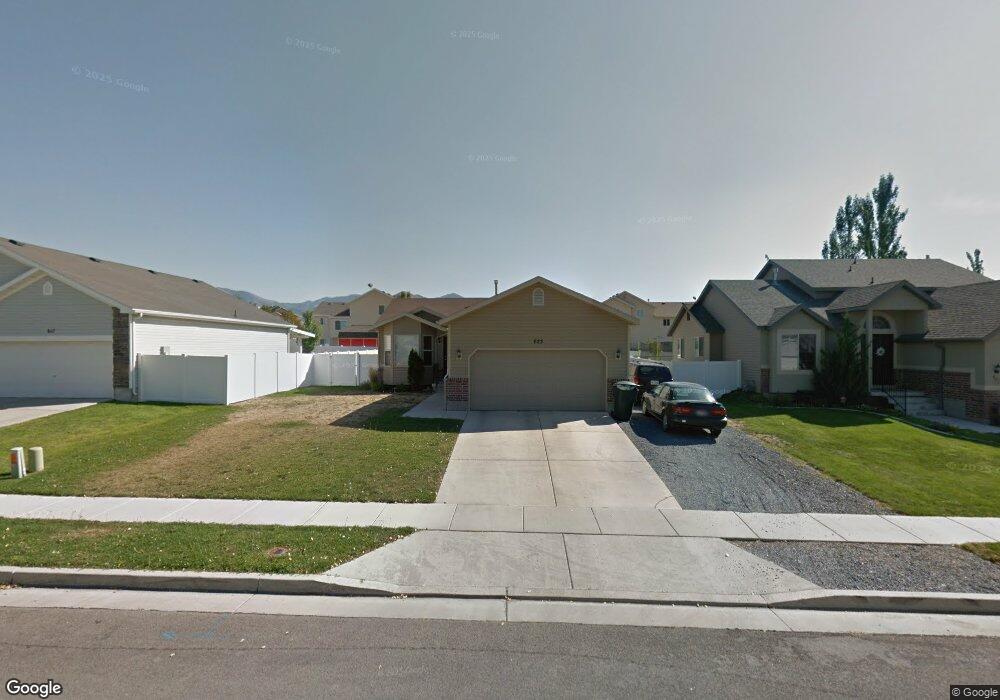
625 W 890 N Tooele, UT 84074
Estimated Value: $442,000 - $456,000
6
Beds
--
Bath
2,470
Sq Ft
$182/Sq Ft
Est. Value
About This Home
This home is located at 625 W 890 N, Tooele, UT 84074 and is currently estimated at $448,881, approximately $181 per square foot. 625 W 890 N is a home located in Tooele County with nearby schools including Northlake Elementary School, Tooele Junior High School, and Tooele High School.
Ownership History
Date
Name
Owned For
Owner Type
Purchase Details
Closed on
Jun 22, 2022
Sold by
Opendoor Property Trust
Bought by
Mile High Borrower 1 Core Llc
Current Estimated Value
Purchase Details
Closed on
May 11, 2022
Sold by
Pacheco Samuel and Pacheco Frances Sue
Bought by
Opendoor Property Trust
Purchase Details
Closed on
Jun 14, 2019
Sold by
Viking Shield Llc
Bought by
Pacheco Samuel and Pacheco Frances Sue
Home Financials for this Owner
Home Financials are based on the most recent Mortgage that was taken out on this home.
Original Mortgage
$297,000
Interest Rate
4.1%
Mortgage Type
VA
Purchase Details
Closed on
Jan 31, 2019
Sold by
Vass Samuel and Vass Kari
Bought by
Viking Shield Llc and 625 W 890 S Trust
Purchase Details
Closed on
Sep 2, 2014
Sold by
Colvin Aaron A and Colvin Jenny M
Bought by
Vass Samuel and Vass Kari
Home Financials for this Owner
Home Financials are based on the most recent Mortgage that was taken out on this home.
Original Mortgage
$184,712
Interest Rate
4.1%
Mortgage Type
VA
Purchase Details
Closed on
Sep 15, 2010
Sold by
Colvin Aaron A
Bought by
Colvin Aaron A and Colvin Jenny M
Home Financials for this Owner
Home Financials are based on the most recent Mortgage that was taken out on this home.
Original Mortgage
$159,900
Interest Rate
4.37%
Mortgage Type
FHA
Purchase Details
Closed on
Apr 11, 2008
Sold by
Colvin Aaron
Bought by
Colvin Aaron A and Colvin Jenny M
Home Financials for this Owner
Home Financials are based on the most recent Mortgage that was taken out on this home.
Original Mortgage
$154,000
Interest Rate
5.99%
Mortgage Type
New Conventional
Purchase Details
Closed on
Jan 31, 2006
Sold by
Colvin Aaron A
Bought by
Colvin Aaron A and Colvin Jenny M
Home Financials for this Owner
Home Financials are based on the most recent Mortgage that was taken out on this home.
Original Mortgage
$28,960
Interest Rate
6.16%
Mortgage Type
Stand Alone Second
Create a Home Valuation Report for This Property
The Home Valuation Report is an in-depth analysis detailing your home's value as well as a comparison with similar homes in the area
Home Values in the Area
Average Home Value in this Area
Purchase History
| Date | Buyer | Sale Price | Title Company |
|---|---|---|---|
| Mile High Borrower 1 Core Llc | -- | First Integrity Title | |
| Opendoor Property Trust | -- | Cottonwood Title | |
| Pacheco Samuel | -- | Gt Title Services | |
| Viking Shield Llc | -- | Gt Title Services | |
| Vass Samuel | -- | Equity Title | |
| Colvin Aaron A | -- | Monument Title Insurance | |
| Colvin Aaron A | -- | Monument Title Insurance Inc | |
| Colvin Aaron A | -- | Tooele Title Co | |
| Colvin Aaron | -- | Meridian Title Co | |
| Colvin Aaron A | -- | Meridian Title Co | |
| Colvin Aaron A | -- | Meridian Title Co |
Source: Public Records
Mortgage History
| Date | Status | Borrower | Loan Amount |
|---|---|---|---|
| Previous Owner | Pacheco Samuel | $297,000 | |
| Previous Owner | Vass Samuel | $184,712 | |
| Previous Owner | Colvin Aaron A | $159,900 | |
| Previous Owner | Colvin Aaron | $154,000 | |
| Previous Owner | Colvin Aaron A | $28,960 | |
| Previous Owner | Colvin Aaron A | $28,960 | |
| Previous Owner | Colvin Aaron A | $115,840 |
Source: Public Records
Tax History Compared to Growth
Tax History
| Year | Tax Paid | Tax Assessment Tax Assessment Total Assessment is a certain percentage of the fair market value that is determined by local assessors to be the total taxable value of land and additions on the property. | Land | Improvement |
|---|---|---|---|---|
| 2025 | $2,753 | $417,554 | $100,000 | $317,554 |
| 2024 | $3,013 | $229,990 | $55,000 | $174,990 |
| 2023 | $3,013 | $235,892 | $52,383 | $183,509 |
| 2022 | $2,909 | $250,280 | $66,110 | $184,170 |
| 2021 | $2,235 | $160,842 | $20,763 | $140,079 |
| 2020 | $2,124 | $265,151 | $37,750 | $227,401 |
| 2019 | $1,919 | $235,578 | $37,750 | $197,828 |
| 2018 | $1,741 | $202,651 | $35,000 | $167,651 |
| 2017 | $1,409 | $194,668 | $35,000 | $159,668 |
| 2016 | $1,157 | $93,794 | $13,750 | $80,044 |
| 2015 | $1,157 | $84,132 | $0 | $0 |
| 2014 | -- | $84,132 | $0 | $0 |
Source: Public Records
Map
Nearby Homes
- 831 Gleneagle Ct
- 792 N 630 W
- 1151 N 680 W Unit 8
- 1176 N 620 W Unit 221
- 1177 N 680 W Unit 3
- 515 W Caroles Way Unit 123
- 606 W Caroles Way Unit 12
- 602 W Caroles Way Unit 13
- 454 W 2520 N
- 459 W Sapphire Dr Unit 7034
- 412 W Sapphire Dr Unit 7009
- 429 W Sapphire Dr Unit 7038
- 1096 N 340 W
- 409 W Sapphire Dr Unit 7040
- 366 W Diamant Ln
- 541 N Coleman St
- 643 W 1360 N Unit 223
- 312 W Sapphire Dr
- 294 W Quartz Rd
- 374 W 630 North St Unit 10