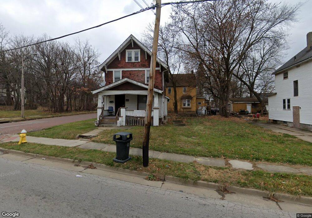
625 W Thornton St Akron, OH 44307
Sherbondy Hill NeighborhoodEstimated Value: $56,000 - $112,000
4
Beds
1
Bath
1,272
Sq Ft
$61/Sq Ft
Est. Value
About This Home
This home is located at 625 W Thornton St, Akron, OH 44307 and is currently estimated at $77,778, approximately $61 per square foot. 625 W Thornton St is a home located in Summit County with nearby schools including Emmanuel Christian Academy and St. Bernard-St. Mary Elementary School.
Ownership History
Date
Name
Owned For
Owner Type
Purchase Details
Closed on
Aug 22, 2014
Sold by
Tucker Dave W and Tucker Linda Y
Bought by
Tucker David W and Tucker Linda Y
Current Estimated Value
Purchase Details
Closed on
Feb 14, 2014
Sold by
Frye Jeffrey R
Bought by
Tucker Dave W and Tucker Linda Y
Home Financials for this Owner
Home Financials are based on the most recent Mortgage that was taken out on this home.
Original Mortgage
$23,000
Outstanding Balance
$17,455
Interest Rate
4.45%
Mortgage Type
Purchase Money Mortgage
Estimated Equity
$60,323
Purchase Details
Closed on
Feb 20, 2013
Sold by
Always Investing Llc
Bought by
Frye Jeffrey R
Purchase Details
Closed on
Jul 1, 2010
Sold by
Brewer Keith
Bought by
Always Investing Llc
Purchase Details
Closed on
Oct 2, 2008
Sold by
Bank Of New York
Bought by
Brewer Keith
Purchase Details
Closed on
Apr 3, 2008
Sold by
Howard Johnny
Bought by
Bank Of New York and Certificateholders Cwabs Inc Asset Backe
Purchase Details
Closed on
May 31, 2005
Sold by
Rida Fatima
Bought by
Howard Johnny
Home Financials for this Owner
Home Financials are based on the most recent Mortgage that was taken out on this home.
Original Mortgage
$61,750
Interest Rate
8.85%
Mortgage Type
Fannie Mae Freddie Mac
Purchase Details
Closed on
Mar 31, 2004
Sold by
Deutsche Bank National Trust Co
Bought by
Rida Fatima
Purchase Details
Closed on
Jan 22, 2004
Sold by
Douglas Edwin
Bought by
Deutsche Bank National Trust Co and Asset Backed Securities Corp Long Beach
Purchase Details
Closed on
Jul 14, 2000
Sold by
Turner Ralph M
Bought by
Douglas Edwin and Douglas Barbara
Home Financials for this Owner
Home Financials are based on the most recent Mortgage that was taken out on this home.
Original Mortgage
$34,400
Interest Rate
11.75%
Purchase Details
Closed on
May 15, 1996
Sold by
Jones Geneva
Bought by
Turner Ralph M
Create a Home Valuation Report for This Property
The Home Valuation Report is an in-depth analysis detailing your home's value as well as a comparison with similar homes in the area
Home Values in the Area
Average Home Value in this Area
Purchase History
| Date | Buyer | Sale Price | Title Company |
|---|---|---|---|
| Tucker David W | -- | None Available | |
| Tucker Dave W | $25,000 | Wlsley Title Agency Inc | |
| Frye Jeffrey R | -- | None Available | |
| Always Investing Llc | -- | Minnesota | |
| Brewer Keith | $2,800 | Attorney | |
| Bank Of New York | $32,000 | None Available | |
| Howard Johnny | $65,000 | -- | |
| Rida Fatima | $10,000 | Sovereign Title Agency Llc | |
| Deutsche Bank National Trust Co | $20,000 | -- | |
| Douglas Edwin | $43,000 | Southeast Equity Title | |
| Turner Ralph M | $10,000 | -- |
Source: Public Records
Mortgage History
| Date | Status | Borrower | Loan Amount |
|---|---|---|---|
| Open | Tucker Dave W | $23,000 | |
| Previous Owner | Howard Johnny | $61,750 | |
| Previous Owner | Douglas Edwin | $34,400 | |
| Closed | Douglas Edwin | $8,600 |
Source: Public Records
Tax History Compared to Growth
Tax History
| Year | Tax Paid | Tax Assessment Tax Assessment Total Assessment is a certain percentage of the fair market value that is determined by local assessors to be the total taxable value of land and additions on the property. | Land | Improvement |
|---|---|---|---|---|
| 2025 | $639 | $9,636 | $2,062 | $7,574 |
| 2024 | $639 | $9,636 | $2,062 | $7,574 |
| 2023 | $639 | $9,636 | $2,062 | $7,574 |
| 2022 | $511 | $5,671 | $1,215 | $4,456 |
| 2021 | $512 | $5,671 | $1,215 | $4,456 |
| 2020 | $506 | $5,680 | $1,220 | $4,460 |
| 2019 | $526 | $5,430 | $1,660 | $3,770 |
| 2018 | $521 | $5,430 | $1,660 | $3,770 |
| 2017 | $535 | $5,430 | $1,660 | $3,770 |
| 2016 | $536 | $5,540 | $1,660 | $3,880 |
| 2015 | $535 | $5,540 | $1,660 | $3,880 |
| 2014 | $532 | $5,540 | $1,660 | $3,880 |
| 2013 | $620 | $6,190 | $1,660 | $4,530 |
Source: Public Records
Map
Nearby Homes
- 1001 Celina Ave
- 1132 Bristol Terrace
- 702 W Thornton St
- 1174 La Croix Ave
- 738 Longview Ave
- 721 Vernon Odom Blvd
- 737 Vernon Odom Blvd
- 677 Vernon Odom Blvd
- 699 Fultz St
- 776 Krause Ct
- 985 Diana Ave
- 1063 Raymond St
- 949 Raymond St
- 794 Ruth Ave
- 385 Campbell St
- 364 Campbell St
- 817 Raymond St
- 639 Bellevue Ave
- 955 Fess Ave
- 0 East Ave
- 619 W Thornton St
- 617 W Thornton St
- 1021 La Croix Ave
- 1017 La Croix Ave
- 633 W Thornton St
- 609 W Thornton St
- 1011 La Croix Ave
- 624 W Thornton St
- 620 W Thornton St
- 637 W Thornton St
- 1014 La Croix Ave
- 616 W Thornton St
- 1018 Celina Ave
- 1007 La Croix Ave
- 612 W Thornton St
- 1014 Celina Ave
- 640 W Thornton St
- 608 W Thornton St
- 643 W Thornton St
- 1005 La Croix Ave