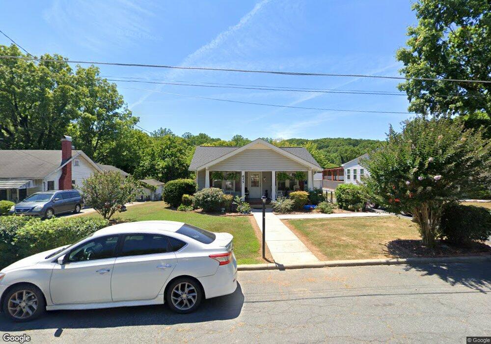
625 White Oak St Asheboro, NC 27203
Estimated Value: $158,031 - $200,000
--
Bed
1
Bath
1,242
Sq Ft
$148/Sq Ft
Est. Value
About This Home
This home is located at 625 White Oak St, Asheboro, NC 27203 and is currently estimated at $183,508, approximately $147 per square foot. 625 White Oak St is a home located in Randolph County with nearby schools including Charles W. McCrary Elementary School, North Asheboro Middle School, and Asheboro High School.
Ownership History
Date
Name
Owned For
Owner Type
Purchase Details
Closed on
Jan 22, 2021
Sold by
Strickland Terry and Strickland Mary
Bought by
Strickland Terry and Strickland Mary
Current Estimated Value
Purchase Details
Closed on
Oct 1, 2019
Sold by
Strickland Steven Anthony and Strickland Barbara Jean
Bought by
Mckinnon Strickland Jr and Strickland Terry
Purchase Details
Closed on
Sep 25, 2019
Sold by
Morton Lucille F and Ferguson Lucille F
Bought by
Morton Lucille F and Strickland Steven Anthony
Purchase Details
Closed on
Jun 2, 1992
Bought by
Morton Lucille K
Create a Home Valuation Report for This Property
The Home Valuation Report is an in-depth analysis detailing your home's value as well as a comparison with similar homes in the area
Home Values in the Area
Average Home Value in this Area
Purchase History
| Date | Buyer | Sale Price | Title Company |
|---|---|---|---|
| Strickland Terry | -- | None Available | |
| Mckinnon Strickland Jr | -- | None Available | |
| Morton Lucille F | -- | None Available | |
| Morton Lucille K | $40,000 | -- |
Source: Public Records
Tax History Compared to Growth
Tax History
| Year | Tax Paid | Tax Assessment Tax Assessment Total Assessment is a certain percentage of the fair market value that is determined by local assessors to be the total taxable value of land and additions on the property. | Land | Improvement |
|---|---|---|---|---|
| 2025 | $1,567 | $118,210 | $17,170 | $101,040 |
| 2024 | $1,567 | $118,210 | $17,170 | $101,040 |
| 2023 | $1,567 | $118,210 | $17,170 | $101,040 |
| 2022 | $1,236 | $85,710 | $16,260 | $69,450 |
| 2021 | $1,236 | $85,710 | $16,260 | $69,450 |
| 2020 | $1,236 | $85,710 | $16,260 | $69,450 |
| 2019 | $623 | $85,710 | $16,260 | $69,450 |
| 2018 | $524 | $70,670 | $16,860 | $53,810 |
| 2016 | $524 | $70,670 | $16,860 | $53,810 |
| 2015 | $525 | $70,670 | $16,860 | $53,810 |
| 2014 | -- | $70,670 | $16,860 | $53,810 |
Source: Public Records
Map
Nearby Homes
- 255 Liberty St
- 330 13 W Presnell St
- 330 W Presnell St Unit 37
- 246 Hampton Rd Unit 8A
- 0 Amity Rd
- 606 Greensboro St
- 000 W Presnell St
- TBD Oakland Ave
- 914 Tamworth Rd
- 516 and 518 Peachtree St
- 435 Peachtree St
- 443 E Pritchard St
- 0000 Little Gate Dr
- 611 Tucker St
- 923 Arnold St
- 612 Sunset Ave Unit 6
- 612 Sunset Ave Unit 5
- 00 Hillsdale Dr
- 401 Worth St
- 127 N Randolph Ave
- 629 White Oak St
- 619 White Oak St
- 251 Liberty St
- 613 White Oak St
- 225 Liberty St
- 622 White Oak St
- 253 Liberty St
- 238 Liberty St
- 232 Liberty St
- 246 Liberty St
- 217 Liberty St
- 234 W Presnell St
- 230 W Presnell St
- 228 Liberty St
- 214 W Presnell St
- 252 Liberty St
- 222 Liberty St
- 211 Liberty St
- 244 W Presnell St
- 208 W Presnell St