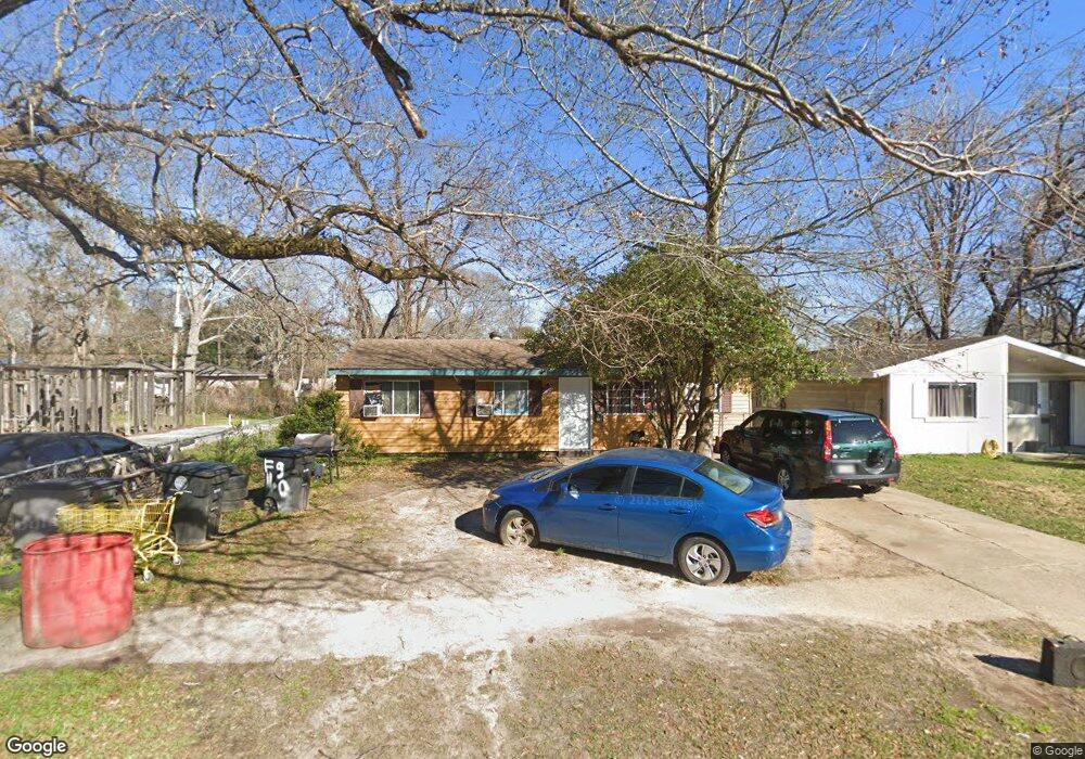
6250 Flag St Baton Rouge, LA 70812
Merrydale NeighborhoodEstimated Value: $47,000 - $101,000
3
Beds
1
Bath
1,011
Sq Ft
$72/Sq Ft
Est. Value
About This Home
This home is located at 6250 Flag St, Baton Rouge, LA 70812 and is currently estimated at $72,986, approximately $72 per square foot. 6250 Flag St is a home located in East Baton Rouge Parish with nearby schools including Glen Oaks Park Elementary School, Glen Oaks Senior High School, and Celerity Lanier Charter School.
Ownership History
Date
Name
Owned For
Owner Type
Purchase Details
Closed on
Apr 16, 2021
Sold by
Mungal Carol
Bought by
Bahc Properties Llc
Current Estimated Value
Home Financials for this Owner
Home Financials are based on the most recent Mortgage that was taken out on this home.
Original Mortgage
$33,000
Outstanding Balance
$29,795
Interest Rate
3%
Mortgage Type
Purchase Money Mortgage
Estimated Equity
$43,191
Purchase Details
Closed on
Feb 9, 2011
Sold by
Jones Elton J
Bought by
Mungal Carol
Purchase Details
Closed on
Jan 12, 2011
Sold by
Mungal Carol
Bought by
Jones Elton J
Create a Home Valuation Report for This Property
The Home Valuation Report is an in-depth analysis detailing your home's value as well as a comparison with similar homes in the area
Home Values in the Area
Average Home Value in this Area
Purchase History
| Date | Buyer | Sale Price | Title Company |
|---|---|---|---|
| Bahc Properties Llc | $33,000 | Cypress Title Llc | |
| Mungal Carol | $20,000 | -- | |
| Jones Elton J | $20,000 | -- |
Source: Public Records
Mortgage History
| Date | Status | Borrower | Loan Amount |
|---|---|---|---|
| Open | Bahc Properties Llc | $33,000 |
Source: Public Records
Tax History
| Year | Tax Paid | Tax Assessment Tax Assessment Total Assessment is a certain percentage of the fair market value that is determined by local assessors to be the total taxable value of land and additions on the property. | Land | Improvement |
|---|---|---|---|---|
| 2024 | $509 | $3,517 | $493 | $3,024 |
| 2023 | $511 | $3,140 | $440 | $2,700 |
| 2022 | $465 | $3,140 | $440 | $2,700 |
| 2021 | $339 | $2,260 | $440 | $1,820 |
| 2020 | $342 | $2,260 | $440 | $1,820 |
| 2019 | $323 | $2,050 | $400 | $1,650 |
| 2018 | $320 | $2,050 | $400 | $1,650 |
| 2017 | $320 | $2,050 | $400 | $1,650 |
| 2016 | $235 | $1,473 | $400 | $1,073 |
| 2015 | $311 | $2,000 | $400 | $1,600 |
| 2014 | $310 | $2,000 | $400 | $1,600 |
| 2013 | -- | $2,000 | $400 | $1,600 |
Source: Public Records
Map
Nearby Homes
- 6155 Pontotoc St
- 6129 E Glen Ct
- 6032 Matthews St
- 5965 Denova St
- 7341 Whitney Dr
- 6868 Oak Glen Dr
- 5726 Matthews St
- 5723 Hartford Ave
- 7363 Richey Dr
- 6822 Oak Park Dr
- 6744 Dalark Dr
- 5717 Nashville Ave
- 6855 Dalark Dr
- 7672 Sumrall Dr
- 6970 Coronet Dr
- 6778 Glen Echo Dr
- 7915 Mickens Rd
- 7925 Mickens Rd
- 7144 Perimeter Dr
- 7153 Perimeter Dr
- 6236 Flag St
- 6232 Flag St
- 6286 Flag St
- 6219 Matthews St
- 6219 Matthews St Unit 1
- 6233 Matthews St
- 6222 Flag St
- 6197 Matthews St
- 6326 Flag St
- 6241 Matthews St
- 6185 Matthews St
- 6178 Flag St
- 6261 Flag St
- 6233 Flag St
- 6227 Flag St
- 6255 Matthews St
- 6173 Matthews St
- 6338 Flag St
- 6166 Flag St
- 6267 Matthews St