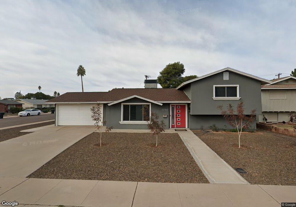
6250 N 85th St Scottsdale, AZ 85250
Indian Bend NeighborhoodEstimated Value: $652,165 - $875,000
--
Bed
3
Baths
1,860
Sq Ft
$413/Sq Ft
Est. Value
About This Home
This home is located at 6250 N 85th St, Scottsdale, AZ 85250 and is currently estimated at $768,541, approximately $413 per square foot. 6250 N 85th St is a home located in Maricopa County with nearby schools including Pueblo Elementary School, Navajo Elementary School, and Mohave Middle School.
Ownership History
Date
Name
Owned For
Owner Type
Purchase Details
Closed on
Oct 13, 2008
Sold by
Young Kenneth G and Young Miriam
Bought by
Prosnier Nathan
Current Estimated Value
Home Financials for this Owner
Home Financials are based on the most recent Mortgage that was taken out on this home.
Original Mortgage
$194,750
Outstanding Balance
$128,756
Interest Rate
6.31%
Mortgage Type
New Conventional
Estimated Equity
$639,785
Create a Home Valuation Report for This Property
The Home Valuation Report is an in-depth analysis detailing your home's value as well as a comparison with similar homes in the area
Home Values in the Area
Average Home Value in this Area
Purchase History
| Date | Buyer | Sale Price | Title Company |
|---|---|---|---|
| Prosnier Nathan | $205,000 | Magnus Title Agency |
Source: Public Records
Mortgage History
| Date | Status | Borrower | Loan Amount |
|---|---|---|---|
| Open | Prosnier Nathan | $194,750 |
Source: Public Records
Tax History Compared to Growth
Tax History
| Year | Tax Paid | Tax Assessment Tax Assessment Total Assessment is a certain percentage of the fair market value that is determined by local assessors to be the total taxable value of land and additions on the property. | Land | Improvement |
|---|---|---|---|---|
| 2025 | $1,708 | $28,597 | -- | -- |
| 2024 | $1,604 | $27,235 | -- | -- |
| 2023 | $1,604 | $53,300 | $10,660 | $42,640 |
| 2022 | $1,528 | $40,210 | $8,040 | $32,170 |
| 2021 | $1,657 | $36,620 | $7,320 | $29,300 |
| 2020 | $1,644 | $34,000 | $6,800 | $27,200 |
| 2019 | $1,594 | $29,570 | $5,910 | $23,660 |
| 2018 | $1,549 | $27,060 | $5,410 | $21,650 |
| 2017 | $1,462 | $25,570 | $5,110 | $20,460 |
| 2016 | $1,423 | $23,210 | $4,640 | $18,570 |
| 2015 | $1,376 | $23,330 | $4,660 | $18,670 |
Source: Public Records
Map
Nearby Homes
- 8525 E Keim Dr
- 8509 E Malcomb Dr
- 6326 N 86th St
- 8419 E Stella Ln
- 6338 N 86th St
- 8614 E Rose Ln
- 8414 E Stella Ln
- 8614 E Berridge Ln
- 8619 E Malcomb Dr
- 8449 E Lincoln Dr
- 8238 E Keim Dr
- 8426 E Lincoln Dr
- 8340 E McDonald Dr Unit 1003
- 8560 E McDonald Dr Unit 113
- 8701 E Edward Ave
- 8564 E McDonald Dr
- 8302 E Lincoln Dr
- 8619 E El Charro Ln
- 8742 E Berridge Ln
- 5941 N 83rd St
- 6256 N 85th St
- 8513 E Rose Ln
- 8507 E Rose Ln
- 8519 E Rose Ln
- 8501 E Rose Ln
- 8491 E Malcomb Dr
- 8491 E Malcomb Dr
- 8501 E Edward Ave
- 6268 N 85th St
- 8508 E Rose Ln
- 8525 E Rose Ln
- 8487 E Malcomb Dr
- 8443 E Rose Ln
- 8514 E Keim Dr
- 8506 E Keim Dr
- 8507 E Edward Ave
- 8531 E Rose Ln
- 8502 E Keim Dr
- 6302 N 85th St
- 8437 E Rose Ln