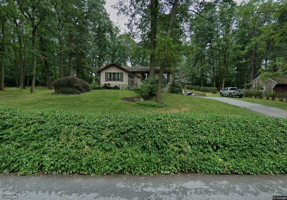
6252 Hill Top Dr E Spring Grove, PA 17362
Estimated Value: $313,699 - $363,000
3
Beds
2
Baths
2,210
Sq Ft
$153/Sq Ft
Est. Value
About This Home
This home is located at 6252 Hill Top Dr E, Spring Grove, PA 17362 and is currently estimated at $337,675, approximately $152 per square foot. 6252 Hill Top Dr E is a home located in York County with nearby schools including Spring Grove Area Middle School, Spring Grove Area High School, and Garbers Mennonite School.
Ownership History
Date
Name
Owned For
Owner Type
Purchase Details
Closed on
Jun 19, 1998
Sold by
Smeltzer Merle A and Smeltzer Donna S
Bought by
Osmun Matthew J and Osmun Christy Ann
Current Estimated Value
Home Financials for this Owner
Home Financials are based on the most recent Mortgage that was taken out on this home.
Original Mortgage
$122,450
Outstanding Balance
$24,582
Interest Rate
7.09%
Estimated Equity
$313,093
Create a Home Valuation Report for This Property
The Home Valuation Report is an in-depth analysis detailing your home's value as well as a comparison with similar homes in the area
Home Values in the Area
Average Home Value in this Area
Purchase History
| Date | Buyer | Sale Price | Title Company |
|---|---|---|---|
| Osmun Matthew J | $128,900 | -- |
Source: Public Records
Mortgage History
| Date | Status | Borrower | Loan Amount |
|---|---|---|---|
| Open | Osmun Matthew J | $122,450 |
Source: Public Records
Tax History Compared to Growth
Tax History
| Year | Tax Paid | Tax Assessment Tax Assessment Total Assessment is a certain percentage of the fair market value that is determined by local assessors to be the total taxable value of land and additions on the property. | Land | Improvement |
|---|---|---|---|---|
| 2025 | $5,056 | $150,460 | $41,500 | $108,960 |
| 2024 | $5,002 | $150,460 | $41,500 | $108,960 |
| 2023 | $5,002 | $150,460 | $41,500 | $108,960 |
| 2022 | $5,002 | $150,460 | $41,500 | $108,960 |
| 2021 | $4,787 | $150,460 | $41,500 | $108,960 |
| 2020 | $4,787 | $150,460 | $41,500 | $108,960 |
| 2019 | $4,685 | $150,460 | $41,500 | $108,960 |
| 2018 | $4,623 | $150,460 | $41,500 | $108,960 |
| 2017 | $4,480 | $150,460 | $41,500 | $108,960 |
| 2016 | -- | $150,460 | $41,500 | $108,960 |
| 2015 | $3,041 | $150,460 | $41,500 | $108,960 |
| 2014 | $3,041 | $150,460 | $41,500 | $108,960 |
Source: Public Records
Map
Nearby Homes
- 1063 Porters Rd
- 1098 Porters Rd
- 6170 York Rd
- 1342 Marburg Rd
- 1350 Porters Rd
- 5931 York Rd
- 1315 Moulstown Rd N
- 5720 Colonial Valley Rd
- 1233 Glatco Lodge Rd
- 5497 Stambaugh Rd
- Lot# 3 Midhill Rd
- Lot # 2 Midhill Rd
- Lot # 1 Midhill Rd
- 1403 Krafts Mill Rd
- 0 Moulstown Rd N Unit PAYK2082362
- 5363 Waltersdorff Rd
- 7877 Gnatstown Rd
- 799 Laurel Woods Ln
- 2116 Jefferson Rd
- 6302 Liam Dr
- 6270 Hill Top Dr E
- 6270 Hilltop Dr E
- 6232 Hill Top Dr E
- 1051 Porters Rd
- 6251 Hill Top Dr E
- 6235 Hill Top Dr E
- 6284 Hill Top Dr E
- 6283 Hill Top Dr E
- 6267 Hill Top Dr E
- 6210 Hill Top Dr E
- 6219 Hill Top Dr E
- 1066 Porters Rd
- 6298 Hill Top Dr E
- 6299 Hill Top Dr E
- 6300 Straw Acres Rd
- 1072 Porters Rd
- 6301 Straw Acres Rd
- 1099 Clinton Ct
- 929 Porters Rd
- 1087 Porters Rd