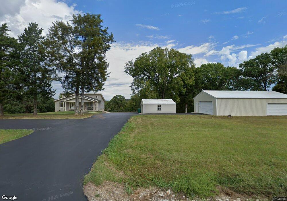
6252 State Road B Hillsboro, MO 63050
Estimated Value: $312,000 - $432,000
--
Bed
--
Bath
2,696
Sq Ft
$132/Sq Ft
Est. Value
About This Home
This home is located at 6252 State Road B, Hillsboro, MO 63050 and is currently estimated at $355,119, approximately $131 per square foot. 6252 State Road B is a home located in Jefferson County with nearby schools including Hillsboro Elementary School, Hillsboro Primary School, and Hillsboro Middle Elementary School.
Ownership History
Date
Name
Owned For
Owner Type
Purchase Details
Closed on
Oct 8, 2004
Sold by
Brandes Charles J and Brandes Hollie G
Bought by
Allgeyer Richard K
Current Estimated Value
Home Financials for this Owner
Home Financials are based on the most recent Mortgage that was taken out on this home.
Original Mortgage
$134,000
Outstanding Balance
$66,032
Interest Rate
5.8%
Mortgage Type
Purchase Money Mortgage
Estimated Equity
$289,087
Create a Home Valuation Report for This Property
The Home Valuation Report is an in-depth analysis detailing your home's value as well as a comparison with similar homes in the area
Home Values in the Area
Average Home Value in this Area
Purchase History
| Date | Buyer | Sale Price | Title Company |
|---|---|---|---|
| Richard K Allgeyer Revocable Trust | -- | -- | |
| Allgeyer Richard K | -- | -- |
Source: Public Records
Mortgage History
| Date | Status | Borrower | Loan Amount |
|---|---|---|---|
| Previous Owner | Allgeyer Richard K | $134,000 | |
| Closed | Allgeyer Richard K | $10,000 |
Source: Public Records
Tax History Compared to Growth
Tax History
| Year | Tax Paid | Tax Assessment Tax Assessment Total Assessment is a certain percentage of the fair market value that is determined by local assessors to be the total taxable value of land and additions on the property. | Land | Improvement |
|---|---|---|---|---|
| 2025 | $1,942 | $34,500 | $8,800 | $25,700 |
| 2024 | $1,942 | $32,200 | $8,800 | $23,400 |
| 2023 | $1,942 | $32,200 | $8,800 | $23,400 |
| 2022 | $1,953 | $32,200 | $8,800 | $23,400 |
| 2021 | $2,098 | $32,200 | $8,800 | $23,400 |
| 2020 | $1,794 | $26,700 | $8,000 | $18,700 |
| 2019 | $1,792 | $26,700 | $8,000 | $18,700 |
| 2018 | $1,796 | $26,700 | $8,000 | $18,700 |
| 2017 | $1,707 | $26,700 | $8,000 | $18,700 |
| 2016 | $1,691 | $25,300 | $8,000 | $17,300 |
| 2015 | $1,686 | $25,300 | $8,000 | $17,300 |
| 2013 | -- | $24,600 | $7,300 | $17,300 |
Source: Public Records
Map
Nearby Homes
- 6391 Forest Meadow Rd
- 6103 Union Dr
- 9701 Lee Dr
- 847 Dogwood Dr
- 826 Dogwood Dr
- 831 Dogwood Dr
- 835 Dogwood Dr
- 822 Dogwood Dr
- 848 Dogwood Dr
- 9748 Lee Dr
- 9761 W Vista Dr
- 9860 E Vista Dr
- 9843 E Vista Dr
- 157 Cottonblossom Dr
- 3076 Jackson Dr
- 9691 W Vista Dr
- 120 Azelia Lot 120 Section 10
- 9718 Magnolia Dr
- 9607 Moonshine Dr
- 9632 Moonshine Dr
- 6242 State Road B
- 6281 State Road B
- 6237 State Road B
- 6285 State Road B
- 6285 State Road B
- 6285 State Road B
- 6287 State Road B
- 6215 State Road B
- 6291 State Road B
- 1018 Park Ridge Rd
- 6167 State Road B
- 6231 State Road B
- 6186 Highway B
- 1021 Park Ridge Rd
- 1026 Park Ridge Rd
- 1015 Park Ridge Rd
- 131 Evergreen Dr
- 23 Cedar Trace Rd
- 0Lot 23 Cedar Trace Rd
- 991 Tracy Ln