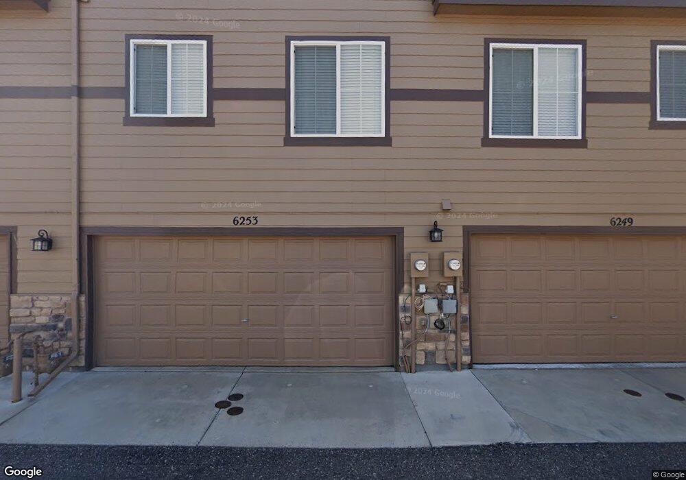
6253 Upham Heights Colorado Springs, CO 80923
Norwood NeighborhoodEstimated Value: $323,320 - $338,000
2
Beds
4
Baths
1,290
Sq Ft
$258/Sq Ft
Est. Value
About This Home
This home is located at 6253 Upham Heights, Colorado Springs, CO 80923 and is currently estimated at $333,330, approximately $258 per square foot. 6253 Upham Heights is a home located in El Paso County with nearby schools including Martinez Elementary School, Jenkins Middle School, and Doherty High School.
Ownership History
Date
Name
Owned For
Owner Type
Purchase Details
Closed on
Jun 7, 2017
Sold by
Igou Natalie R and Hosmer Natalie
Bought by
2518 Llc
Current Estimated Value
Purchase Details
Closed on
Mar 30, 2011
Sold by
Vistas At Norwood Llc
Bought by
Igou Natalie R
Home Financials for this Owner
Home Financials are based on the most recent Mortgage that was taken out on this home.
Original Mortgage
$146,148
Interest Rate
4.37%
Mortgage Type
FHA
Create a Home Valuation Report for This Property
The Home Valuation Report is an in-depth analysis detailing your home's value as well as a comparison with similar homes in the area
Home Values in the Area
Average Home Value in this Area
Purchase History
| Date | Buyer | Sale Price | Title Company |
|---|---|---|---|
| 2518 Llc | $205,000 | Unified Title Co | |
| Igou Natalie R | $149,950 | First American |
Source: Public Records
Mortgage History
| Date | Status | Borrower | Loan Amount |
|---|---|---|---|
| Previous Owner | Igou Natalie R | $146,148 |
Source: Public Records
Tax History Compared to Growth
Tax History
| Year | Tax Paid | Tax Assessment Tax Assessment Total Assessment is a certain percentage of the fair market value that is determined by local assessors to be the total taxable value of land and additions on the property. | Land | Improvement |
|---|---|---|---|---|
| 2025 | $1,171 | $25,450 | -- | -- |
| 2024 | $1,060 | $24,020 | $4,960 | $19,060 |
| 2023 | $1,060 | $24,020 | $4,960 | $19,060 |
| 2022 | $1,069 | $17,850 | $3,200 | $14,650 |
| 2021 | $1,156 | $18,360 | $3,290 | $15,070 |
| 2020 | $1,118 | $15,570 | $2,470 | $13,100 |
| 2019 | $1,112 | $15,570 | $2,470 | $13,100 |
| 2018 | $966 | $12,500 | $1,940 | $10,560 |
| 2017 | $918 | $12,500 | $1,940 | $10,560 |
| 2016 | $794 | $12,820 | $1,910 | $10,910 |
| 2015 | $791 | $12,820 | $1,910 | $10,910 |
| 2014 | $789 | $12,300 | $1,910 | $10,390 |
Source: Public Records
Map
Nearby Homes
- 6243 Fowler Mill Point
- 6256 Fowler Mill Point
- 4718 Rowland Heights
- 4735 Seton Place
- 5739 Wells Fargo Dr E
- 6315 Andersen Mill Heights Unit 206
- 4790 Wells Branch Heights Unit 204
- 5745 Doe Skin Ct
- 4543 Clark Fork Place
- 4740 Rustler Ct
- 6465 Whirlwind Dr
- 4431 Flat Top Place
- 6103 Treeledge Dr
- 5978 Maroon Mesa Dr
- 6515 Medicine Springs Dr
- 5347 Wells Fargo Dr
- 6662 Barrel Race Dr
- 5635 Altitude Dr
- 5940 Corinth Dr
- 5965 Corinth Dr
- 6249 Upham Heights
- 6257 Upham Heights
- 6245 Upham Heights
- 6261 Upham Heights
- 6241 Upham Heights
- 6260 Fowler Mill Point
- 6252 Fowler Mill Point
- 6248 Fowler Mill Point
- 4725 Rowland Heights
- 6237 Upham Heights
- 6250 Upham Heights
- 6246 Upham Heights
- 6244 Fowler Mill Point
- 6242 Upham Heights
- 4721 Rowland Heights
- 6238 Upham Heights
- 6269 Andersen Mill Heights
- 4717 Rowland Heights
- 6267 Liberty Hill Point
- 6273 Andersen Mill Heights