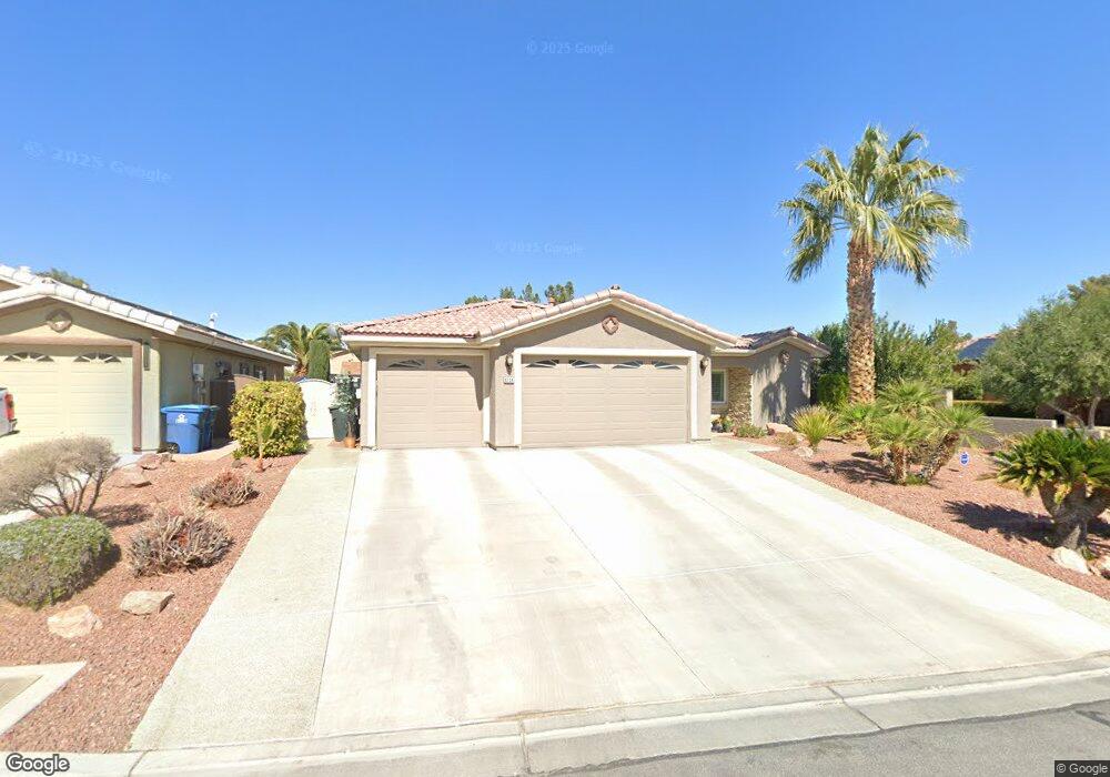
6254 Kraft Ave Las Vegas, NV 89130
North Cheyenne NeighborhoodEstimated Value: $511,000 - $518,236
3
Beds
2
Baths
2,163
Sq Ft
$238/Sq Ft
Est. Value
About This Home
This home is located at 6254 Kraft Ave, Las Vegas, NV 89130 and is currently estimated at $513,809, approximately $237 per square foot. 6254 Kraft Ave is a home located in Clark County with nearby schools including Ernest May Elementary School, Theron L Swainston Middle School, and Cheyenne High School.
Ownership History
Date
Name
Owned For
Owner Type
Purchase Details
Closed on
Jan 24, 2025
Sold by
Pittz Eugene P and Allaire-Pittz Judith
Bought by
Ap Family 2025 Trust and Pittz
Current Estimated Value
Purchase Details
Closed on
Apr 7, 2004
Sold by
Ten Plus Inc
Bought by
Pittz Eugene P and Pittz Judith E Allarie
Home Financials for this Owner
Home Financials are based on the most recent Mortgage that was taken out on this home.
Original Mortgage
$247,800
Interest Rate
5.56%
Mortgage Type
Unknown
Create a Home Valuation Report for This Property
The Home Valuation Report is an in-depth analysis detailing your home's value as well as a comparison with similar homes in the area
Home Values in the Area
Average Home Value in this Area
Purchase History
| Date | Buyer | Sale Price | Title Company |
|---|---|---|---|
| Ap Family 2025 Trust | -- | None Listed On Document | |
| Pittz Eugene P | $309,750 | Old Republic Title Co Of Ne |
Source: Public Records
Mortgage History
| Date | Status | Borrower | Loan Amount |
|---|---|---|---|
| Previous Owner | Pittz Eugene P | $247,800 |
Source: Public Records
Tax History Compared to Growth
Tax History
| Year | Tax Paid | Tax Assessment Tax Assessment Total Assessment is a certain percentage of the fair market value that is determined by local assessors to be the total taxable value of land and additions on the property. | Land | Improvement |
|---|---|---|---|---|
| 2025 | $2,777 | $144,352 | $37,800 | $106,552 |
| 2024 | $2,696 | $144,352 | $37,800 | $106,552 |
| 2023 | $2,200 | $134,320 | $33,950 | $100,370 |
| 2022 | $2,618 | $122,261 | $30,450 | $91,811 |
| 2021 | $2,542 | $115,480 | $28,350 | $87,130 |
| 2020 | $2,465 | $114,536 | $28,350 | $86,186 |
| 2019 | $2,393 | $108,167 | $23,450 | $84,717 |
| 2018 | $2,323 | $99,898 | $18,200 | $81,698 |
| 2017 | $3,025 | $92,288 | $16,100 | $76,188 |
| 2016 | $2,200 | $87,402 | $11,550 | $75,852 |
| 2015 | $2,196 | $80,984 | $8,750 | $72,234 |
| 2014 | $2,132 | $66,607 | $8,750 | $57,857 |
Source: Public Records
Map
Nearby Homes
- 6225 Minerva Dr
- 6277 Kraft Ave
- 6256 Hill Haven Ave
- 4517 Carbine Chapel St
- 4505 Truscott Ct
- 6105 Sadler Dr
- 4505 Mollison Mesa Ct
- 4521 Night Dance Ct
- 5774 Smithsonian Way
- 6300 W La Madre Way
- 6425 Wheelbarrow Peak Dr
- 6505 Quantum Ln
- 5812 Ventana Dr
- 6421 Doby Peak Dr
- 5005 Chambliss Dr
- 6540 Angel Mountain Ave Unit 2
- 5041 Peaceful Paradise St
- 6508 Faith Peak Dr
- 5144 Maverick St
- 6608 Messenger Ct
- 6258 Kraft Ave
- 4710 Trimwater Ct
- 4720 Windy Hollow St
- 6262 Kraft Ave
- 6253 Kraft Ave
- 6257 Kraft Ave
- 4740 Windy Hollow St
- 4628 Windy Hollow St
- 6261 Kraft Ave
- 4720 Trimwater Ct
- 6265 Kraft Ave
- 6228 Dorchester Cir
- 6224 Sadler Dr
- 6270 Kraft Ave
- 6225 Dorchester Cir
- 6252 Chimney Wood Ave
- 6256 Chimney Wood Ave
- 6229 Sadler Dr
- 6260 Chimney Wood Ave
- 6269 Kraft Ave