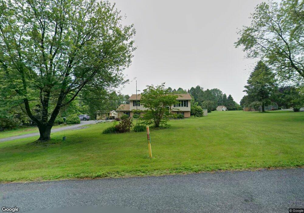
626 Almond Rd Walnutport, PA 18088
Estimated Value: $429,098 - $471,000
3
Beds
2
Baths
1,952
Sq Ft
$229/Sq Ft
Est. Value
About This Home
This home is located at 626 Almond Rd, Walnutport, PA 18088 and is currently estimated at $447,275, approximately $229 per square foot. 626 Almond Rd is a home located in Northampton County with nearby schools including Norfolk Highlands Primary School, Lehigh Elementary School, and Northampton Area Middle School.
Ownership History
Date
Name
Owned For
Owner Type
Purchase Details
Closed on
Oct 9, 2003
Sold by
Schollenberger Suzanne
Bought by
Campbell Sean T
Current Estimated Value
Home Financials for this Owner
Home Financials are based on the most recent Mortgage that was taken out on this home.
Original Mortgage
$179,450
Outstanding Balance
$84,545
Interest Rate
6.35%
Mortgage Type
New Conventional
Estimated Equity
$362,730
Purchase Details
Closed on
Dec 31, 2001
Bought by
Schollenberger Suzanne M
Create a Home Valuation Report for This Property
The Home Valuation Report is an in-depth analysis detailing your home's value as well as a comparison with similar homes in the area
Home Values in the Area
Average Home Value in this Area
Purchase History
| Date | Buyer | Sale Price | Title Company |
|---|---|---|---|
| Campbell Sean T | $185,000 | -- | |
| Schollenberger Suzanne M | $150,000 | -- |
Source: Public Records
Mortgage History
| Date | Status | Borrower | Loan Amount |
|---|---|---|---|
| Open | Campbell Sean T | $179,450 |
Source: Public Records
Tax History Compared to Growth
Tax History
| Year | Tax Paid | Tax Assessment Tax Assessment Total Assessment is a certain percentage of the fair market value that is determined by local assessors to be the total taxable value of land and additions on the property. | Land | Improvement |
|---|---|---|---|---|
| 2025 | $764 | $70,700 | $26,800 | $43,900 |
| 2024 | $5,197 | $70,700 | $26,800 | $43,900 |
| 2023 | $5,105 | $70,700 | $26,800 | $43,900 |
| 2022 | $5,105 | $70,700 | $26,800 | $43,900 |
| 2021 | $5,118 | $70,700 | $26,800 | $43,900 |
| 2020 | $5,118 | $70,700 | $26,800 | $43,900 |
| 2019 | $5,043 | $70,700 | $26,800 | $43,900 |
| 2018 | $4,968 | $70,700 | $26,800 | $43,900 |
| 2017 | $4,860 | $70,700 | $26,800 | $43,900 |
| 2016 | -- | $70,700 | $26,800 | $43,900 |
| 2015 | -- | $70,700 | $26,800 | $43,900 |
| 2014 | -- | $70,700 | $26,800 | $43,900 |
Source: Public Records
Map
Nearby Homes
- 448 Long Lane Rd
- 464 Long Lane Rd
- 582 Ironwood Rd
- 436 Willow Rd Unit Lot 15
- 4405 Lehigh Dr
- 4441 Lehigh Dr
- 390 Long Lane Rd
- 4266 Chestnut Dr
- 315 Long Lane Rd
- 4750 Three Mile Ln
- 84 Linda Dr
- 12 Stacey Dr
- 43 David Dr
- 4586 W Mountain View Dr
- 744 Williams Ave
- 319 Washington St
- 723 Fir Dr
- 47 Cherry St
- 1041 Dogwood St
- 1110 Greenbriar Ln
- 624 Almond Rd
- 636 Almond Rd
- 4530 Deerbrook Ct
- 622 Almond Rd
- 643 Overlook Cir
- 4534 Deerbrook Ct
- 4536 Deerbrook Ct
- 629 Almond Rd
- 633 Almond Rd
- 620 Almond Rd
- 4487 Chestnut Dr
- 4518 Deerbrook Ct
- 645 Almond Rd
- 4529 Deerbrook Ct
- 661 Overlook Cir
- 646 Overlook Cir
- 618 Almond Rd
- 4527 Richard Terrace
- 4542 Deerbrook Ct
- 654 Overlook Cir