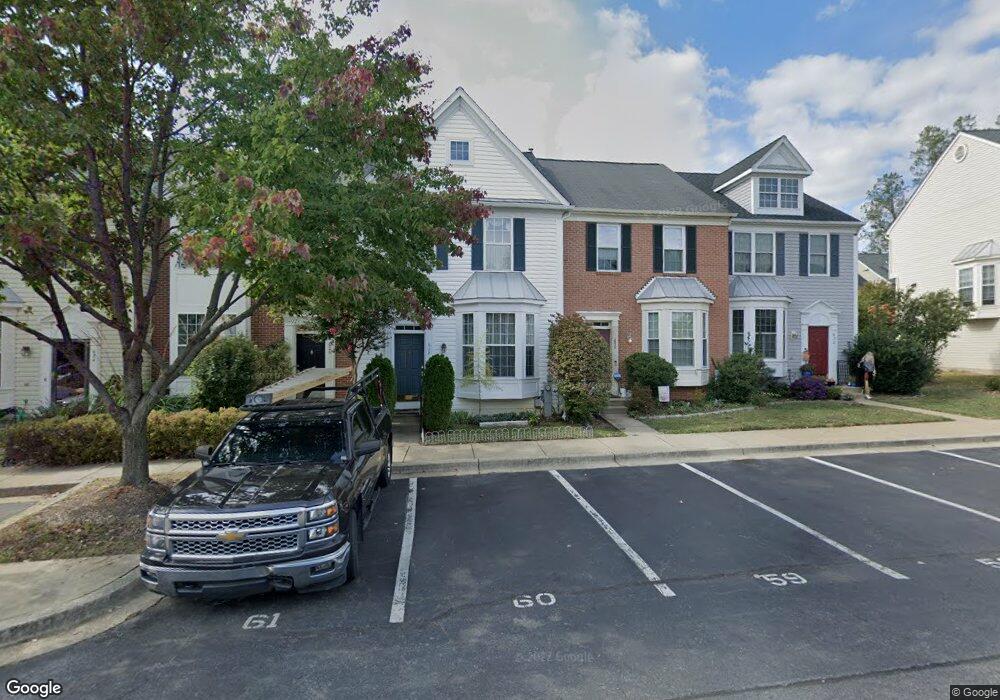
626 Howards Loop Annapolis, MD 21401
Parole NeighborhoodEstimated Value: $451,227 - $503,000
Studio
3
Baths
1,428
Sq Ft
$334/Sq Ft
Est. Value
About This Home
This home is located at 626 Howards Loop, Annapolis, MD 21401 and is currently estimated at $477,557, approximately $334 per square foot. 626 Howards Loop is a home located in Anne Arundel County with nearby schools including West Annapolis Elementary School, Wiley H. Bates Middle School, and Annapolis High School.
Ownership History
Date
Name
Owned For
Owner Type
Purchase Details
Closed on
Dec 8, 2005
Sold by
Pope William C
Bought by
Heim Raymond and Hein Brenda
Current Estimated Value
Home Financials for this Owner
Home Financials are based on the most recent Mortgage that was taken out on this home.
Original Mortgage
$77,800
Outstanding Balance
$43,219
Interest Rate
6.17%
Mortgage Type
New Conventional
Estimated Equity
$434,338
Purchase Details
Closed on
Feb 27, 1997
Sold by
Pulte Home Corp
Bought by
Pope William C and Pope Michelle Pope
Create a Home Valuation Report for This Property
The Home Valuation Report is an in-depth analysis detailing your home's value as well as a comparison with similar homes in the area
Home Values in the Area
Average Home Value in this Area
Purchase History
| Date | Buyer | Sale Price | Title Company |
|---|---|---|---|
| Heim Raymond | $389,000 | -- | |
| Pope William C | $151,470 | -- |
Source: Public Records
Mortgage History
| Date | Status | Borrower | Loan Amount |
|---|---|---|---|
| Open | Heim Raymond | $77,800 | |
| Closed | Pope William C | -- |
Source: Public Records
Tax History
| Year | Tax Paid | Tax Assessment Tax Assessment Total Assessment is a certain percentage of the fair market value that is determined by local assessors to be the total taxable value of land and additions on the property. | Land | Improvement |
|---|---|---|---|---|
| 2025 | $4,303 | $414,200 | $180,000 | $234,200 |
| 2024 | $4,303 | $389,400 | -- | -- |
| 2023 | $4,019 | $364,600 | $0 | $0 |
| 2022 | $3,551 | $339,800 | $155,000 | $184,800 |
| 2020 | $3,581 | $338,933 | $0 | $0 |
| 2019 | $3,580 | $338,500 | $160,000 | $178,500 |
| 2018 | $3,408 | $336,133 | $0 | $0 |
| 2017 | $3,222 | $333,767 | $0 | $0 |
| 2016 | -- | $331,400 | $0 | $0 |
| 2015 | -- | $324,067 | $0 | $0 |
| 2014 | -- | $316,733 | $0 | $0 |
Source: Public Records
Map
Nearby Homes
- 603 Burtons Cove Way Unit 3
- 775 Howards Loop Unit 167
- 2052 Quaker Way Unit 7
- 2058 Quaker Way Unit 12
- 668 N Bestgate Rd
- 2006 Peggy Stewart Way Unit 204
- 2002 Phillips Terrace Unit 6
- 2013 Warners Terrace S Unit 138
- 2013 Warners Terrace S Unit 242
- 2015 Gov Thomas Bladen Way Unit 204
- 2150 Hideaway Ct Unit 28
- 25 Lincoln Pkwy
- 615 Admiral Dr
- 623 Admiral Dr Unit 304
- 12 Harbour Heights Dr
- 1873 Luce Creek Dr
- 629 Admiral Dr Unit U206
- 34 Harbour Heights Dr
- 1703 Nimitz Dr
- 1930 Severn Grove Rd
- 624 Howards Loop
- 624 Howards Loop Unit 8
- 622 Howards Loop
- 628 Howards Loop
- 628 Howards Loop Unit 10
- 620 Howards Loop
- 630 Howards Loop Unit 11
- 630 Howards Loop
- 618 Howards Loop
- 632 Howards Loop
- 617 Puritan Ct
- 617 Puritan Ct Unit 120
- 619 Puritan Ct Unit 121
- 619 Puritan Ct
- 621 Puritan Ct
- 2044 Puritan Terrace Unit 127
- 2044 Puritan Terrace
- 2042 Puritan Terrace
- 2046 Puritan Terrace
- 615 Howards Loop
Your Personal Tour Guide
Ask me questions while you tour the home.