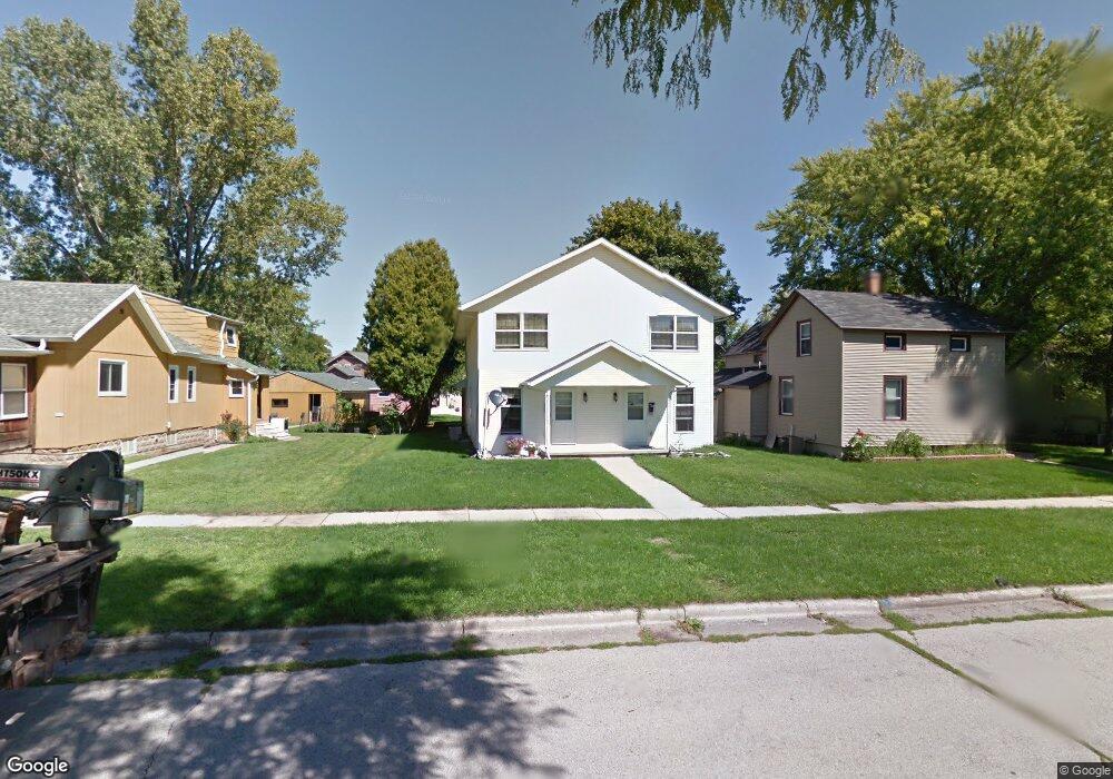
626 Reid St Unit 628 de Pere, WI 54115
Estimated Value: $325,000 - $410,817
4
Beds
4
Baths
2,400
Sq Ft
$160/Sq Ft
Est. Value
About This Home
This home is located at 626 Reid St Unit 628, de Pere, WI 54115 and is currently estimated at $383,954, approximately $159 per square foot. 626 Reid St Unit 628 is a home located in Brown County with nearby schools including Westwood Elementary School, West De Pere Middle School, and West De Pere High School.
Ownership History
Date
Name
Owned For
Owner Type
Purchase Details
Closed on
Sep 23, 2004
Sold by
Kinate James W and Kinate Katherine Y
Bought by
4K Residential Properties Llc
Current Estimated Value
Purchase Details
Closed on
Jan 1, 2004
Sold by
Kinate James W and Kinate Katherine Y
Bought by
4K Enterprises Llp
Create a Home Valuation Report for This Property
The Home Valuation Report is an in-depth analysis detailing your home's value as well as a comparison with similar homes in the area
Home Values in the Area
Average Home Value in this Area
Purchase History
| Date | Buyer | Sale Price | Title Company |
|---|---|---|---|
| 4K Residential Properties Llc | -- | -- | |
| Kinate James W | -- | -- | |
| 4K Enterprises Llp | -- | -- |
Source: Public Records
Tax History Compared to Growth
Tax History
| Year | Tax Paid | Tax Assessment Tax Assessment Total Assessment is a certain percentage of the fair market value that is determined by local assessors to be the total taxable value of land and additions on the property. | Land | Improvement |
|---|---|---|---|---|
| 2024 | $5,793 | $364,900 | $24,300 | $340,600 |
| 2023 | $5,182 | $312,100 | $24,300 | $287,800 |
| 2022 | $4,942 | $282,800 | $24,300 | $258,500 |
| 2021 | $4,824 | $252,200 | $20,200 | $232,000 |
| 2020 | $4,816 | $237,200 | $20,200 | $217,000 |
| 2019 | $4,464 | $220,700 | $20,200 | $200,500 |
| 2018 | $4,345 | $208,600 | $20,200 | $188,400 |
| 2017 | $3,931 | $184,800 | $20,200 | $164,600 |
| 2016 | $3,955 | $184,800 | $20,200 | $164,600 |
| 2015 | $4,249 | $194,700 | $20,300 | $174,400 |
| 2014 | $4,349 | $194,700 | $20,300 | $174,400 |
| 2013 | $4,349 | $194,700 | $20,300 | $174,400 |
Source: Public Records
Map
Nearby Homes
- 555 Main Ave Unit 104
- 555 Main Ave Unit 111
- 555 Main Ave Unit 113
- 555 Main Ave Unit 110
- 555 Main Ave Unit 206
- 657 Reid St
- 634 Grant St
- 721 Cedar St
- 978 Saint Anthony Dr Unit 980
- 978 Saint Anthony Dr Unit 2
- 1115 Twilight Dr Unit 1117
- 717 4th St
- 806 4th St
- 200 William St Unit 402
- 822 Westwood Dr
- 1611 N Honeysuckle Cir
- 305 Battery Ave
- 416 Lansdowne St
- 337 Battery Ave
- 385 Battery Ave