Estimated Value: $330,000 - $420,017
3
Beds
2
Baths
1,589
Sq Ft
$239/Sq Ft
Est. Value
About This Home
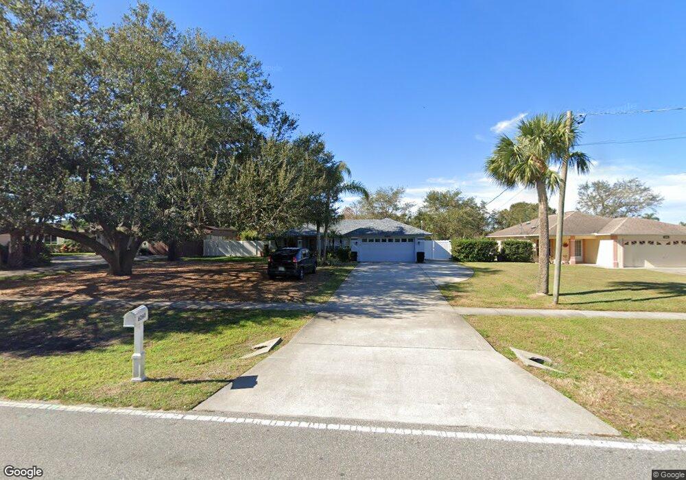
This home is located at 6260 Homestead Ave, Cocoa, FL 32927 and is currently estimated at $380,004, approximately $239 per square foot. 6260 Homestead Ave is a home located in Brevard County with nearby schools including Enterprise Elementary School, Space Coast Junior/Senior High School, and East Atlantic Prep of Brevard County.
Ownership History
Date
Name
Owned For
Owner Type
Purchase Details
Closed on
May 27, 2016
Sold by
Sulivam Terry and Sulivam Nancy
Bought by
Sullivan Terry T
Current Estimated Value
Purchase Details
Closed on
Feb 6, 2008
Sold by
Osullivan Terry Thimothy
Bought by
Osullivan Terry T and Osullivan Nancy A
Purchase Details
Closed on
Nov 14, 2000
Sold by
Sullivan Terry T and Sparks Christina M
Bought by
Sullivan Terry T
Home Financials for this Owner
Home Financials are based on the most recent Mortgage that was taken out on this home.
Original Mortgage
$94,000
Interest Rate
7.87%
Mortgage Type
New Conventional
Create a Home Valuation Report for This Property
The Home Valuation Report is an in-depth analysis detailing your home's value as well as a comparison with similar homes in the area
Home Values in the Area
Average Home Value in this Area
Purchase History
| Date | Buyer | Sale Price | Title Company |
|---|---|---|---|
| Sullivan Terry T | -- | None Available | |
| Osullivan Terry T | $87,500 | None Available | |
| Sullivan Terry T | -- | -- |
Source: Public Records
Mortgage History
| Date | Status | Borrower | Loan Amount |
|---|---|---|---|
| Previous Owner | Sullivan Terry T | $94,000 |
Source: Public Records
Tax History Compared to Growth
Tax History
| Year | Tax Paid | Tax Assessment Tax Assessment Total Assessment is a certain percentage of the fair market value that is determined by local assessors to be the total taxable value of land and additions on the property. | Land | Improvement |
|---|---|---|---|---|
| 2025 | $2,270 | $173,270 | -- | -- |
| 2024 | $2,229 | $168,390 | -- | -- |
| 2023 | $2,229 | $163,490 | $0 | $0 |
| 2022 | $1,178 | $85,920 | $0 | $0 |
| 2021 | $1,169 | $83,420 | $0 | $0 |
| 2020 | $1,105 | $82,270 | $0 | $0 |
| 2019 | $1,039 | $80,430 | $0 | $0 |
| 2018 | $1,029 | $78,940 | $0 | $0 |
| 2017 | $1,017 | $77,320 | $0 | $0 |
| 2016 | $1,014 | $75,730 | $19,800 | $55,930 |
| 2015 | $1,020 | $75,210 | $16,500 | $58,710 |
| 2014 | $1,023 | $74,620 | $12,100 | $62,520 |
Source: Public Records
Map
Nearby Homes
- 6365 Homestead Ave
- 23-35-21-JX-B-2 Aruin St
- 5915 Akers St
- 6010 Fay Blvd
- 6309 Alleghany Ave
- 6545 Addie Ave
- 5720 Flint Rd
- 6198 Dees Rd
- 5715 Fairbridge St
- 6118 Dees Rd
- 5955 Keystone Ave
- 4650 N Highway 1 Hwy
- 6665 Addie Ave
- 6003 Gilson
- 6105 Banyan St
- 6070 Baltimore Ave
- 6115 Allmont St
- 5940 Fisherman Ln
- 5575 Curtis Blvd
- 00000 Golfview Ave
- 6270 Homestead Ave
- 6250 Homestead Ave
- 6280 Homestead Ave
- 6240 Homestead Ave
- 6255 Homestead Ave
- 6265 Homestead Ave
- 6230 Homestead Ave
- 6235 Homestead Ave
- 6285 Homestead Ave
- 6310 Homestead Ave Unit 6
- 6310 Homestead Ave
- 6290 Homestead Ave
- 6284 Bamboo Ave
- 6296 Bamboo Ave
- 6272 Bamboo Ave
- 6220 Homestead Ave
- 6295 Homestead Ave
- 6260 Bamboo Ave
- 6300 Homestead Ave
- 6215 Homestead Ave