Estimated Value: $189,185 - $212,000
3
Beds
1
Bath
1,560
Sq Ft
$129/Sq Ft
Est. Value
About This Home
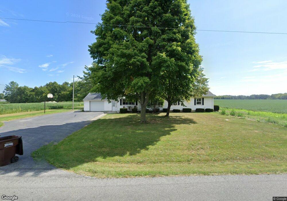
This home is located at 6262 Stewart Rd, Lima, OH 45807 and is currently estimated at $200,796, approximately $128 per square foot. 6262 Stewart Rd is a home located in Allen County with nearby schools including Bath Elementary School, Bath Middle School, and Bath High School.
Ownership History
Date
Name
Owned For
Owner Type
Purchase Details
Closed on
Jul 27, 2021
Sold by
High Jeffery and High Philip
Bought by
Hale Todd A and Hale Ashley
Current Estimated Value
Home Financials for this Owner
Home Financials are based on the most recent Mortgage that was taken out on this home.
Original Mortgage
$142,500
Outstanding Balance
$129,693
Interest Rate
2.96%
Mortgage Type
New Conventional
Estimated Equity
$71,103
Purchase Details
Closed on
May 29, 2018
Sold by
High Elizabeth J and High Elizabeth
Bought by
High Jeffery and High Philip
Purchase Details
Closed on
Oct 1, 1969
Bought by
High Clyde
Create a Home Valuation Report for This Property
The Home Valuation Report is an in-depth analysis detailing your home's value as well as a comparison with similar homes in the area
Purchase History
| Date | Buyer | Sale Price | Title Company |
|---|---|---|---|
| Hale Todd A | $150,000 | None Available | |
| High Jeffery | -- | None Available | |
| High Elizabeth J | -- | None Available | |
| High Clyde | $20,000 | -- |
Source: Public Records
Mortgage History
| Date | Status | Borrower | Loan Amount |
|---|---|---|---|
| Open | Hale Todd A | $142,500 |
Source: Public Records
Tax History
| Year | Tax Paid | Tax Assessment Tax Assessment Total Assessment is a certain percentage of the fair market value that is determined by local assessors to be the total taxable value of land and additions on the property. | Land | Improvement |
|---|---|---|---|---|
| 2024 | $1,839 | $46,420 | $9,000 | $37,420 |
| 2023 | $1,673 | $38,050 | $7,390 | $30,660 |
| 2022 | $1,685 | $38,050 | $7,390 | $30,660 |
| 2021 | $1,303 | $38,050 | $7,390 | $30,660 |
| 2020 | $1,042 | $30,240 | $6,720 | $23,520 |
| 2019 | $1,042 | $30,240 | $6,720 | $23,520 |
| 2018 | $1,017 | $30,240 | $6,720 | $23,520 |
| 2017 | $922 | $28,110 | $6,720 | $21,390 |
| 2016 | $927 | $28,110 | $6,720 | $21,390 |
| 2015 | $1,268 | $28,110 | $6,720 | $21,390 |
| 2014 | $1,268 | $35,110 | $6,720 | $28,390 |
| 2013 | $1,269 | $35,110 | $6,720 | $28,390 |
Source: Public Records
Map
Nearby Homes
- 102 W Main St
- 201 Wall St
- 513 W Main St
- 634 W Main St
- 3270 Bonnieview Dr
- 108 Highland Lakes Dr
- 3263 Shiloh Dr
- 2878 Autumn Lake Dr
- 0 N Dixie Hwy Unit 300253
- 0 Fraunfelter Unit 307817
- 0 N Eastown Rd Unit 1034495
- 3137 Thorndyke Dr
- 5025 N Cool Rd
- 475 Kenmore St
- 520 Kenmore St
- 5817 N Dixie Hwy
- 6431 Couples Ln
- 1656 Stewart Rd
- 105 Watt Ave
- 6477 Woods Dr Unit 220
- 6261 Stewart Rd
- 6209 Stewart Rd
- 6144 Stewart Rd
- 6490 Stewart Rd
- 1940 E Lincoln Hwy
- 2122 E Lincoln Hwy
- 2025 E Lincoln Hwy
- 2174 E Lincoln Hwy
- 1694 E Lincoln Hwy
- 1697 E Lincoln Hwy
- 5874 Stewart Rd
- 2250 E Lincoln Hwy
- 1669 E Lincoln Hwy
- 1621 E Lincoln Hwy
- 2373 E Lincoln Hwy
- 212 Maple Dr
- 225 Redwood Dr
- 2288 E Lincoln Hwy