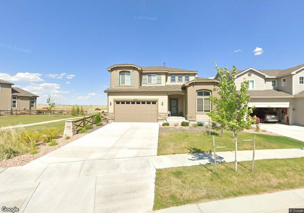
6265 Ashmore Ln Colorado Springs, CO 80927
Banning Lewis Ranch NeighborhoodEstimated Value: $495,000 - $559,000
3
Beds
3
Baths
2,174
Sq Ft
$247/Sq Ft
Est. Value
About This Home
This home is located at 6265 Ashmore Ln, Colorado Springs, CO 80927 and is currently estimated at $537,175, approximately $247 per square foot. 6265 Ashmore Ln is a home with nearby schools including Stetson Elementary School, Falcon Middle School, and Sand Creek High School.
Ownership History
Date
Name
Owned For
Owner Type
Purchase Details
Closed on
Feb 10, 2021
Sold by
Covington Homes Llc
Bought by
Meyer Joseph P and Meyer Delene R
Current Estimated Value
Home Financials for this Owner
Home Financials are based on the most recent Mortgage that was taken out on this home.
Original Mortgage
$273,760
Outstanding Balance
$244,423
Interest Rate
2.6%
Mortgage Type
Purchase Money Mortgage
Estimated Equity
$292,752
Purchase Details
Closed on
Apr 2, 2020
Sold by
Clayton Properties Group Ii Inc
Bought by
Covington Homes Llc
Home Financials for this Owner
Home Financials are based on the most recent Mortgage that was taken out on this home.
Original Mortgage
$338,270
Interest Rate
3.2%
Mortgage Type
Construction
Create a Home Valuation Report for This Property
The Home Valuation Report is an in-depth analysis detailing your home's value as well as a comparison with similar homes in the area
Home Values in the Area
Average Home Value in this Area
Purchase History
| Date | Buyer | Sale Price | Title Company |
|---|---|---|---|
| Meyer Joseph P | $404,411 | Land Title Guarantee Company | |
| Covington Homes Llc | $81,000 | None Available |
Source: Public Records
Mortgage History
| Date | Status | Borrower | Loan Amount |
|---|---|---|---|
| Open | Meyer Joseph P | $273,760 | |
| Previous Owner | Covington Homes Llc | $338,270 |
Source: Public Records
Tax History Compared to Growth
Tax History
| Year | Tax Paid | Tax Assessment Tax Assessment Total Assessment is a certain percentage of the fair market value that is determined by local assessors to be the total taxable value of land and additions on the property. | Land | Improvement |
|---|---|---|---|---|
| 2025 | $4,901 | $37,230 | -- | -- |
| 2024 | $4,794 | $39,070 | $6,430 | $32,640 |
| 2023 | $4,794 | $39,070 | $6,430 | $32,640 |
| 2022 | $3,301 | $26,130 | $5,560 | $20,570 |
| 2021 | $2,851 | $22,650 | $5,720 | $16,930 |
| 2020 | $1,596 | $12,610 | $12,610 | $0 |
| 2019 | $47 | $370 | $370 | $0 |
Source: Public Records
Map
Nearby Homes
- 6361 Moate Ln
- 6207 Kildare Dr
- 9285 Birr Ct
- 6129 Callan Dr
- 9354 Crosshaven View
- 6053 Callan Dr
- 6435 Dunleer Grove
- 6125 Armdale Heights
- 9328 Twin Sisters Dr
- 6263 Armdale Heights
- 9324 Twin Sisters Dr
- 9332 Twin Sisters Dr
- 9336 Twin Sisters Dr
- 9356 Twin Sisters Dr
- 9340 Twin Sisters Dr
- 9486 Timberlake Loop
- 9344 Twin Sisters Dr
- 9348 Twin Sisters Dr
- 9368 Twin Sisters Dr
- 9360 Twin Sisters Dr
- 6261 Ashmore Ln
- 6257 Ashmore Ln
- 6311 Suncroft Ln
- 6253 Ashmore Ln
- 6317 Suncroft Ln
- 6268 Ashmore Ln
- 6256 Ashmore Ln
- 6249 Ashmore Ln
- 6252 Ashmore Ln
- 6323 Suncroft Ln
- 6318 Suncroft Ln
- 6248 Ashmore Ln
- 6245 Ashmore Ln
- 6324 Suncroft Ln
- 6240 Ashmore Ln
- 6279 Kildare Dr
- 6285 Kildare Dr
- 6291 Kildare Dr
- 6273 Kildare Dr
- 6330 Suncroft Ln