Estimated Value: $221,000 - $324,000
3
Beds
2
Baths
1,090
Sq Ft
$254/Sq Ft
Est. Value
About This Home
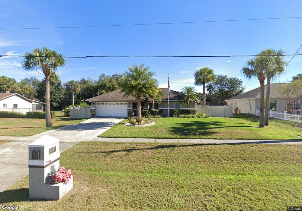
This home is located at 6265 Homestead Ave, Cocoa, FL 32927 and is currently estimated at $276,824, approximately $253 per square foot. 6265 Homestead Ave is a home located in Brevard County with nearby schools including Enterprise Elementary School, Space Coast Junior/Senior High School, and East Atlantic Prep of Brevard County.
Ownership History
Date
Name
Owned For
Owner Type
Purchase Details
Closed on
Feb 10, 1995
Sold by
Messer Const Corp
Bought by
Kamenelis Nicholas M
Current Estimated Value
Home Financials for this Owner
Home Financials are based on the most recent Mortgage that was taken out on this home.
Original Mortgage
$63,640
Interest Rate
9.21%
Purchase Details
Closed on
Sep 27, 1994
Sold by
Pierini Sandra G
Bought by
Messer Const Inc
Purchase Details
Closed on
Apr 28, 1994
Sold by
Torres Rene and Torres Maria C
Bought by
Pierine Sandra G
Create a Home Valuation Report for This Property
The Home Valuation Report is an in-depth analysis detailing your home's value as well as a comparison with similar homes in the area
Home Values in the Area
Average Home Value in this Area
Purchase History
| Date | Buyer | Sale Price | Title Company |
|---|---|---|---|
| Kamenelis Nicholas M | $63,700 | -- | |
| Messer Const Inc | $8,000 | -- | |
| Pierine Sandra G | $5,000 | -- |
Source: Public Records
Mortgage History
| Date | Status | Borrower | Loan Amount |
|---|---|---|---|
| Closed | Kamenelis Nicholas M | $63,640 |
Source: Public Records
Tax History
| Year | Tax Paid | Tax Assessment Tax Assessment Total Assessment is a certain percentage of the fair market value that is determined by local assessors to be the total taxable value of land and additions on the property. | Land | Improvement |
|---|---|---|---|---|
| 2025 | $1,052 | $83,240 | -- | -- |
| 2024 | $1,020 | $80,900 | -- | -- |
| 2023 | $1,020 | $78,550 | -- | -- |
| 2022 | $943 | $76,270 | $0 | $0 |
| 2021 | $939 | $74,050 | $0 | $0 |
| 2020 | $906 | $73,030 | $0 | $0 |
| 2019 | $855 | $71,390 | $0 | $0 |
| 2018 | $857 | $70,060 | $0 | $0 |
| 2017 | $862 | $68,620 | $0 | $0 |
| 2016 | $870 | $67,210 | $18,000 | $49,210 |
| 2015 | $878 | $66,750 | $15,000 | $51,750 |
| 2014 | $883 | $66,220 | $11,000 | $55,220 |
Source: Public Records
Map
Nearby Homes
- 23-35-21-JX-B-2 Aruin St
- 0 Aruin St Unit 1222557
- 6470 Bamboo Ave
- 6460 Homestead Ave
- 6085 Edison St
- 5720 Flint Rd
- 6545 Addie Ave
- 6574 Bamboo Ave
- 6200 Edison St
- 5680 Banos Ave
- 5715 Fairbridge St
- 5601 Banos Ave
- 6135 Allmont St
- 6150 Baltimore Ave
- 6665 Addie Ave
- 6105 Banyan St
- 6481 La Brea Ave
- 6230 Balsam St
- 6115 Allmont St
- 6438 Hudson Rd
- 6255 Homestead Ave
- 6285 Homestead Ave
- 6296 Bamboo Ave
- 6284 Bamboo Ave
- 6272 Bamboo Ave
- 6320 Bamboo Ave
- 6270 Homestead Ave
- 6260 Homestead Ave
- 6235 Homestead Ave
- 6295 Homestead Ave
- 6280 Homestead Ave
- 6250 Homestead Ave
- 6260 Bamboo Ave
- 6332 Bamboo Ave
- 6297 Bamboo Ave
- 6285 Bamboo Ave
- 6309 Bamboo Ave
- 6305 Homestead Ave
- 6240 Homestead Ave
- 6310 Homestead Ave Unit 6
Your Personal Tour Guide
Ask me questions while you tour the home.