Estimated Value: $204,000 - $248,000
Studio
1
Bath
2,124
Sq Ft
$107/Sq Ft
Est. Value
About This Home
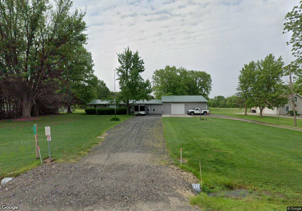
This home is located at 6266 E Pierson Rd, Flint, MI 48506 and is currently estimated at $227,636, approximately $107 per square foot. 6266 E Pierson Rd is a home located in Genesee County with nearby schools including Weston Elementary School, Leota Fiedler Elementary School, and Kate Dowdall Elementary School.
Ownership History
Date
Name
Owned For
Owner Type
Purchase Details
Closed on
Jun 4, 2019
Sold by
Masters Sandra
Bought by
Wetherwax Daniel
Current Estimated Value
Purchase Details
Closed on
Jan 7, 2015
Sold by
Wetherwax Daniel
Bought by
Wetherwax Daniel and Wetherwax Laura L
Purchase Details
Closed on
Feb 26, 2014
Sold by
Masters Sondra
Bought by
Wetherwax Daniel
Purchase Details
Closed on
Jun 29, 2012
Sold by
Masters Sondra and Bacon Thelma
Bought by
Masters Sondra and Wetherwax Daniel
Purchase Details
Closed on
Dec 22, 2007
Sold by
Bacon Thelma
Bought by
Bacon Thelma and Masters Sondra
Purchase Details
Closed on
Nov 11, 2002
Sold by
Bacon Thelma C and Bacon Rolland H
Bought by
Bacon Thelma C and Thelma C Bacon Revocable Trust
Create a Home Valuation Report for This Property
The Home Valuation Report is an in-depth analysis detailing your home's value as well as a comparison with similar homes in the area
Home Values in the Area
Average Home Value in this Area
Purchase History
| Date | Buyer | Sale Price | Title Company |
|---|---|---|---|
| Wetherwax Daniel | -- | None Available | |
| Wetherwax Daniel | -- | None Available | |
| Wetherwax Daniel | -- | None Available | |
| Masters Sondra | -- | First American Title Ins Co | |
| Bacon Thelma | -- | None Available | |
| Bacon Thelma C | -- | -- |
Source: Public Records
Tax History
| Year | Tax Paid | Tax Assessment Tax Assessment Total Assessment is a certain percentage of the fair market value that is determined by local assessors to be the total taxable value of land and additions on the property. | Land | Improvement |
|---|---|---|---|---|
| 2025 | $1,817 | $123,700 | $0 | $0 |
| 2024 | $492 | $88,000 | $0 | $0 |
| 2023 | $469 | $79,500 | $0 | $0 |
| 2022 | $1,480 | $72,000 | $0 | $0 |
| 2021 | $1,467 | $65,600 | $0 | $0 |
| 2020 | $429 | $59,600 | $0 | $0 |
| 2019 | $423 | $52,600 | $0 | $0 |
| 2018 | $1,380 | $48,300 | $0 | $0 |
| 2017 | $1,320 | $47,100 | $0 | $0 |
| 2016 | $1,317 | $44,900 | $0 | $0 |
| 2015 | $1,168 | $42,500 | $0 | $0 |
| 2014 | $295 | $33,100 | $0 | $0 |
| 2012 | -- | $25,200 | $25,200 | $0 |
Source: Public Records
Map
Nearby Homes
- 6367 E Pierson Rd
- 6443 Richfield Rd
- 6054 E Pierson Rd
- 3485 N Vassar Rd
- 3365 Eastdale Dr
- 6161 Finch Ln
- 6312 Tamara Dr
- 0 Whisper Ridge Ct
- 3267 Mills Acres St
- 6099 Brookwood Dr
- 6158 Golfview Dr
- 5067 Paro Dr
- 6076 E Carpenter Rd
- 5401 S Sycamore Dr
- V/L S Sycamore Dr
- 4435 Meadowbrook Dr
- 3246 Comer Dr
- 4413 Esta Dr
- 2514 N Genesee Rd
- 4455 N Genesee Rd
- 6250 E Pierson Rd
- 6288 E Pierson Rd
- 6278 E Pierson Rd
- 6296 E Pierson Rd
- 6236 E Pierson Rd
- 6310 E Pierson Rd
- 6228 E Pierson Rd
- 6216 E Pierson Rd
- 6328 E Pierson Rd
- 6328 E Pierson Rd
- 6202 E Pierson Rd
- 6345 Richfield Rd
- 6317 Richfield Rd
- 6334 E Pierson Rd
- 6194 E Pierson Rd
- 6342 E Pierson Rd
- 6329 Richfield Rd
- 6346 E Pierson Rd
- 6363 Richfield Rd
- 6182 E Pierson Rd
Your Personal Tour Guide
Ask me questions while you tour the home.