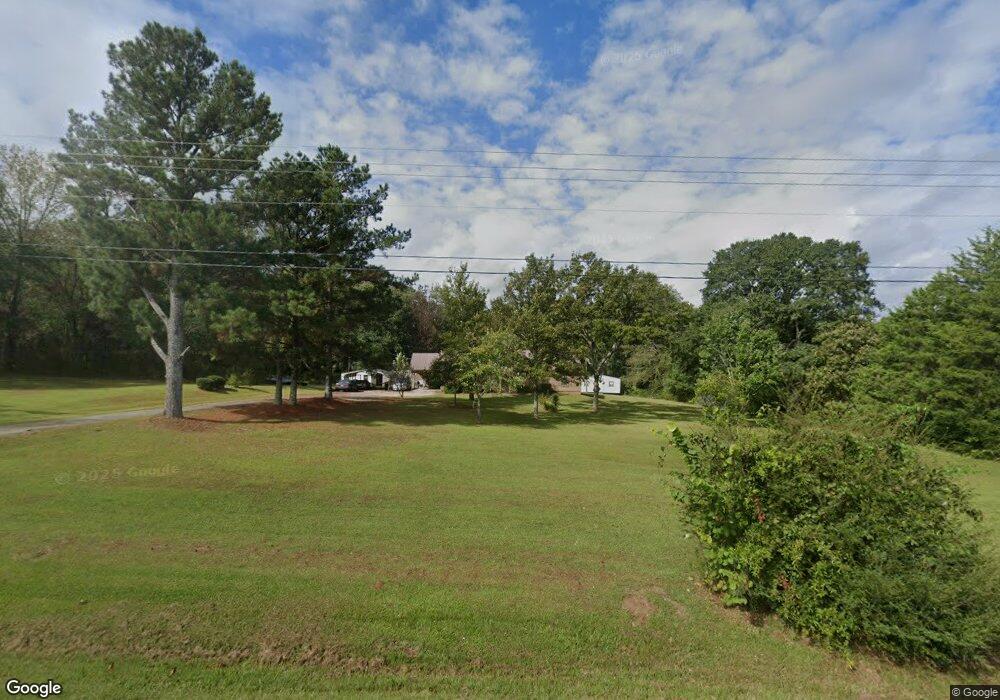
6266 Whitesville Rd West Point, GA 31833
Estimated Value: $244,000 - $333,000
4
Beds
3
Baths
2,687
Sq Ft
$102/Sq Ft
Est. Value
About This Home
This home is located at 6266 Whitesville Rd, West Point, GA 31833 and is currently estimated at $275,280, approximately $102 per square foot. 6266 Whitesville Rd is a home located in Troup County with nearby schools including Whitesville Road Elementary School, West Point Elementary School, and Berta Weathersbee Elementary School.
Ownership History
Date
Name
Owned For
Owner Type
Purchase Details
Closed on
Jul 17, 2024
Sold by
Heard Betty Ann
Bought by
Poythress Brenda Diane
Current Estimated Value
Purchase Details
Closed on
May 25, 2000
Sold by
Charlie Ray
Bought by
Ray Betty Jean
Purchase Details
Closed on
Aug 1, 1983
Sold by
Rocky Pemberton
Bought by
Charlie Ray
Purchase Details
Closed on
Dec 31, 1980
Sold by
Wade Stuart
Bought by
Rocky Pemberton
Purchase Details
Closed on
Jan 18, 1979
Sold by
Bailey?
Bought by
Wade Stuart
Purchase Details
Closed on
Nov 13, 1975
Bought by
Bailey?
Purchase Details
Closed on
Jan 1, 1969
Sold by
Charles O Jennings
Create a Home Valuation Report for This Property
The Home Valuation Report is an in-depth analysis detailing your home's value as well as a comparison with similar homes in the area
Home Values in the Area
Average Home Value in this Area
Purchase History
| Date | Buyer | Sale Price | Title Company |
|---|---|---|---|
| Poythress Brenda Diane | -- | -- | |
| Ray Betty Jean | -- | -- | |
| Charlie Ray | $32,500 | -- | |
| Rocky Pemberton | $26,000 | -- | |
| Wade Stuart | $20,000 | -- | |
| Bailey? | -- | -- | |
| -- | -- | -- |
Source: Public Records
Tax History Compared to Growth
Tax History
| Year | Tax Paid | Tax Assessment Tax Assessment Total Assessment is a certain percentage of the fair market value that is determined by local assessors to be the total taxable value of land and additions on the property. | Land | Improvement |
|---|---|---|---|---|
| 2024 | $1,767 | $74,740 | $11,280 | $63,460 |
| 2023 | $1,624 | $69,500 | $11,280 | $58,220 |
| 2022 | $1,585 | $66,740 | $11,280 | $55,460 |
| 2021 | $1,384 | $55,844 | $9,160 | $46,684 |
| 2020 | $1,384 | $55,844 | $9,160 | $46,684 |
| 2019 | $1,351 | $54,732 | $9,160 | $45,572 |
| 2018 | $1,199 | $49,700 | $9,160 | $40,540 |
| 2017 | $1,199 | $49,700 | $9,160 | $40,540 |
| 2016 | $1,181 | $49,092 | $9,184 | $39,908 |
| 2015 | $997 | $42,872 | $9,184 | $33,688 |
| 2014 | $999 | $42,872 | $9,184 | $33,688 |
| 2013 | -- | $42,872 | $9,184 | $33,688 |
Source: Public Records
Map
Nearby Homes
- 143 W Drummond Rd
- 151 W Drummond Rd
- 157 W Drummond Rd
- 137 W Drummond Rd
- 131 W Drummond Rd
- 5191 Georgia 18
- 1550 Baughs Cross Rd
- 0 Shake Rag Rd Unit 23310609
- 0 Shake Rag Rd Unit TRACT 1 10492530
- 0 Shake Rag Rd Unit TRACT 2 10492533
- 0 Shake Rag Rd Unit TRACT 3 10492532
- 0 Shake Rag Rd Unit 23670261
- 1612 Dennis Smith Rd
- 208 Harris Walk Unit 80
- 311 Tomme Rd
- 8705 Ga Highway 18
- 8705 Georgia 18
- 1820 Salem Rd
- 20+/- AC White Rd
- 2067 Bartley Rd
- 6290 Whitesville Rd
- 6240 Whitesville Rd
- 6214 Whitesville Rd
- 6221 Whitesville Rd
- 6221 Whitesville Rd
- 6186 Whitesville Rd
- 82 Drummond Rd
- 6181 Whitesville Rd
- 6168 Whitesville Rd
- 148 Drummond Rd
- 6453 Whitesville Rd
- 6033 Whitesville Rd
- 5937 Whitesville Rd
- 0 Whitesville Rd Unit 20137713
- 393 Drummond Rd
- 5901 Whitesville Rd
- 114 Ely Callaway Rd
- 6620 Whitesville Rd
- 5871 Whitesville Rd
- 31 Ike Davidson Rd