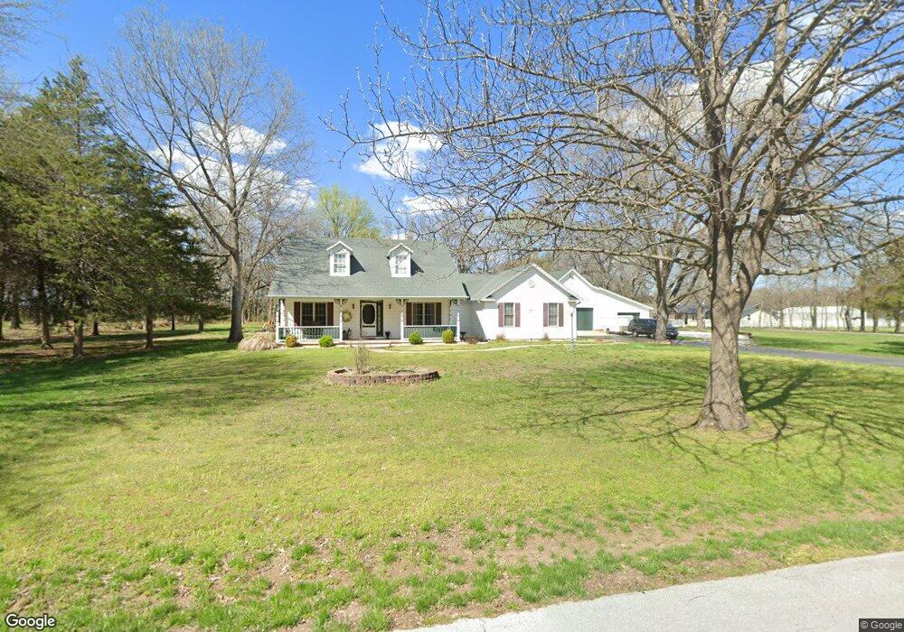
6269 E Roberts Ln Springfield, MO 65802
Southeast Springfield NeighborhoodEstimated Value: $378,000 - $664,000
3
Beds
3
Baths
3,602
Sq Ft
$133/Sq Ft
Est. Value
About This Home
This home is located at 6269 E Roberts Ln, Springfield, MO 65802 and is currently estimated at $479,467, approximately $133 per square foot. 6269 E Roberts Ln is a home located in Greene County with nearby schools including Strafford Elementary School, Strafford Middle School, and Strafford High School.
Ownership History
Date
Name
Owned For
Owner Type
Purchase Details
Closed on
Apr 30, 2008
Sold by
Wallace Allen W and Wallace Sandra E
Bought by
Burwell Donald D and Osborne Kyle
Current Estimated Value
Home Financials for this Owner
Home Financials are based on the most recent Mortgage that was taken out on this home.
Original Mortgage
$256,473
Outstanding Balance
$160,634
Interest Rate
5.84%
Mortgage Type
FHA
Estimated Equity
$318,833
Create a Home Valuation Report for This Property
The Home Valuation Report is an in-depth analysis detailing your home's value as well as a comparison with similar homes in the area
Home Values in the Area
Average Home Value in this Area
Purchase History
| Date | Buyer | Sale Price | Title Company |
|---|---|---|---|
| Burwell Donald D | -- | Lincoln Land Title Inc |
Source: Public Records
Mortgage History
| Date | Status | Borrower | Loan Amount |
|---|---|---|---|
| Open | Burwell Donald D | $256,473 |
Source: Public Records
Tax History
| Year | Tax Paid | Tax Assessment Tax Assessment Total Assessment is a certain percentage of the fair market value that is determined by local assessors to be the total taxable value of land and additions on the property. | Land | Improvement |
|---|---|---|---|---|
| 2025 | $2,700 | $51,240 | $7,810 | $43,430 |
| 2024 | $2,514 | $46,050 | $5,850 | $40,200 |
| 2023 | $2,531 | $46,050 | $5,850 | $40,200 |
| 2022 | $2,335 | $44,820 | $5,850 | $38,970 |
| 2021 | $1,669 | $34,050 | $5,850 | $28,200 |
| 2020 | $1,785 | $35,830 | $5,850 | $29,980 |
| 2019 | $1,779 | $35,830 | $5,850 | $29,980 |
| 2018 | $1,819 | $36,380 | $5,850 | $30,530 |
| 2017 | $1,804 | $36,270 | $5,850 | $30,420 |
| 2016 | $1,791 | $36,270 | $5,850 | $30,420 |
| 2015 | $1,790 | $36,270 | $5,850 | $30,420 |
| 2014 | $1,784 | $35,870 | $5,850 | $30,020 |
Source: Public Records
Map
Nearby Homes
- Lot 7 Farm Road 134
- Lot 11 Farm Road 134
- Lot 8 Farm Road 134
- Lot 6 Farm Road 134
- Lot 12 Farm Road 134
- Lot 13 Farm Road 134
- Lot 2 Farm Road 134
- Lot 3 Farm Road 134
- Tract 3 N Farm Road 211
- 5724 E Farm Road 132
- Lot 14 E Farm Road 132
- 7058 E Farm Road 132
- 1410 S Briar Ave
- 5223 E Hackberry St
- 5221 E Farm Road 142
- 442 S Yellowwood Dr
- 751 S Farm Road 197
- 1619 S Crepe Myrtle Ln
- 1643 S Crepe Myrtle Ln
- 1626 S Pinecone Path
- 6276 E Roberts Ln
- 6257 E Roberts Ln
- 6323 E Roberts Ln
- 000 E Roberts Ln
- 6320 E Roberts Ln
- 6173 E Roberts Ln
- 0 S Roberts Dr Unit 60039798
- 694 S McCrite Ave
- 633 S McCrite Ave
- 702 S Roberts Dr
- 0 S Farm Rd 211 Unit 60019263
- 697 S Roberts Dr
- 6325 E Farm Road 138
- 695 S McCrite Ave
- 6157 E Roberts Ln
- 749 S Roberts Dr
- 746 S McCrite Ave
- Lot 5 Farm Road 134
- 6385 E Farm Road 138
- Lot 4 Farm Road 134
Your Personal Tour Guide
Ask me questions while you tour the home.