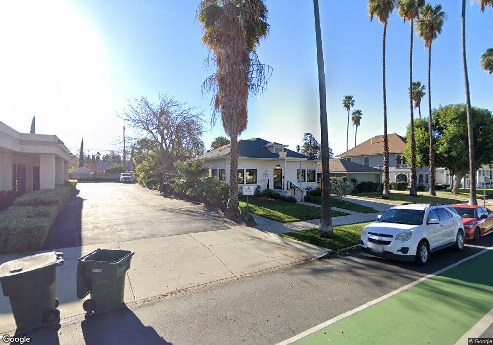
627 Brookside Ave Redlands, CA 92373
South Redlands NeighborhoodEstimated Value: $1,244,990
2
Beds
1
Bath
1,547
Sq Ft
$805/Sq Ft
Est. Value
About This Home
This home is located at 627 Brookside Ave, Redlands, CA 92373 and is currently estimated at $1,244,990, approximately $804 per square foot. 627 Brookside Ave is a home located in San Bernardino County with nearby schools including McKinley Elementary School, Cope Middle School, and Redlands Senior High School.
Ownership History
Date
Name
Owned For
Owner Type
Purchase Details
Closed on
Apr 26, 2024
Sold by
Practice Collective Llc
Bought by
Henson Investments Llc
Current Estimated Value
Home Financials for this Owner
Home Financials are based on the most recent Mortgage that was taken out on this home.
Original Mortgage
$520,000
Outstanding Balance
$511,734
Interest Rate
7.17%
Estimated Equity
$733,256
Purchase Details
Closed on
Sep 4, 2021
Sold by
Global Auto Investment Group Inc
Bought by
Practice Collective Llc
Home Financials for this Owner
Home Financials are based on the most recent Mortgage that was taken out on this home.
Original Mortgage
$1,100,000
Interest Rate
3.05%
Mortgage Type
New Conventional
Purchase Details
Closed on
Feb 10, 2021
Sold by
Hossain M M M and Hossain Ruby
Bought by
Global Auto Investment Group
Create a Home Valuation Report for This Property
The Home Valuation Report is an in-depth analysis detailing your home's value as well as a comparison with similar homes in the area
Home Values in the Area
Average Home Value in this Area
Purchase History
| Date | Buyer | Sale Price | Title Company |
|---|---|---|---|
| Henson Investments Llc | $1,260,000 | Fidelity National Title | |
| Practice Collective Llc | $699,000 | Lawyers Title | |
| Global Auto Investment Group | $475,000 | Lawyers Title |
Source: Public Records
Mortgage History
| Date | Status | Borrower | Loan Amount |
|---|---|---|---|
| Open | Henson Investments Llc | $520,000 | |
| Closed | Henson Investments Llc | $630,000 | |
| Previous Owner | Practice Collective Llc | $1,100,000 |
Source: Public Records
Tax History
| Year | Tax Paid | Tax Assessment Tax Assessment Total Assessment is a certain percentage of the fair market value that is determined by local assessors to be the total taxable value of land and additions on the property. | Land | Improvement |
|---|---|---|---|---|
| 2025 | $15,913 | $1,285,200 | $295,800 | $989,400 |
| 2024 | $8,588 | $727,240 | $208,080 | $519,160 |
| 2023 | $8,579 | $712,980 | $204,000 | $508,980 |
| 2022 | $5,874 | $484,500 | $132,600 | $351,900 |
| 2021 | $1,545 | $119,995 | $24,096 | $95,899 |
| 2020 | $1,523 | $118,765 | $23,849 | $94,916 |
| 2019 | $1,481 | $116,436 | $23,381 | $93,055 |
| 2018 | $1,445 | $114,153 | $22,923 | $91,230 |
| 2017 | $1,433 | $111,915 | $22,474 | $89,441 |
| 2016 | $1,417 | $109,720 | $22,033 | $87,687 |
| 2015 | $1,407 | $108,072 | $21,702 | $86,370 |
| 2014 | $1,382 | $105,955 | $21,277 | $84,678 |
Source: Public Records
Map
Nearby Homes
- 520 Linda Place
- 48 N Center St
- 122 Tamarisk St
- 975 Brookside Ave
- 74 N Buena Vista St
- 163 N Center St
- 167 N Center St
- 186 N Center St
- 32 N San Mateo St
- 0 0 Unit IG26066829
- 211 E Olive Ave
- 521 Bond St
- 215 San Rafael St
- 302 Sonora St
- 424 La Verne St
- 509 S 4th St
- 127 W Colton Ave
- 416 Sonora Cir
- 622 Esther Way
- 162 Lakeside Ave
- 637 Brookside Ave
- 633 Brookside Ave
- 645 Brookside Ave
- 624 Linda Place
- 620 Linda Place
- 611 Brookside Ave
- 626 Linda Place
- 622 Linda Place
- 616 Linda Place
- 630 Linda Place
- 612 Linda Place
- 601 Brookside Ave
- 533 Brookside Ave
- 604 Linda Place
- 524 Linda Place
- 522 Linda Place
- 623 Linda Place
- 619 Linda Place
- 627 Linda Place
- 37 S Center St
Your Personal Tour Guide
Ask me questions while you tour the home.