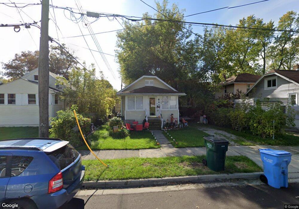
627 Cooper Ave Lansing, MI 48910
Greencroft Park NeighborhoodEstimated Value: $65,566 - $100,000
Studio
--
Bath
704
Sq Ft
$117/Sq Ft
Est. Value
About This Home
This home is located at 627 Cooper Ave, Lansing, MI 48910 and is currently estimated at $82,642, approximately $117 per square foot. 627 Cooper Ave is a home located in Ingham County with nearby schools including Averill Elementary School, Attwood School, and J.W. Sexton High School.
Ownership History
Date
Name
Owned For
Owner Type
Purchase Details
Closed on
Jul 16, 2010
Sold by
Runion Michael Ray
Bought by
Lilly Barbara Rose
Current Estimated Value
Home Financials for this Owner
Home Financials are based on the most recent Mortgage that was taken out on this home.
Original Mortgage
$60,000
Outstanding Balance
$44,130
Interest Rate
7%
Mortgage Type
Seller Take Back
Estimated Equity
$38,512
Purchase Details
Closed on
Aug 30, 2000
Sold by
Young Norval G and Young Carol E
Bought by
Runion Michael R
Home Financials for this Owner
Home Financials are based on the most recent Mortgage that was taken out on this home.
Original Mortgage
$41,650
Interest Rate
12.5%
Mortgage Type
Purchase Money Mortgage
Create a Home Valuation Report for This Property
The Home Valuation Report is an in-depth analysis detailing your home's value as well as a comparison with similar homes in the area
Home Values in the Area
Average Home Value in this Area
Purchase History
| Date | Buyer | Sale Price | Title Company |
|---|---|---|---|
| Lilly Barbara Rose | $60,000 | None Available | |
| Runion Michael R | $49,000 | Chicago Title |
Source: Public Records
Mortgage History
| Date | Status | Borrower | Loan Amount |
|---|---|---|---|
| Open | Lilly Barbara Rose | $60,000 | |
| Previous Owner | Runion Michael R | $41,650 |
Source: Public Records
Tax History
| Year | Tax Paid | Tax Assessment Tax Assessment Total Assessment is a certain percentage of the fair market value that is determined by local assessors to be the total taxable value of land and additions on the property. | Land | Improvement |
|---|---|---|---|---|
| 2025 | $2,027 | $31,200 | $3,200 | $28,000 |
| 2024 | $16 | $29,900 | $3,200 | $26,700 |
| 2023 | $1,909 | $27,300 | $3,200 | $24,100 |
| 2022 | $1,745 | $25,600 | $4,400 | $21,200 |
| 2021 | $1,705 | $23,300 | $3,900 | $19,400 |
| 2020 | $1,693 | $22,400 | $3,900 | $18,500 |
| 2019 | $1,634 | $22,000 | $3,900 | $18,100 |
| 2018 | $1,551 | $20,000 | $3,900 | $16,100 |
| 2017 | $1,492 | $20,000 | $3,900 | $16,100 |
| 2016 | $1,433 | $19,700 | $3,900 | $15,800 |
| 2015 | $1,433 | $19,100 | $7,715 | $11,385 |
| 2014 | $1,433 | $18,600 | $4,340 | $14,260 |
Source: Public Records
Map
Nearby Homes
- 712 Lenore Ave
- 1917 Osband Ave
- 612 W Mount Hope Ave
- 815 Woodbine Ave
- 717 Smith Ave
- 815 Smith Ave
- 1723 Osband Ave
- 1824 Davis Ave
- 1033 Kelsey Ave
- 1116 George St
- 0 Rickle
- 211 W Barnes Ave
- 1312 W Mount Hope Ave
- 2316 Forest Ave
- 1315 Goodrich St
- 1722 S Washington Ave
- 2229 Forest Ave
- 1027 Britten Ave
- 1319 Pico Ave
- 1414 Cooper Ave
Your Personal Tour Guide
Ask me questions while you tour the home.