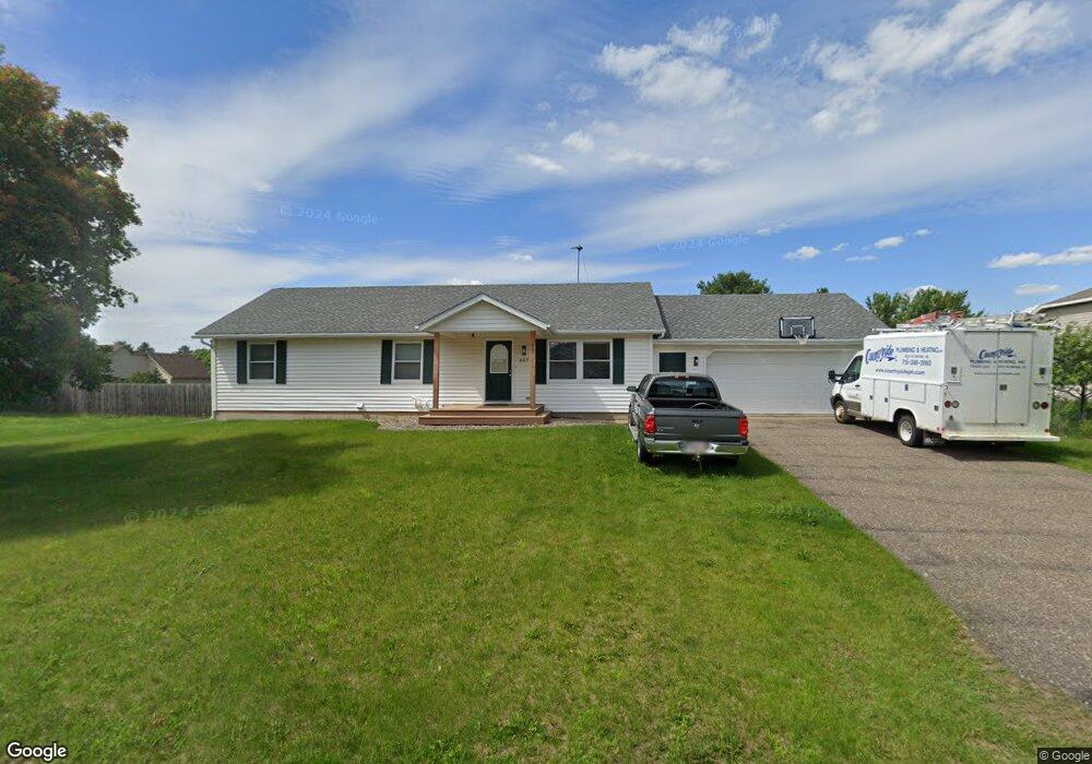
627 Laurel Dr New Richmond, WI 54017
Estimated Value: $350,665 - $380,000
4
Beds
3
Baths
--
Sq Ft
0.31
Acres
About This Home
This home is located at 627 Laurel Dr, New Richmond, WI 54017 and is currently estimated at $360,416. 627 Laurel Dr is a home located in St. Croix County with nearby schools including New Richmond High School and St. Mary School.
Ownership History
Date
Name
Owned For
Owner Type
Purchase Details
Closed on
Jul 13, 2017
Sold by
Berends Ryan B
Bought by
Worrell Anthony and Worrell Karolyn
Current Estimated Value
Home Financials for this Owner
Home Financials are based on the most recent Mortgage that was taken out on this home.
Original Mortgage
$189,000
Outstanding Balance
$157,113
Interest Rate
3.91%
Mortgage Type
New Conventional
Estimated Equity
$203,303
Purchase Details
Closed on
Aug 24, 2006
Sold by
Albrecht Vern and Albrecht Patricia
Bought by
Berends Ryan B
Home Financials for this Owner
Home Financials are based on the most recent Mortgage that was taken out on this home.
Original Mortgage
$168,300
Interest Rate
6.77%
Mortgage Type
New Conventional
Create a Home Valuation Report for This Property
The Home Valuation Report is an in-depth analysis detailing your home's value as well as a comparison with similar homes in the area
Home Values in the Area
Average Home Value in this Area
Purchase History
| Date | Buyer | Sale Price | Title Company |
|---|---|---|---|
| Worrell Anthony | $210,000 | Westconsin Title | |
| Berends Ryan B | $165,000 | None Available |
Source: Public Records
Mortgage History
| Date | Status | Borrower | Loan Amount |
|---|---|---|---|
| Open | Worrell Anthony | $189,000 | |
| Previous Owner | Berends Ryan B | $168,300 |
Source: Public Records
Tax History Compared to Growth
Tax History
| Year | Tax Paid | Tax Assessment Tax Assessment Total Assessment is a certain percentage of the fair market value that is determined by local assessors to be the total taxable value of land and additions on the property. | Land | Improvement |
|---|---|---|---|---|
| 2024 | $44 | $310,500 | $29,300 | $281,200 |
| 2023 | $4,152 | $302,300 | $29,300 | $273,000 |
| 2022 | $3,628 | $268,100 | $29,300 | $238,800 |
| 2021 | $3,636 | $243,600 | $29,300 | $214,300 |
| 2020 | $3,686 | $158,500 | $20,700 | $137,800 |
| 2019 | $3,511 | $158,500 | $20,700 | $137,800 |
| 2018 | $3,553 | $158,500 | $20,700 | $137,800 |
| 2017 | $3,410 | $158,500 | $20,700 | $137,800 |
| 2016 | $3,410 | $158,500 | $20,700 | $137,800 |
| 2015 | $3,469 | $158,500 | $20,700 | $137,800 |
| 2014 | $3,384 | $158,500 | $20,700 | $137,800 |
| 2013 | $3,317 | $158,500 | $20,700 | $137,800 |
Source: Public Records
Map
Nearby Homes
- 637 Maple Ct
- 1016 W Ridge Ct
- 1141 Pinewood Trail
- 941 W Edge Place Unit 14
- 1272 Pheasant Run
- 1368 Creekwood Dr
- 425 W 8th St Unit 22
- 425 W 8th St Unit 20
- 425 W 8th St Unit 21
- 425 W 8th St Unit 19
- 425 W 8th St Unit 24
- 425 W 8th St Unit 23
- 1142 W Edge Place
- 1337 Eagle Ct
- 236 W 5th St
- 1131 Alfred Place
- 114 E 6th St Unit A
- TBD County Road A
- 1517 Creekwood Dr
- Hudson Plan at The Creek at Gloverdale
- 611 Laurel Dr
- 635 Laurel Dr
- 628 Chestnut Dr
- 636 Chestnut Dr
- 612 Chestnut Dr
- 638 Laurel Dr
- 549 Laurel Dr
- 653 Laurel Dr
- 648 Laurel Dr
- 548 Chestnut Dr
- 648 Chestnut Dr
- 552 Laurel Dr
- 660 Laurel Dr
- 531 Laurel Dr
- 639 Sycamore Dr
- 633 Chestnut Dr
- 619 Chestnut Dr
- 625 Sycamore Dr
- 530 Chestnut Dr
- 649 Sycamore Dr