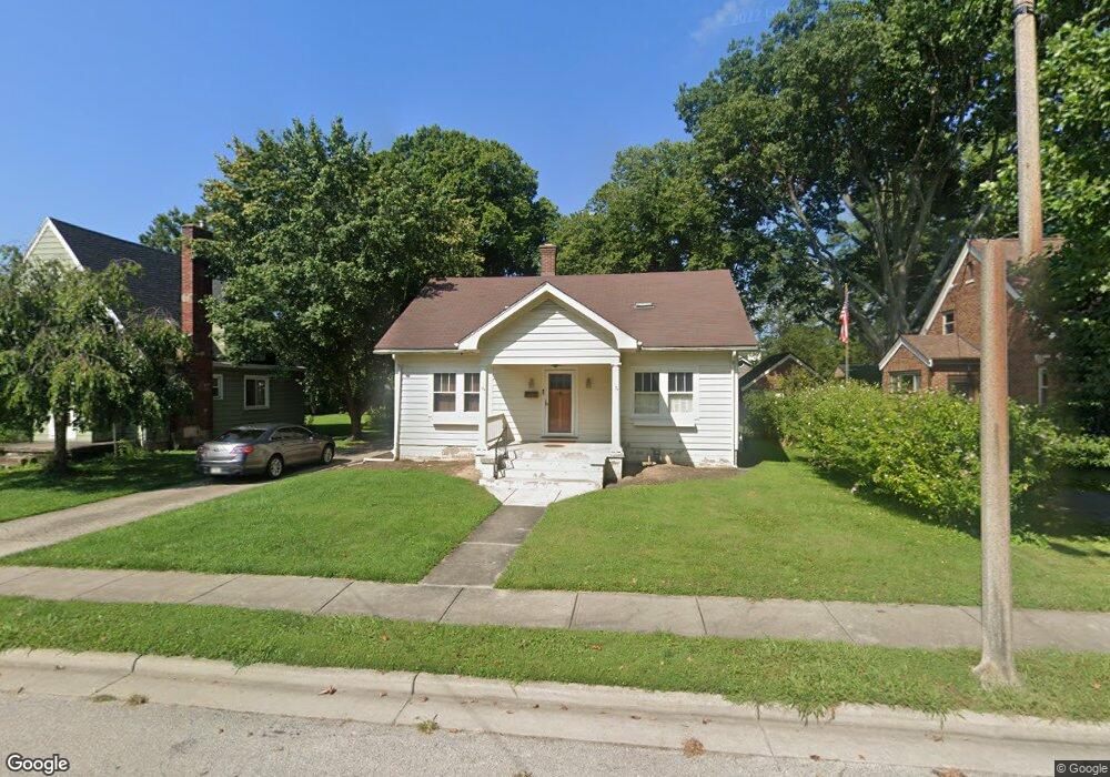
627 Ludlow St Greendale, IN 47025
Estimated Value: $269,000 - $341,000
3
Beds
3
Baths
2,356
Sq Ft
$132/Sq Ft
Est. Value
About This Home
This home is located at 627 Ludlow St, Greendale, IN 47025 and is currently estimated at $309,957, approximately $131 per square foot. 627 Ludlow St is a home located in Dearborn County with nearby schools including Lawrenceburg Primary School, Central Elementary School, and Greendale Middle School.
Ownership History
Date
Name
Owned For
Owner Type
Purchase Details
Closed on
Oct 28, 2020
Sold by
Daniel Daniel E and Daniel Lisa T
Bought by
Mucker Stacy
Current Estimated Value
Home Financials for this Owner
Home Financials are based on the most recent Mortgage that was taken out on this home.
Original Mortgage
$174,775
Outstanding Balance
$155,525
Interest Rate
2.8%
Mortgage Type
New Conventional
Estimated Equity
$154,432
Purchase Details
Closed on
May 10, 2017
Sold by
Walsh Lisa C and Snider Lisa C
Bought by
Walsh Daniel E and Walsh Lisa C
Purchase Details
Closed on
Apr 17, 2006
Sold by
Snider Jerry K and Snider Lisa C
Bought by
Snider Lisa C
Create a Home Valuation Report for This Property
The Home Valuation Report is an in-depth analysis detailing your home's value as well as a comparison with similar homes in the area
Home Values in the Area
Average Home Value in this Area
Purchase History
| Date | Buyer | Sale Price | Title Company |
|---|---|---|---|
| Mucker Stacy | $178,000 | Stewart Title Of Cincinnati-Re | |
| Walsh Daniel E | -- | None Available | |
| Snider Lisa C | -- | -- |
Source: Public Records
Mortgage History
| Date | Status | Borrower | Loan Amount |
|---|---|---|---|
| Open | Mucker Stacy | $174,775 |
Source: Public Records
Tax History Compared to Growth
Tax History
| Year | Tax Paid | Tax Assessment Tax Assessment Total Assessment is a certain percentage of the fair market value that is determined by local assessors to be the total taxable value of land and additions on the property. | Land | Improvement |
|---|---|---|---|---|
| 2024 | $2,161 | $216,100 | $25,300 | $190,800 |
| 2023 | $1,987 | $198,700 | $25,300 | $173,400 |
| 2022 | $1,860 | $186,000 | $25,300 | $160,700 |
| 2021 | $1,777 | $177,700 | $25,300 | $152,400 |
| 2020 | $1,835 | $183,500 | $25,300 | $158,200 |
| 2019 | $3,676 | $183,800 | $25,300 | $158,500 |
| 2018 | $3,114 | $155,700 | $25,300 | $130,400 |
| 2017 | $2,748 | $137,400 | $25,300 | $112,100 |
| 2016 | $2,752 | $137,600 | $25,300 | $112,300 |
| 2014 | $2,774 | $138,700 | $25,300 | $113,400 |
Source: Public Records
Map
Nearby Homes
- 122 Billups Dr
- 35 Oakey Ave
- 520 Sheldon St
- 497 Sheldon St
- 0 Sunset Dr Unit 204596
- 0 Sunset Dr Unit 1856832
- 0 Sunset Dr Unit MBR22065196
- 887 Nowlin Ave
- 130 Parkside Ave
- 60 Dearborn Ct
- 46 Parkside Ave
- 10 Dearborn Ct
- 219 Parkgrove Ave
- 939 Nowlin Ave
- 952 Miller Ave
- 151 Brown St
- 1015 Ridge Ave
- 1005 Nowlin Ave
- 1009 Nowlin Ave
- 0 Crossbow Trail Unit 204758