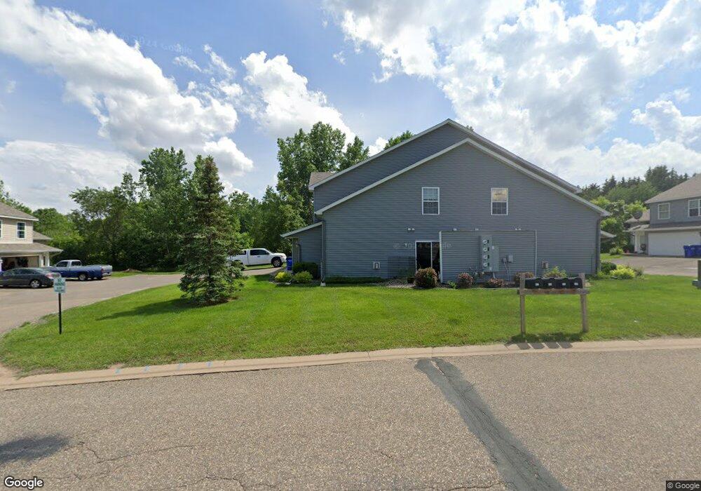
627 Meadow Ln Unit 10 Somerset, WI 54025
Estimated Value: $230,000 - $252,000
3
Beds
2
Baths
1,380
Sq Ft
$176/Sq Ft
Est. Value
About This Home
This home is located at 627 Meadow Ln Unit 10, Somerset, WI 54025 and is currently estimated at $243,462, approximately $176 per square foot. 627 Meadow Ln Unit 10 is a home located in St. Croix County with nearby schools including Somerset Elementary School, Somerset Middle School, and Somerset High School.
Ownership History
Date
Name
Owned For
Owner Type
Purchase Details
Closed on
Dec 27, 2024
Sold by
Kazle Sean and Kazle Christi
Bought by
Wyss Family Trust and Kazle
Current Estimated Value
Purchase Details
Closed on
Oct 29, 2020
Sold by
Mcraith Marcene A
Bought by
Wyss Family Trust
Purchase Details
Closed on
Jun 18, 2019
Sold by
Mcraith Marcene A
Bought by
Mcraith Paul J
Purchase Details
Closed on
Aug 12, 2011
Sold by
Greene Mary M
Bought by
Mcraith Marcene A
Home Financials for this Owner
Home Financials are based on the most recent Mortgage that was taken out on this home.
Original Mortgage
$49,200
Interest Rate
3.75%
Mortgage Type
New Conventional
Purchase Details
Closed on
Jun 22, 2006
Sold by
Federal National Mortgage Asn
Bought by
Greene Mary M
Home Financials for this Owner
Home Financials are based on the most recent Mortgage that was taken out on this home.
Original Mortgage
$140,882
Interest Rate
6.73%
Mortgage Type
FHA
Create a Home Valuation Report for This Property
The Home Valuation Report is an in-depth analysis detailing your home's value as well as a comparison with similar homes in the area
Home Values in the Area
Average Home Value in this Area
Purchase History
| Date | Buyer | Sale Price | Title Company |
|---|---|---|---|
| Wyss Family Trust | $16,300 | None Listed On Document | |
| Wyss Family Trust | $162,000 | St Croix County Abstract & T | |
| Mcraith Paul J | -- | None Available | |
| Mcraith Marcene A | $63,200 | St Croix County Abstract & T | |
| Greene Mary M | -- | None Available |
Source: Public Records
Mortgage History
| Date | Status | Borrower | Loan Amount |
|---|---|---|---|
| Previous Owner | Mcraith Marcene A | $49,200 | |
| Previous Owner | Greene Mary M | $140,882 |
Source: Public Records
Tax History Compared to Growth
Tax History
| Year | Tax Paid | Tax Assessment Tax Assessment Total Assessment is a certain percentage of the fair market value that is determined by local assessors to be the total taxable value of land and additions on the property. | Land | Improvement |
|---|---|---|---|---|
| 2024 | $27 | $149,000 | $15,000 | $134,000 |
| 2023 | $2,580 | $149,000 | $15,000 | $134,000 |
| 2022 | $2,521 | $149,000 | $15,000 | $134,000 |
| 2021 | $2,501 | $149,000 | $15,000 | $134,000 |
| 2020 | $1,577 | $149,000 | $15,000 | $134,000 |
| 2019 | $1,654 | $64,900 | $5,000 | $59,900 |
| 2018 | $1,530 | $64,900 | $5,000 | $59,900 |
| 2017 | $1,378 | $64,900 | $5,000 | $59,900 |
| 2016 | $1,378 | $64,900 | $5,000 | $59,900 |
| 2015 | $1,371 | $64,900 | $5,000 | $59,900 |
| 2014 | $1,332 | $64,900 | $5,000 | $59,900 |
| 2013 | $1,333 | $64,900 | $5,000 | $59,900 |
Source: Public Records
Map
Nearby Homes
- XXXX 50th St
- 108 Main St
- 314 Cedar St
- 415 Bruce Larson Way
- The Water Stone Plan at Pine Vale - Pine Valley
- The Ashton Plan at Pine Vale - Pine Valley
- The Rockport Plan at Pine Vale - Pine Valley
- The Primrose Plan at Pine Vale - Pine Valley
- The Waverly Plan at Pine Vale - Pine Valley
- The Brook View Plan at Pine Vale - Pine Valley
- The Newport Plan at Pine Vale - Pine Valley
- The Cheyenne Plan at Pine Vale - Pine Valley
- The Mulbery Plan at Pine Vale - Pine Valley
- 213 Church Hill Rd
- 5XX County Road I
- 528 Jackson Cir
- 316 Evergreen Dr
- 453 Alex Ct
- 321 Blue Spruce Ln
- 315 Harriman St