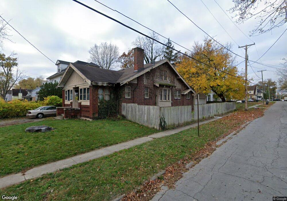
627 N Charles St Lima, OH 45805
Central Lima NeighborhoodEstimated Value: $97,000 - $113,000
4
Beds
2
Baths
2,358
Sq Ft
$45/Sq Ft
Est. Value
About This Home
This home is located at 627 N Charles St, Lima, OH 45805 and is currently estimated at $105,490, approximately $44 per square foot. 627 N Charles St is a home located in Allen County with nearby schools including Heritage Elementary School, Lima North Middle School, and Lima West Middle School.
Ownership History
Date
Name
Owned For
Owner Type
Purchase Details
Closed on
Nov 5, 1998
Sold by
Biederman Douglas
Bought by
Balo Steven
Current Estimated Value
Home Financials for this Owner
Home Financials are based on the most recent Mortgage that was taken out on this home.
Original Mortgage
$46,400
Outstanding Balance
$10,244
Interest Rate
6.72%
Mortgage Type
New Conventional
Estimated Equity
$95,246
Purchase Details
Closed on
Feb 27, 1992
Bought by
Varrato Lou N
Create a Home Valuation Report for This Property
The Home Valuation Report is an in-depth analysis detailing your home's value as well as a comparison with similar homes in the area
Home Values in the Area
Average Home Value in this Area
Purchase History
| Date | Buyer | Sale Price | Title Company |
|---|---|---|---|
| Balo Steven | $42,000 | -- | |
| Varrato Lou N | $17,000 | -- |
Source: Public Records
Mortgage History
| Date | Status | Borrower | Loan Amount |
|---|---|---|---|
| Open | Balo Steven | $46,400 |
Source: Public Records
Tax History Compared to Growth
Tax History
| Year | Tax Paid | Tax Assessment Tax Assessment Total Assessment is a certain percentage of the fair market value that is determined by local assessors to be the total taxable value of land and additions on the property. | Land | Improvement |
|---|---|---|---|---|
| 2024 | $916 | $23,420 | $2,450 | $20,970 |
| 2023 | $866 | $20,520 | $2,140 | $18,380 |
| 2022 | $870 | $20,520 | $2,140 | $18,380 |
| 2021 | $922 | $20,520 | $2,140 | $18,380 |
| 2020 | $997 | $19,780 | $2,070 | $17,710 |
| 2019 | $997 | $19,780 | $2,070 | $17,710 |
| 2018 | $987 | $19,780 | $2,070 | $17,710 |
| 2017 | $1,001 | $19,780 | $2,070 | $17,710 |
| 2016 | $1,014 | $19,780 | $2,070 | $17,710 |
| 2015 | $1,107 | $19,780 | $2,070 | $17,710 |
| 2014 | $1,107 | $21,360 | $2,210 | $19,150 |
| 2013 | $1,077 | $21,360 | $2,210 | $19,150 |
Source: Public Records
Map
Nearby Homes
- 1023 Leland Ave
- 1120 Richie Ave
- 618 Woodward Ave
- 1206 Rice Ave
- 648 Hazel Ave
- 631 Hazel Ave
- 638 Hazel Ave
- 1036 W High St
- 676 Cortlandt Ave
- 745 Brice Ave
- 576 Cortlandt Ave
- 612 N Metcalf St
- 708 N Metcalf St
- 627 Brice Ave
- 1517 Allentown Rd
- 1116 Belvidere Ave
- 434 N Washington St
- 621 Fairfield Dr
- 0 Sherman Ave
- 416 Hazel Ave