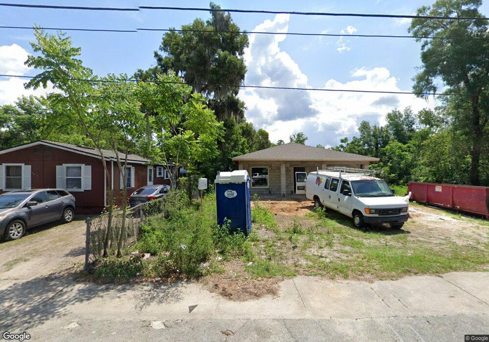
627 S Adelle Ave Deland, FL 32720
Estimated Value: $234,000 - $268,000
3
Beds
2
Baths
1,320
Sq Ft
$194/Sq Ft
Est. Value
About This Home
This home is located at 627 S Adelle Ave, Deland, FL 32720 and is currently estimated at $256,687, approximately $194 per square foot. 627 S Adelle Ave is a home with nearby schools including Edith I. Starke Elementary School, Deland High School, and Southwestern Middle School.
Ownership History
Date
Name
Owned For
Owner Type
Purchase Details
Closed on
Oct 30, 2020
Sold by
Johnson Terehl
Bought by
Powell Jelmaine A
Current Estimated Value
Purchase Details
Closed on
Nov 8, 2019
Sold by
Powell Andrew H
Bought by
Johnson Terehl
Purchase Details
Closed on
Jan 9, 2017
Sold by
Victoria Apartments Llc
Bought by
Powell Andrew H
Purchase Details
Closed on
Jul 18, 2016
Sold by
Victoria Apartments Llc
Bought by
Victoria Aparatmets Llc
Purchase Details
Closed on
Nov 17, 2009
Sold by
County Of Volusia
Bought by
Victoria Apartments Llc
Create a Home Valuation Report for This Property
The Home Valuation Report is an in-depth analysis detailing your home's value as well as a comparison with similar homes in the area
Home Values in the Area
Average Home Value in this Area
Purchase History
| Date | Buyer | Sale Price | Title Company |
|---|---|---|---|
| Powell Jelmaine A | -- | None Available | |
| Powell Jermaine A | $100 | Johnson Terehl | |
| Johnson Terehl | $1,920 | None Available | |
| Powell Andrew H | -- | Attorney | |
| Victoria Aparatmets Llc | -- | None Available | |
| Victoria Apartments Llc | $2,800 | None Available |
Source: Public Records
Tax History Compared to Growth
Tax History
| Year | Tax Paid | Tax Assessment Tax Assessment Total Assessment is a certain percentage of the fair market value that is determined by local assessors to be the total taxable value of land and additions on the property. | Land | Improvement |
|---|---|---|---|---|
| 2025 | $173 | $246,389 | $19,570 | $226,819 |
| 2024 | $173 | $244,410 | $19,570 | $224,840 |
| 2023 | $173 | $11,073 | $11,073 | $0 |
| 2022 | $153 | $8,859 | $8,859 | $0 |
| 2021 | $288 | $14,008 | $14,008 | $0 |
| 2020 | $195 | $9,476 | $9,476 | $0 |
| 2019 | $169 | $7,828 | $7,828 | $0 |
| 2018 | $148 | $6,592 | $6,592 | $0 |
| 2017 | $144 | $6,155 | $6,155 | $0 |
| 2016 | $138 | $6,155 | $0 | $0 |
| 2015 | $134 | $6,155 | $0 | $0 |
| 2014 | $120 | $4,923 | $0 | $0 |
Source: Public Records
Map
Nearby Homes
- 647 S Delaware Ave
- 534 S Adelle Ave
- 526 W Hubbard Ave
- 709 S Parsons Ave
- 632 W Hubbard Ave
- 624 W Euclid Ave
- 430 S Parsons Ave
- 409 W Beresford Ave
- 406 S Delaware Ave
- 736 S Stone St
- 205 W Division St
- 808 S Clara Ave
- 221 W Euclid Ave
- 217 W Chelsea St
- 412 W Beresford Ave
- 706 W Franklin Ave
- 540 W Mathis St
- 138 W Volusia Ave
- 536 W Hubbard Ave
- 0 S Adelle Ave Unit MFRS5126188
- 639 S Adelle Ave
- 624 S Thompson Ave
- 643 S Adelle Ave
- 626 S Thompson Ave
- 635 S Adelle Ave
- 620 S Adelle Ave
- 642 S Adelle Ave
- 628 S Thompson Ave
- 634 S Adelle Ave
- 425 W Winnemissett Ave
- 644 S Adelle Ave
- 614 S Thompson Ave
- 503 W Winnemissett Ave
- 430 W Winnemissett Ave
- 604 S Adelle Ave
- 645 S Thompson Ave
- 647 S Thompson Ave
- 703 S Adelle Ave
- 514 W Winnemissett Ave
- 615 S Thompson Ave