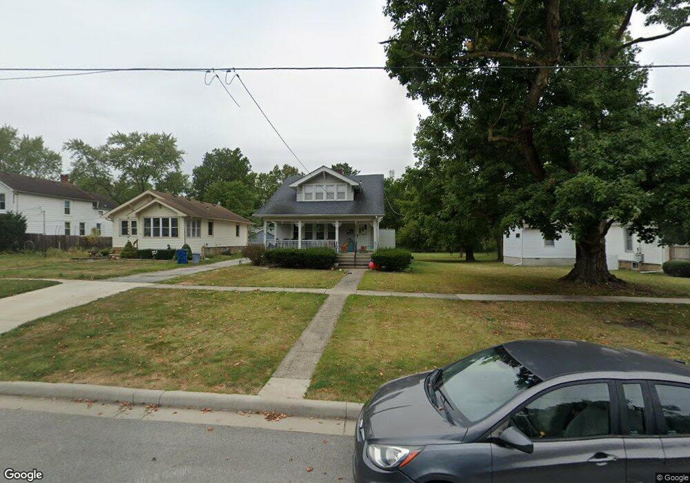
627 S Main St Crown Point, IN 46307
Estimated Value: $296,000 - $330,000
4
Beds
2
Baths
2,244
Sq Ft
$140/Sq Ft
Est. Value
About This Home
This home is located at 627 S Main St, Crown Point, IN 46307 and is currently estimated at $313,718, approximately $139 per square foot. 627 S Main St is a home located in Lake County with nearby schools including Solon Robinson Elementary School, Robert Taft Middle School, and Crown Point High School.
Ownership History
Date
Name
Owned For
Owner Type
Purchase Details
Closed on
Dec 21, 2021
Sold by
Quade Kimberlee S
Bought by
Hnh Properties Llc
Current Estimated Value
Purchase Details
Closed on
Nov 28, 2019
Sold by
Quade Kimberlee S
Bought by
Quade Kimberlee S
Purchase Details
Closed on
Dec 19, 2012
Sold by
Chubbs Harold J
Bought by
Chubbs Harold J and Hertha N Chubbs Family Trust
Purchase Details
Closed on
Jan 28, 2002
Sold by
Chubbs Harold J and Chubbs Hertha N
Bought by
Chubbs Harold J and Chubbs Hertha N
Create a Home Valuation Report for This Property
The Home Valuation Report is an in-depth analysis detailing your home's value as well as a comparison with similar homes in the area
Home Values in the Area
Average Home Value in this Area
Purchase History
| Date | Buyer | Sale Price | Title Company |
|---|---|---|---|
| Hnh Properties Llc | -- | None Available | |
| Quade Kimberlee S | -- | None Available | |
| Quade Kimberlee S | -- | None Available | |
| Chubbs Harold J | -- | None Available | |
| Chubbs Harold J | -- | None Available |
Source: Public Records
Tax History Compared to Growth
Tax History
| Year | Tax Paid | Tax Assessment Tax Assessment Total Assessment is a certain percentage of the fair market value that is determined by local assessors to be the total taxable value of land and additions on the property. | Land | Improvement |
|---|---|---|---|---|
| 2024 | $5,142 | $205,300 | $33,900 | $171,400 |
| 2023 | $3,958 | $187,100 | $33,900 | $153,200 |
| 2022 | $3,958 | $179,100 | $33,900 | $145,200 |
| 2021 | $3,673 | $166,200 | $26,500 | $139,700 |
| 2020 | $3,782 | $171,400 | $26,500 | $144,900 |
| 2019 | $3,701 | $165,700 | $26,500 | $139,200 |
| 2018 | $4,023 | $159,100 | $26,500 | $132,600 |
| 2017 | $3,923 | $153,300 | $26,500 | $126,800 |
| 2016 | $3,884 | $149,200 | $26,500 | $122,700 |
| 2014 | $3,730 | $153,100 | $26,500 | $126,600 |
| 2013 | $3,621 | $147,000 | $26,400 | $120,600 |
Source: Public Records
Map
Nearby Homes
- 744 S Court St
- 334 Ellendale Pkwy
- 780 Williams Ct
- 321 Bluebird Ave
- 312 Fairfield Dr
- 316 W South St
- 622 E Brookside Dr
- 924 W Crestview Ct
- 269 Maxwell St
- 266 Maxwell St
- 801 Courtney Dr
- 772 Courtney Dr
- 629 W South St
- 901 Iroquois Dr
- 1 Walnut Pkwy
- 531 E Joliet St
- 936 Seneca Dr
- 905 S Indiana Ave
- 300 Omega Dr
- 0 W Joliet St
- 623 S Main St
- 635 S Main St
- 637 S Main St
- 617 S Main St
- 642 S Park Ave
- 645 S Main St
- 609 S Main St
- 646 S Park Ave
- 109 Elmwood Place
- 649 S Main St
- 111 Elmwood Place
- 140 Elmwood Place
- 614 S Main St
- 620 S Main St
- 121 Elmwood Place
- 653 S Main St
- 654 S Park Ave
- 645 S Park Ave
- 123 Elmwood Place
- 657 S Main St