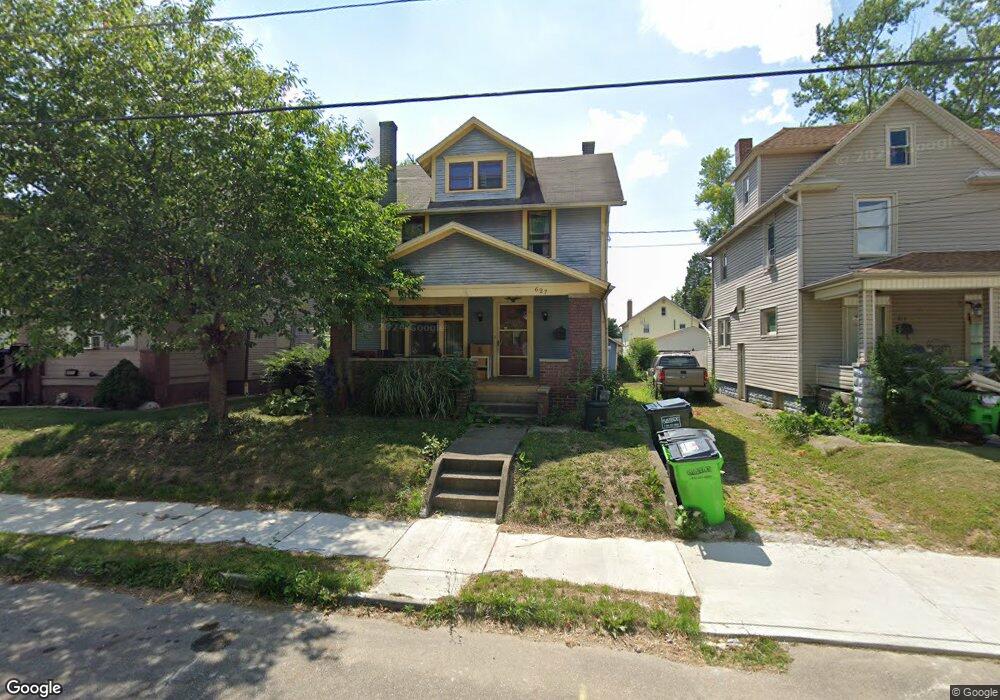
627 Wright Ave Alliance, OH 44601
Estimated Value: $78,000 - $114,000
3
Beds
1
Bath
1,428
Sq Ft
$62/Sq Ft
Est. Value
About This Home
This home is located at 627 Wright Ave, Alliance, OH 44601 and is currently estimated at $88,055, approximately $61 per square foot. 627 Wright Ave is a home located in Stark County with nearby schools including Alliance Early Learning School, Alliance Intermediate School at Northside, and Alliance Middle School.
Ownership History
Date
Name
Owned For
Owner Type
Purchase Details
Closed on
May 20, 1996
Sold by
Reeder James A
Bought by
Kerns Gary R and Kerns Diana
Current Estimated Value
Home Financials for this Owner
Home Financials are based on the most recent Mortgage that was taken out on this home.
Original Mortgage
$31,800
Interest Rate
7.86%
Mortgage Type
New Conventional
Create a Home Valuation Report for This Property
The Home Valuation Report is an in-depth analysis detailing your home's value as well as a comparison with similar homes in the area
Home Values in the Area
Average Home Value in this Area
Purchase History
| Date | Buyer | Sale Price | Title Company |
|---|---|---|---|
| Kerns Gary R | $33,500 | -- |
Source: Public Records
Mortgage History
| Date | Status | Borrower | Loan Amount |
|---|---|---|---|
| Closed | Kerns Gary R | $31,800 |
Source: Public Records
Tax History
| Year | Tax Paid | Tax Assessment Tax Assessment Total Assessment is a certain percentage of the fair market value that is determined by local assessors to be the total taxable value of land and additions on the property. | Land | Improvement |
|---|---|---|---|---|
| 2025 | -- | $10,610 | $5,250 | $5,360 |
| 2024 | -- | $10,610 | $5,250 | $5,360 |
| 2023 | $815 | $12,950 | $4,900 | $8,050 |
| 2022 | $537 | $12,950 | $4,900 | $8,050 |
| 2021 | $524 | $12,950 | $4,900 | $8,050 |
| 2020 | $478 | $11,030 | $4,270 | $6,760 |
| 2019 | $471 | $11,030 | $4,270 | $6,760 |
| 2018 | $474 | $11,030 | $4,270 | $6,760 |
| 2017 | $407 | $9,320 | $3,430 | $5,890 |
| 2016 | $410 | $9,320 | $3,430 | $5,890 |
| 2015 | $434 | $9,320 | $3,430 | $5,890 |
| 2014 | $653 | $14,000 | $3,500 | $10,500 |
| 2013 | $326 | $14,000 | $3,500 | $10,500 |
Source: Public Records
Map
Nearby Homes
- 621 S Haines Ave
- 233 W Cambridge St
- 228 W Oxford St
- 535 S Mckinley Ave
- 427 S Union Ave
- 479 W High St
- 203 Glamorgan St
- 807 S Union Ave
- 343 W Columbia St
- 264 W Market St
- 118 S Mckinley Ave
- 163 W Market St
- 33 S Lincoln Ave
- 171 1/2 W Main St
- 46 Rosenberry St
- 62 E Market St
- 234 Rosenberry St
- 726 S Arch Ave
- 134 11th St
- 231 Rosenberry St
- 621 Wright Ave
- 635 Wright Ave
- 647 Wright Ave
- 258 W Cambridge St
- 268 W Cambridge St
- 620 S Lincoln Ave
- 636 S Lincoln Ave
- 655 Wright Ave
- 646 S Lincoln Ave
- 620 Wright Ave
- 634 Wright Ave
- 280 W Cambridge St
- 232 W Cambridge St
- 646 Wright Ave
- 663 Wright Ave
- 654 Wright Ave
- 662 S Lincoln Ave
- 673 Wright Ave
- 660 Wright Ave
- 670 S Lincoln Ave
Your Personal Tour Guide
Ask me questions while you tour the home.