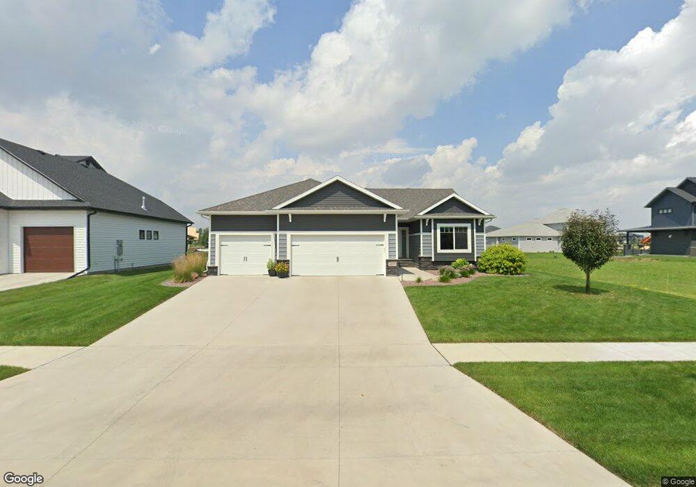
6273 Cattail Cove S Fargo, ND 58104
Osgood NeighborhoodEstimated Value: $605,000 - $872,244
5
Beds
3
Baths
3,553
Sq Ft
$212/Sq Ft
Est. Value
About This Home
This home is located at 6273 Cattail Cove S, Fargo, ND 58104 and is currently estimated at $752,811, approximately $211 per square foot. 6273 Cattail Cove S is a home located in Cass County with nearby schools including Liberty Middle School, West Fargo Sheyenne High School, and Trinity Elementary School.
Ownership History
Date
Name
Owned For
Owner Type
Purchase Details
Closed on
Sep 22, 2020
Sold by
Heritage Homes Llc
Bought by
Peterson Nicholas D and Peterson Ashley S
Current Estimated Value
Home Financials for this Owner
Home Financials are based on the most recent Mortgage that was taken out on this home.
Original Mortgage
$427,000
Outstanding Balance
$378,934
Interest Rate
2.9%
Mortgage Type
New Conventional
Estimated Equity
$373,877
Purchase Details
Closed on
Apr 21, 2020
Sold by
Jetland Properties Llc
Bought by
Heritage Homes Llc
Home Financials for this Owner
Home Financials are based on the most recent Mortgage that was taken out on this home.
Original Mortgage
$394,400
Interest Rate
3.3%
Mortgage Type
Future Advance Clause Open End Mortgage
Create a Home Valuation Report for This Property
The Home Valuation Report is an in-depth analysis detailing your home's value as well as a comparison with similar homes in the area
Home Values in the Area
Average Home Value in this Area
Purchase History
| Date | Buyer | Sale Price | Title Company |
|---|---|---|---|
| Peterson Nicholas D | $534,059 | The Title Co | |
| Heritage Homes Llc | $86,900 | Title Co | |
| Jetland Properties Llc | -- | Title Co |
Source: Public Records
Mortgage History
| Date | Status | Borrower | Loan Amount |
|---|---|---|---|
| Open | Peterson Nicholas D | $427,000 | |
| Previous Owner | Heritage Homes Llc | $394,400 |
Source: Public Records
Tax History Compared to Growth
Tax History
| Year | Tax Paid | Tax Assessment Tax Assessment Total Assessment is a certain percentage of the fair market value that is determined by local assessors to be the total taxable value of land and additions on the property. | Land | Improvement |
|---|---|---|---|---|
| 2024 | $12,622 | $374,900 | $58,350 | $316,550 |
| 2023 | $10,421 | $270,150 | $57,950 | $212,200 |
| 2022 | $8,776 | $195,150 | $57,950 | $137,200 |
| 2021 | $8,537 | $184,750 | $57,950 | $126,800 |
| 2020 | $4,821 | $40,600 | $40,600 | $0 |
| 2019 | $4,283 | $25,550 | $25,550 | $0 |
| 2018 | $4,236 | $25,550 | $25,550 | $0 |
| 2017 | $4,175 | $25,550 | $25,550 | $0 |
| 2016 | $2,857 | $25,550 | $25,550 | $0 |
| 2015 | $868 | $11,250 | $11,250 | $0 |
| 2014 | $632 | $165 | $165 | $0 |
Source: Public Records
Map
Nearby Homes
- 6152 Wildflower Dr
- 6090 Wildflower Dr S
- 6023 Wildflower Dr S
- 6976 65th St S
- 7108 65th St S
- 7018 65th St S
- 6965 65th St S
- 6977 65th St S
- 6988 65th St S
- 7114 65th St S
- 6970 65th St S
- 6971 65th St S
- 7024 65th St S
- 7036 65th St S
- 7102 65th St S
- 7030 65th St S
- 7006 65th St S
- 6982 65th St S
- 7120 65th St S
- 6994 65th St S
- 6257 Cattail Cove S
- 6274 Cattail Cove
- 6287 Cattail Cove
- 6214 Wildflower Dr
- 6229 Cattail Cove S
- 6184 Wildflower Dr S
- 6258 Cattail Cove S
- 6258 Cattail Cove
- 6211 Cattail Cove S
- 6230 Cattail Cove S
- 6200 Cattail Cove S
- 6212 Cattail Cove S
- 6251 49th Ave S
- 6285 Wildflower Dr S
- 6283 49th Ave S
- 6221 49th Ave S
- 6707 49th Ave S
- 4851 63rd St S
- 6167 Wildflower Dr S
- 6187 49th Ave S