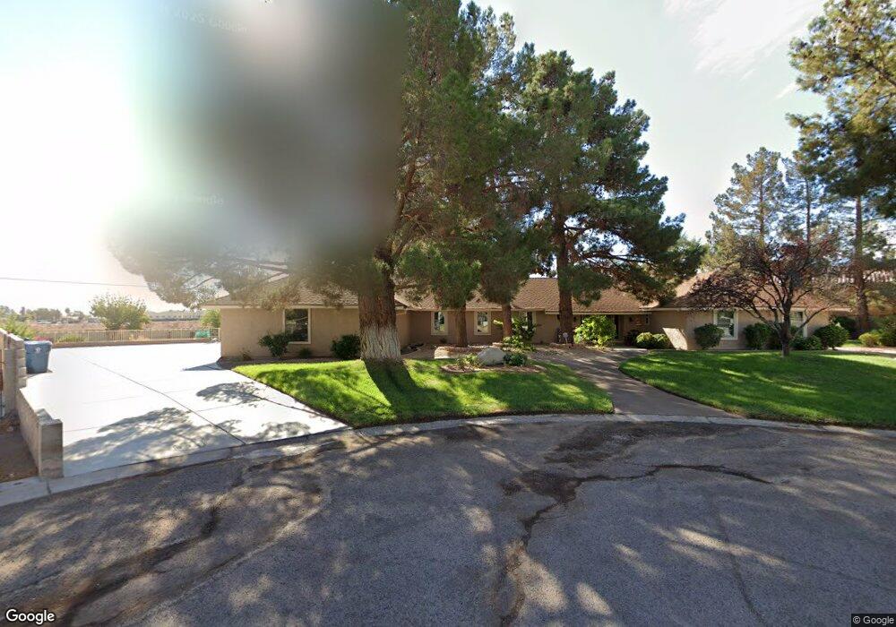
6275 W Patrick Ln Las Vegas, NV 89118
Estimated Value: $719,000 - $843,000
4
Beds
3
Baths
3,044
Sq Ft
$252/Sq Ft
Est. Value
About This Home
This home is located at 6275 W Patrick Ln, Las Vegas, NV 89118 and is currently estimated at $766,544, approximately $251 per square foot. 6275 W Patrick Ln is a home located in Clark County with nearby schools including Marion B Earl Elementary School, Grant Sawyer Middle School, and Durango High School.
Ownership History
Date
Name
Owned For
Owner Type
Purchase Details
Closed on
Oct 23, 2024
Sold by
Krausman Family Trust and Jones Megan Krausman
Bought by
Zavala Weinert Perez and Kulwicka Malgorzata I
Current Estimated Value
Home Financials for this Owner
Home Financials are based on the most recent Mortgage that was taken out on this home.
Original Mortgage
$554,400
Outstanding Balance
$548,279
Interest Rate
6.09%
Mortgage Type
New Conventional
Estimated Equity
$218,265
Purchase Details
Closed on
Jan 20, 2023
Sold by
Krausman Candace S
Bought by
Krausman Family Trust
Create a Home Valuation Report for This Property
The Home Valuation Report is an in-depth analysis detailing your home's value as well as a comparison with similar homes in the area
Home Values in the Area
Average Home Value in this Area
Purchase History
| Date | Buyer | Sale Price | Title Company |
|---|---|---|---|
| Zavala Weinert Perez | $720,000 | Old Republic Title | |
| Zavala Weinert Perez | $720,000 | Old Republic Title | |
| Krausman Family Trust | -- | None Listed On Document |
Source: Public Records
Mortgage History
| Date | Status | Borrower | Loan Amount |
|---|---|---|---|
| Open | Zavala Weinert Perez | $554,400 | |
| Closed | Zavala Weinert Perez | $554,400 |
Source: Public Records
Tax History Compared to Growth
Tax History
| Year | Tax Paid | Tax Assessment Tax Assessment Total Assessment is a certain percentage of the fair market value that is determined by local assessors to be the total taxable value of land and additions on the property. | Land | Improvement |
|---|---|---|---|---|
| 2025 | $3,000 | $161,964 | $73,500 | $88,464 |
| 2024 | $2,778 | $161,964 | $73,500 | $88,464 |
| 2023 | $2,778 | $147,596 | $61,250 | $86,346 |
| 2022 | $2,698 | $134,100 | $54,250 | $79,850 |
| 2021 | $2,619 | $126,305 | $49,000 | $77,305 |
| 2020 | $2,540 | $126,919 | $49,000 | $77,919 |
| 2019 | $2,466 | $121,414 | $43,750 | $77,664 |
| 2018 | $2,394 | $116,110 | $40,250 | $75,860 |
| 2017 | $3,303 | $112,617 | $35,000 | $77,617 |
| 2016 | $2,267 | $106,740 | $28,000 | $78,740 |
| 2015 | $2,263 | $104,750 | $26,250 | $78,500 |
| 2014 | $2,197 | $82,907 | $17,500 | $65,407 |
Source: Public Records
Map
Nearby Homes
- 0 W Unit 2633036
- 0 Unit 2701179
- 0 Quail St Unit 2680467
- 6480 W Oquendo Rd
- 6315 Bellisima St
- 5770 El Camino Rd
- 5829 W Patrick Ln
- 5875 W Post Rd
- 5801 Exbury Gardens Ct
- 0 W Patrick Ln Unit 2718906
- 0 W Patrick Ln Unit 2675444
- 6053 Conroe Ct
- 5603 Deer Creek Falls Ct
- 0 S Lindell Rd
- 5669 Steampunk St
- 5595 El Camino Rd
- 0 Woodstock
- 5568 Yellow Ash St
- 5633 Steampunk St
- 5790 Westwind Rd
- 6285 W Patrick Ln
- 6265 W Patrick Ln
- 6160 El Camino Rd
- 6295 W Patrick Ln
- 6180 El Camino Rd
- 6282 W Patrick Ln
- 6310 Sobb Ave
- 6240 W Patrick Ln
- 6230 El Camino Rd
- 6035 S Bronco St
- 6045 S Bronco St
- 6070 Mann St
- 6025 S Bronco St
- 6158 Mann St
- 6080 Mann St
- 6178 Mann St
- 6015 S Bronco St
- 6090 Mann St
- 6280 El Camino Rd
- 6060 Mann St