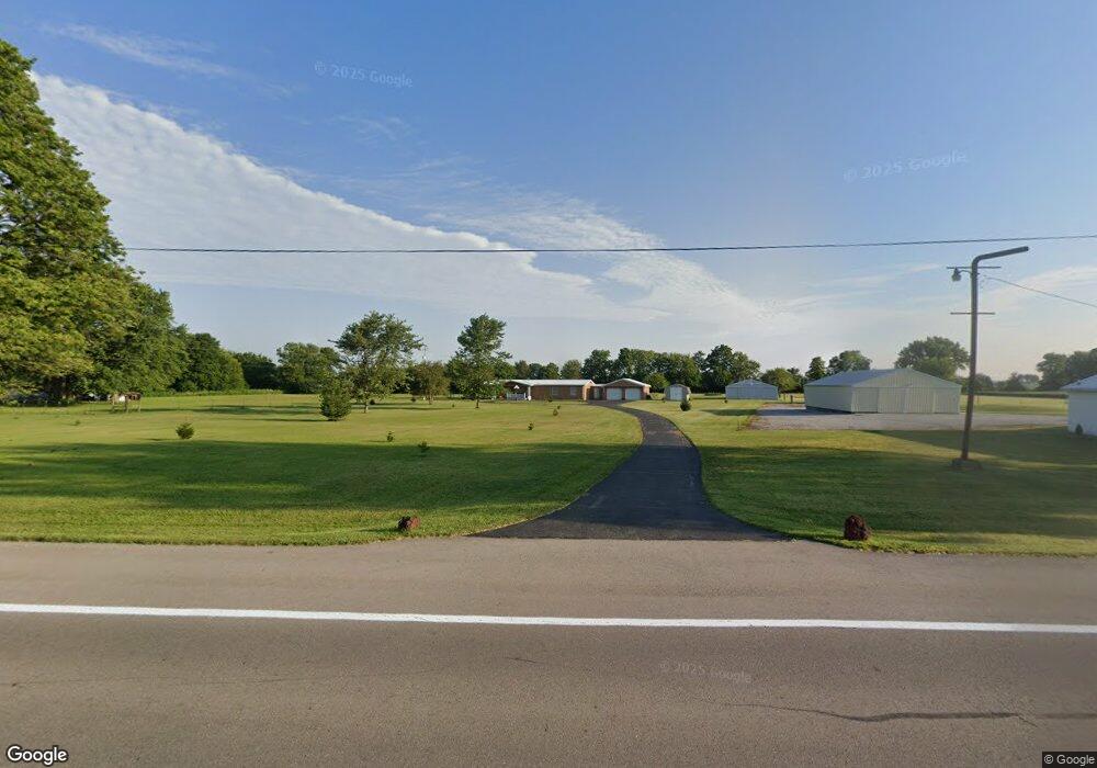
6275 W Us Route 36 Covington, OH 45318
Estimated Value: $255,405 - $317,000
3
Beds
2
Baths
2,556
Sq Ft
$113/Sq Ft
Est. Value
About This Home
This home is located at 6275 W Us Route 36, Covington, OH 45318 and is currently estimated at $288,351, approximately $112 per square foot. 6275 W Us Route 36 is a home located in Miami County with nearby schools including Covington Elementary/Junior High School, Covington Junior High School, and Covington High School.
Ownership History
Date
Name
Owned For
Owner Type
Purchase Details
Closed on
Aug 1, 2019
Sold by
Poore James M and First Financial Bank
Bought by
Billheimer Darrell and Billheimer Joan
Current Estimated Value
Purchase Details
Closed on
Dec 4, 2006
Sold by
Langston Jeanette E
Bought by
Poore James M and Poore Mary E
Home Financials for this Owner
Home Financials are based on the most recent Mortgage that was taken out on this home.
Original Mortgage
$110,000
Interest Rate
6.4%
Purchase Details
Closed on
Jan 1, 1990
Bought by
Langston Russell W
Create a Home Valuation Report for This Property
The Home Valuation Report is an in-depth analysis detailing your home's value as well as a comparison with similar homes in the area
Home Values in the Area
Average Home Value in this Area
Purchase History
| Date | Buyer | Sale Price | Title Company |
|---|---|---|---|
| Billheimer Darrell | $84,000 | None Available | |
| Poore James M | $140,000 | -- | |
| Langston Russell W | -- | -- |
Source: Public Records
Mortgage History
| Date | Status | Borrower | Loan Amount |
|---|---|---|---|
| Previous Owner | Poore James M | $110,000 |
Source: Public Records
Tax History Compared to Growth
Tax History
| Year | Tax Paid | Tax Assessment Tax Assessment Total Assessment is a certain percentage of the fair market value that is determined by local assessors to be the total taxable value of land and additions on the property. | Land | Improvement |
|---|---|---|---|---|
| 2024 | $2,005 | $69,270 | $27,300 | $41,970 |
| 2023 | $2,005 | $69,270 | $27,300 | $41,970 |
| 2022 | $2,067 | $69,270 | $27,300 | $41,970 |
| 2021 | $1,629 | $53,270 | $21,000 | $32,270 |
| 2020 | $1,633 | $53,270 | $21,000 | $32,270 |
| 2019 | $1,628 | $53,270 | $21,000 | $32,270 |
| 2018 | $1,392 | $47,430 | $18,340 | $29,090 |
| 2017 | $1,420 | $47,430 | $18,340 | $29,090 |
| 2016 | $1,365 | $47,430 | $18,340 | $29,090 |
| 2015 | $1,277 | $44,730 | $17,290 | $27,440 |
| 2014 | $1,277 | $44,730 | $17,290 | $27,440 |
| 2013 | $1,283 | $44,730 | $17,290 | $27,440 |
Source: Public Records
Map
Nearby Homes
- 698 E Broadway St
- 271 N Ludlow St
- 520 N Pearl St
- 731 N Pearl St
- 501 N Main St Unit C1
- 00 W Piqua Clay Rd
- 223 Henry Ct
- 7648 Piqua-Clayton Rd
- 124 N Main St
- 133 W Broadway St
- 212 Charles Ct
- 210 Charles Ct
- 207 Charles Ct
- 208 Charles Ct
- 205 Charles Ct
- 206 Charles Ct
- 204 Charles Ct
- 219 Henry Ct
- 221 Henry Ct
- 203 Charles Ct
- 6275 W Us Route 36
- 6255 W Us Route 36
- 6245 W Us Route 36
- 6473 W Us Route 36
- 6341 Rakestraw Rd
- 6341 Rakestraw Rd
- 6341 Rakestraw Rd
- 6341 Rakestraw Rd
- 6415 Rakestraw Rd
- 6485 Rakestraw Rd
- 6172 N Mlberry Grove Rakestr Rd
- 6172 N Mlbry Grv Rkstrw Rd
- 6172 N Mulberry Grove Rakestraw Rd
- 6172 N Mulberry Grv Rake Rd
- 6172 Mulberry Grove-Rakestraw Rd
- 6245 W Us Route 36
- 6125 Rakestraw Rd
- 6515 U S 36
- 6335 W Us Route 36
- 6373 W Us Route 36