Estimated Value: $181,000 - $224,513
--
Bed
--
Bath
1,440
Sq Ft
$144/Sq Ft
Est. Value
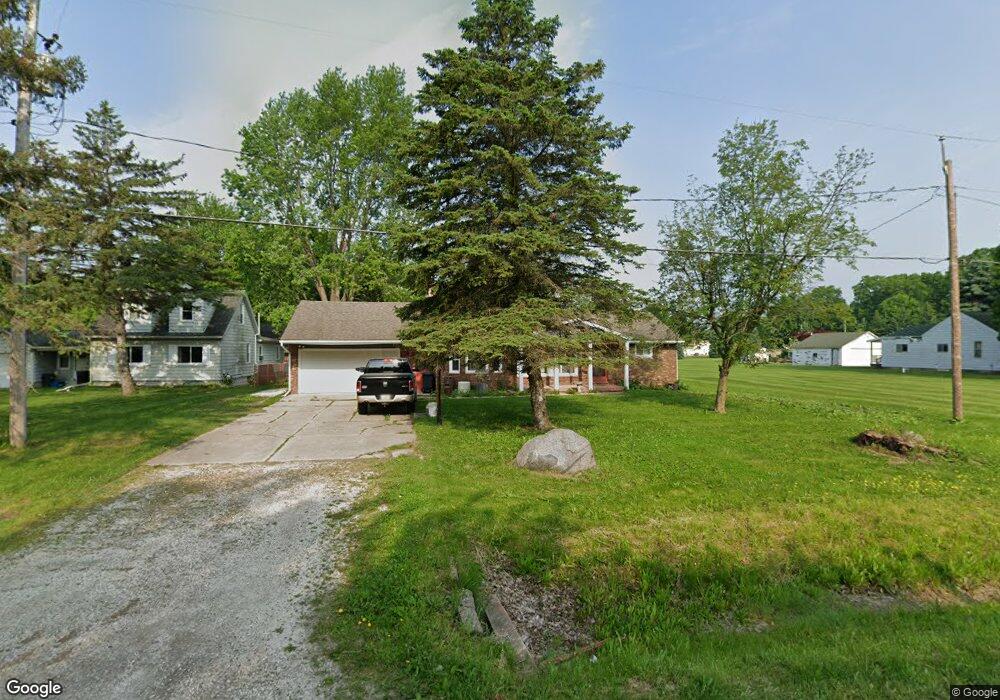
About This Home
This home is located at 6277 N Belsay Rd, Flint, MI 48506 and is currently estimated at $207,878, approximately $144 per square foot. 6277 N Belsay Rd is a home located in Genesee County with nearby schools including Richfield Early Learning Center, St. Mark Lutheran School, and Holy Rosary Catholic School.
Ownership History
Date
Name
Owned For
Owner Type
Purchase Details
Closed on
Jun 4, 2024
Sold by
Wolosonowich Diane C and Wolosonowich-Prieur Diane C
Bought by
Wolosonowich-Prieur Diane C and Wolosonowich Barbara L
Current Estimated Value
Purchase Details
Closed on
Nov 16, 2005
Sold by
Schipper Roger A
Bought by
Wolosonowich Timothy L and Wolosonowich Diane C
Home Financials for this Owner
Home Financials are based on the most recent Mortgage that was taken out on this home.
Original Mortgage
$156,900
Interest Rate
6.2%
Mortgage Type
Fannie Mae Freddie Mac
Create a Home Valuation Report for This Property
The Home Valuation Report is an in-depth analysis detailing your home's value as well as a comparison with similar homes in the area
Home Values in the Area
Average Home Value in this Area
Purchase History
| Date | Buyer | Sale Price | Title Company |
|---|---|---|---|
| Wolosonowich-Prieur Diane C | -- | None Listed On Document | |
| Wolosonowich Timothy L | $156,900 | Garrow Title Agency |
Source: Public Records
Mortgage History
| Date | Status | Borrower | Loan Amount |
|---|---|---|---|
| Previous Owner | Wolosonowich Timothy L | $156,900 |
Source: Public Records
Tax History Compared to Growth
Tax History
| Year | Tax Paid | Tax Assessment Tax Assessment Total Assessment is a certain percentage of the fair market value that is determined by local assessors to be the total taxable value of land and additions on the property. | Land | Improvement |
|---|---|---|---|---|
| 2025 | $2,130 | $93,100 | $0 | $0 |
| 2024 | $466 | $87,100 | $0 | $0 |
| 2023 | $445 | $78,000 | $0 | $0 |
| 2022 | $1,793 | $71,900 | $0 | $0 |
| 2021 | $1,780 | $66,000 | $0 | $0 |
| 2020 | $453 | $66,900 | $0 | $0 |
| 2019 | $446 | $61,200 | $0 | $0 |
| 2018 | $1,974 | $51,600 | $0 | $0 |
| 2017 | $1,902 | $50,900 | $0 | $0 |
| 2016 | $1,886 | $47,700 | $0 | $0 |
| 2015 | $1,622 | $44,300 | $0 | $0 |
| 2014 | $412 | $36,500 | $0 | $0 |
| 2012 | -- | $44,500 | $44,500 | $0 |
Source: Public Records
Map
Nearby Homes
- 6218 N Belsay Rd
- 254 Green Valley Rd
- 5412 E Stanley Rd
- 5521 N Belsay Rd
- 6478 Oxbow Ln
- 18 Timber Ct
- 475 White Willow Dr
- 654 Basswood Ct
- 649 Basswood Ct
- 6185 N Vassar Rd
- 6065 N Genesee Rd
- 3430 N Genesee Rd
- 5492 N Genesee Rd
- 0 N Genesee Rd Unit 50142777
- 6024 N Vassar Rd
- 7017 E Coldwater Rd
- 4455 Burgundy Dr
- 5335 Rose Ln
- 5474 Country Ln
- 7124 Heath St
- 6265 N Belsay Rd
- 6287 N Belsay Rd
- 5482 Woodlawn Dr
- 5500 Woodlawn Dr
- 6245 N Belsay Rd
- 5472 Woodlawn Dr
- 5462 Woodlawn Dr
- 6009 Lucas Rd
- 5452 Woodlawn Dr
- 6319 N Belsay Rd
- 6012 Lucas Rd
- 6225 N Belsay Rd
- 950 Kathy Cir
- 949 Kathy Cir
- 948 Kathy Cir
- 947 Kathy Cir
- 946 Kathy Cir
- 945 Kathy Cir
- 944 Kathy Cir
- 943 Kathy Cir